COLUMBIA, S.C. — Over the years, the City of Columbia has adopted a series of strategic plans for directing the growth and development of downtown. Twenty five years ago it was the City Center Master Plan that pretty much redefined The Vista with the relocation of railroad tracks, guidelines for converting former warehouses into retail businesses, and the redevelopment of the former Central Correctional Institution (CCI) as CanalSide. Fifteen years ago, the Innovista Master Plan was adopted in partnership with the University of South Carolina that included plans for 500 acres of mixed use development, including a large green space and creation of Three Rivers Greenway.
More recently, City of Columbia adopted a new Unified Development Ordinance and Comprehensive Plan (Columbia Compass) to guide any future development.

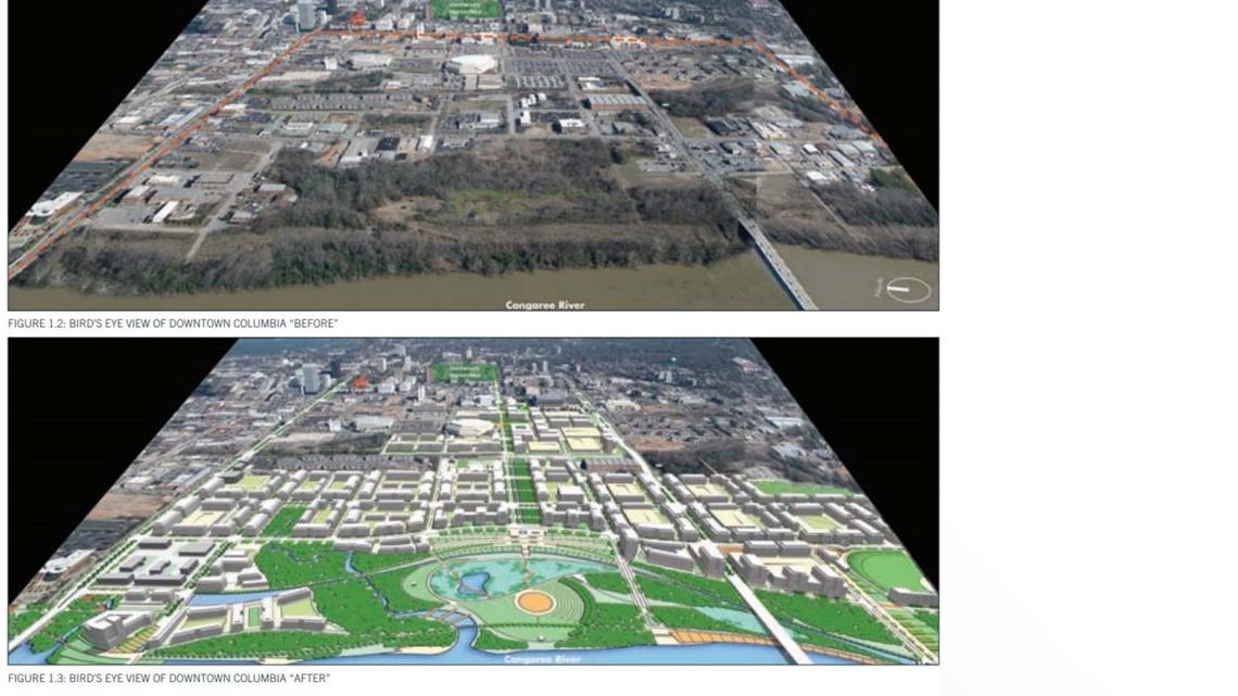
Now, as the City approaches the 250th anniversary of its founding, city leaders are asking the public for ideas of what Columbia could become.
Two public open house drop-in sessions have been scheduled for August 1 in the Carolina Room at Columbia Metropolitan Convention Center, 1101 Lincoln St. The first meeting will be midday, 11 a.m.-1:30 p.m.; the second is later that afternoon, 4-6:30 p.m..
The City has set forth four goals it hopes to reach with a new Strategic Master Plan for Downtown Columbia, including
- creation of a community-driven vision for the public character of downtown
- established priorities for public policy and public investment in the downtown built environment
- protection of the unique character and assets of downtown Columbia's historic urban core
- formation of Downtown Design Guidelines to help shape public spaces
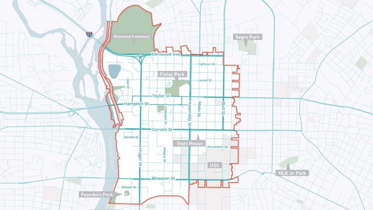
The area under consideration -- pictured at the very top of this story -- is roughly bounded by Elmwood Cemetery and Elmwood Avenue on the north; Pickens Street (excluding the BullStreet District development) to the east; Wheat Street to Assembly Street, then Catawba Street on the south; and the Congaree and Broad rivers to the west.