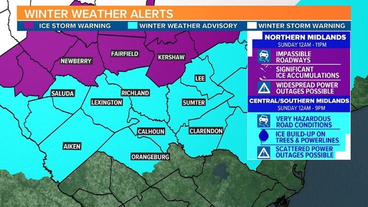
COLUMBIA, S.C. — The National Weather Service has issued new watches and warnings for the Midlands of South Carolina, in advance of a winter storm that's moving to the area. The decision means there's greater concern--particularly in the northern Midlands--for potentially hazardous conditions.
Download the free WLTX app for the latest weather on your mobile device.
The ice storm warning has been issued for the following counties: Newberry, Saluda, and Kershaw and begins late Saturday night. The warning means those areas could see anywhere from a quarter of an inch to 1.5 inches of ice.
Those areas had previously been under a winter storm watch.
On Saturday, morning, the National Weather Service issued a winter weather advisory for the rest of the Midlands. Previously, several counties were under a winter storm watch. The counties affected are Saluda, Lexington, Richland, Sumter, Lee, Aiken, Calhoun, Clarendon, and Orangeburg.
Those areas could see up to two-tenths of an inches of ice as well as sleet.
According to the NWS "Power outages and tree damage are likely due to the ice", "travel could be nearly impossible", and "strong wind gusts may add more stress to ice covered trees", in all these areas.
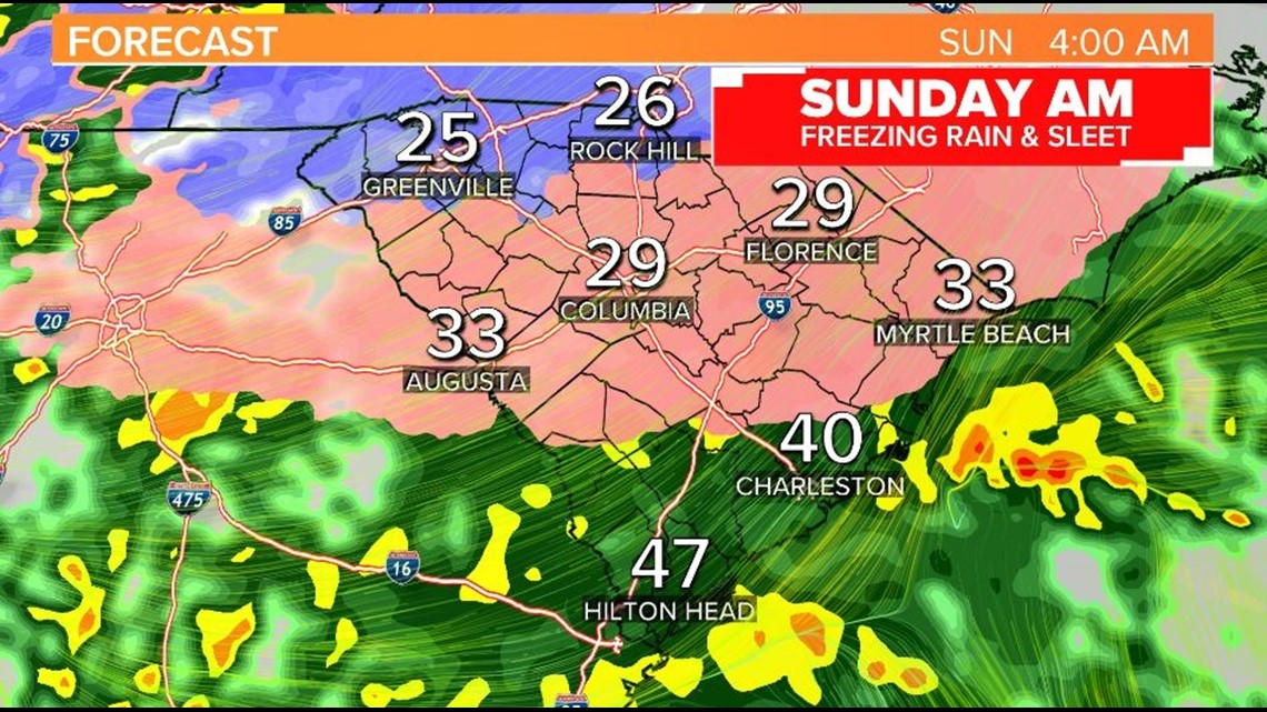
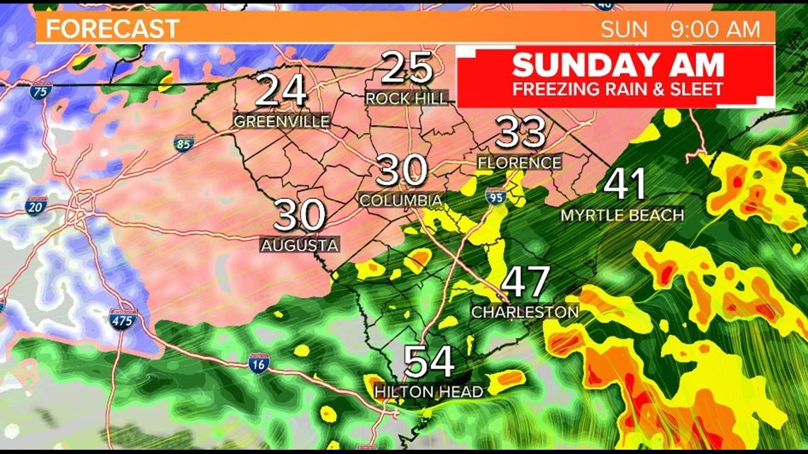
Rain will move into the South Carolina Midlands after midnight and into the morning hours on Sunday. Temperatures will drop near or below freezing which will turn rain into sleet in spots and produce significant ice accretions on power lines, trees, and roads in areas where temperatures remain below freezing.
Northwestern Midlands
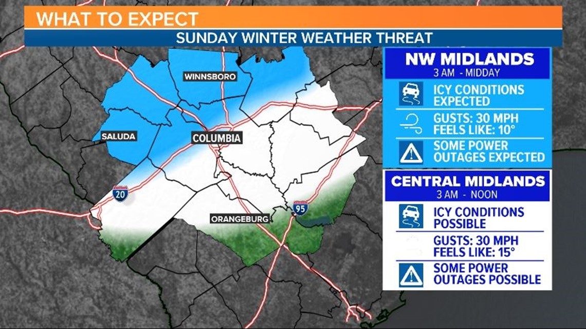
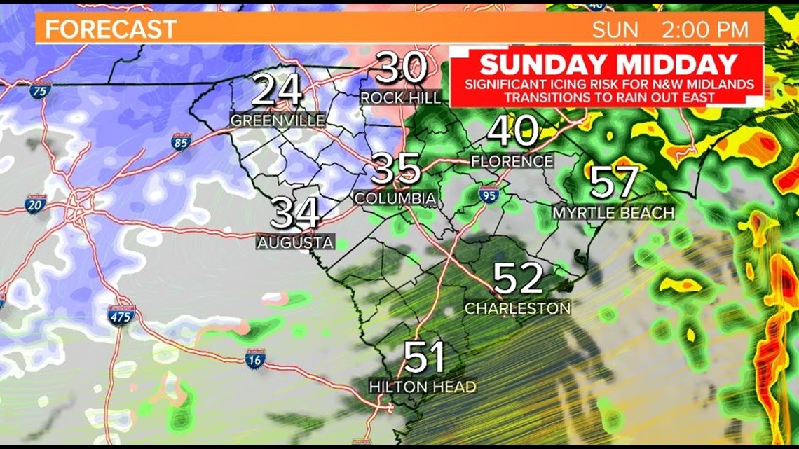
The greatest risk for wintry weather on Sunday will be north and west of I-20 toward Saluda, Newberry, Fairfield, and parts of Kershaw counties. Several hours of wintry precipitation are expected. Rain will freeze on contact with roads, powerlines, and trees and could result in power outages and dangerous travel. Temperatures will hover in the upper 20s or low 30s but wind gusts up to 30 mph will drop wind chills to near 10F on Wednesday morning. Wind gusts could also increase the risk for power outages.
The greatest risk for wintry weather will be on Sunday morning from 3 AM into noon time. Near the afternoon, temperatures may be warm enough to transition precipitation to all rain, but on the back end of the storm there's a possibility for novelty snowflakes.
Central Midlands
A period of wintry weather is possible for parts of Kershaw County, Richland, Lexington, Lee, Sumter, Calhoun, and Aiken Counties. The primary precipitation will be rain, but temperatures in the morning will likely be cold enough for rain to freeze on contact and create slippery spots. Winds will gust up to 30 mph. With temperatures near freezing, wind chills will likely drop as low as 15F on Sunday morning.
The greatest risk for wintry weather will be early Sunday morning after 3am and into the mid morning. Some transition to all rain is expected in the afternoon with a few novelty snowflakes in the evening possible.

Eastern Midlands
Heavy and cold rain is expected to develop through Sunday morning. Localized flooding is possible and gusts will reach over 30 mph. Temperatures will be near freezing so a period of icy conditions are possible, but the late morning and afternoon should be warm enough to limit icing impacts along the I-95 corridor and areas eastward.
There is still uncertainty about the extent of the ice threat on Sunday morning because of inconsistencies between models regarding the spread of below freezing temperatures. With warm air higher up, it will be difficult to get snow in the Midlands, but temperatures could be near or below freezing near the ground across the Midlands. This will result in icy conditions in the form of freezing rain or sleet instead of snow. Freezing rain falls like typical raindrops but these drops freeze on contact with any surface that’s below freezing.



Takeaways for now
With multiple scenarios still on the table, it’s important to keep a close eye on the forecast, for the I-20 corridor and north and westward. Wintry weather is not expected closer to the I-95 corridor, so confidence is higher for an all rain event in the eastern Midlands.
The GFS and European models are considered lower resolution and therefore aren’t always able to predict the subtle nuances of our region, like cold air damming, which could keep below freezing temperatures in a larger portion of the region. Higher resolution model data is more in line with the idea that cold air remains in place for the NW Midlands and produces a risk for slippery conditions which gives us higher confidence that there will be a period of dangerous travel weather on Sunday morning toward the I-20 corridor and northward.


