COLUMBIA, S.C. — We are entering the peak of hurricane season and the Atlantic is certainly behaving like it. Three systems are currently being monitored by the National Hurricane Center and WLTX Weather Team, one of which was just declared Tropical Storm Dorian.
The tropical storm is still located out in the Atlantic Ocean, about 725 miles east south east of Barbados. The storm is forecast to continue to move west northwest. By the middle of next week, the storm is forecast to strengthen to a category 1 hurricane.
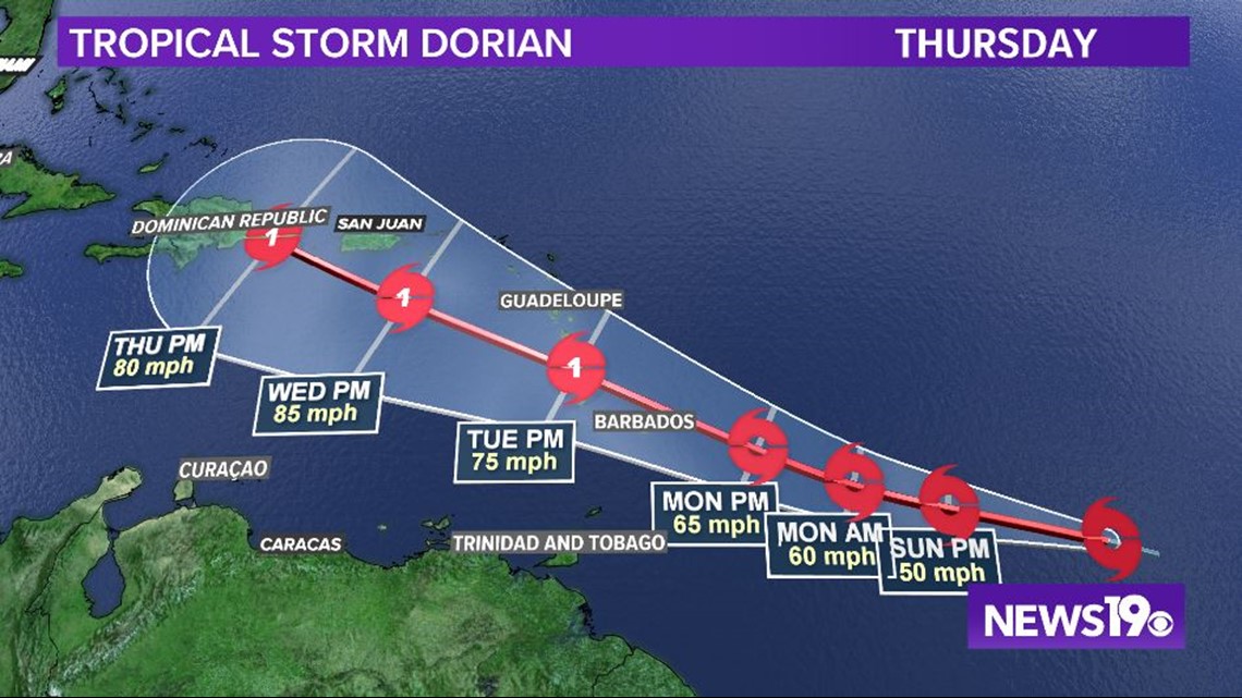
The central and northern Lesser Antilles should monitor the system over the coming days, as well as anyone planning to travel to the Caribbean. There are no immediate concerns with this system to the Carolinas.
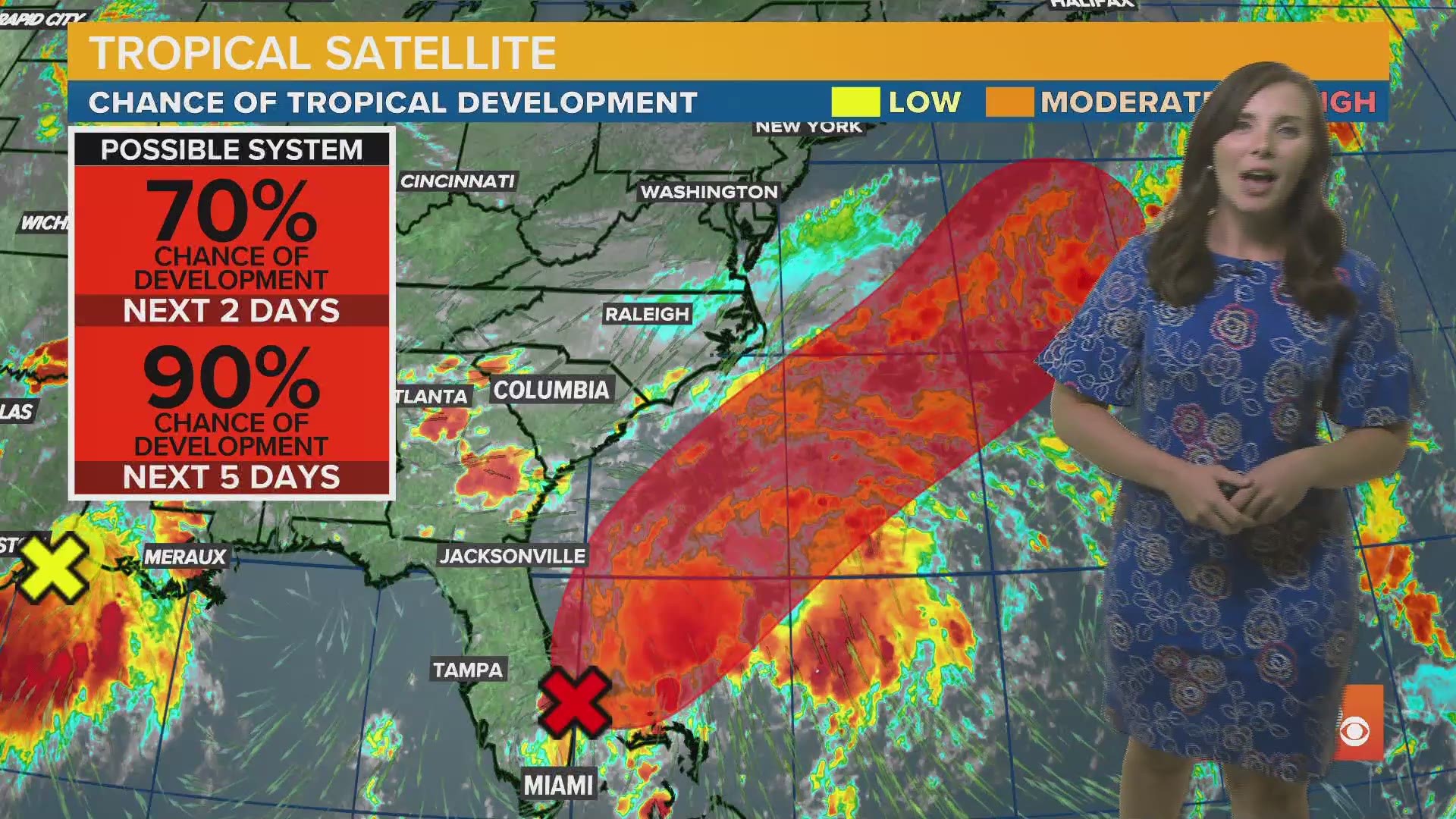
Another disturbance to watch is located just off the eastern Florida coast. This system has a 70% chance of forming into a tropical disturbance in the next 2 days, and a 90% chance of forming in the next 5 days.
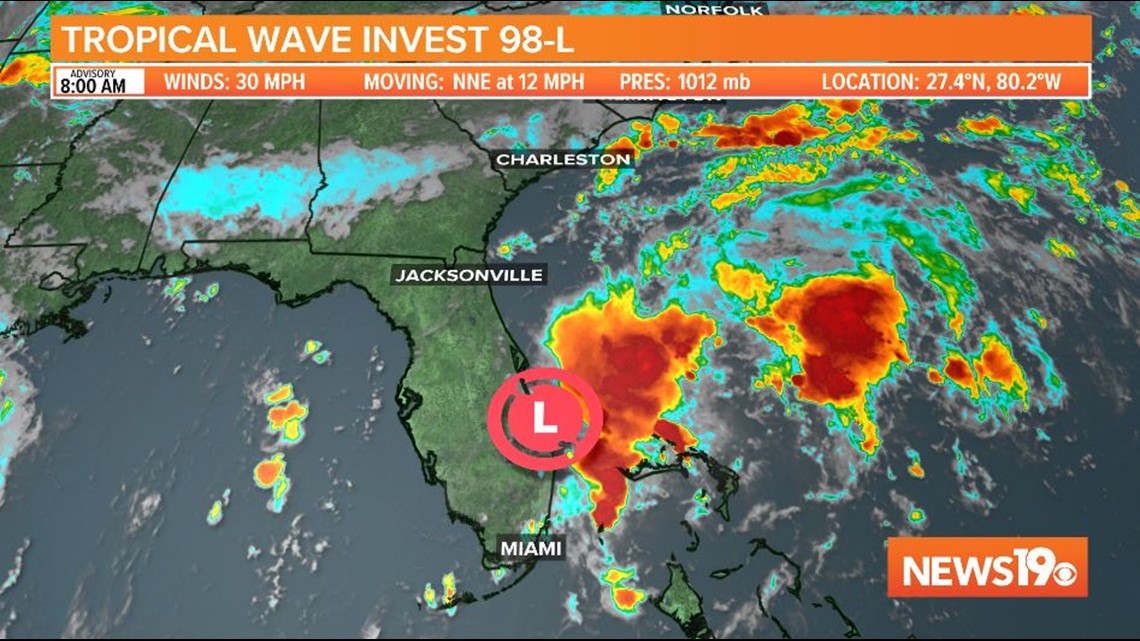
While this storm is closer to the Midlands, it is not an immediate concern, as it is forecast to continue moving northeast and over the ocean, thanks to the front pushing through the Midlands this weekend keeping the storm off of the mainland.