COLUMBIA, S.C. —
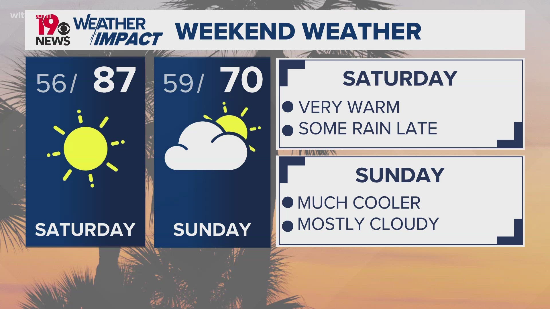
This weekend will bring a refreshing change in the weather. Saturday will have warmer-than-normal temperatures, followed by a cold front moving in at night. This front brings a chance for scattered, light showers, primarily north and east of Columbia, marking the first real chance of rain in nearly a month.

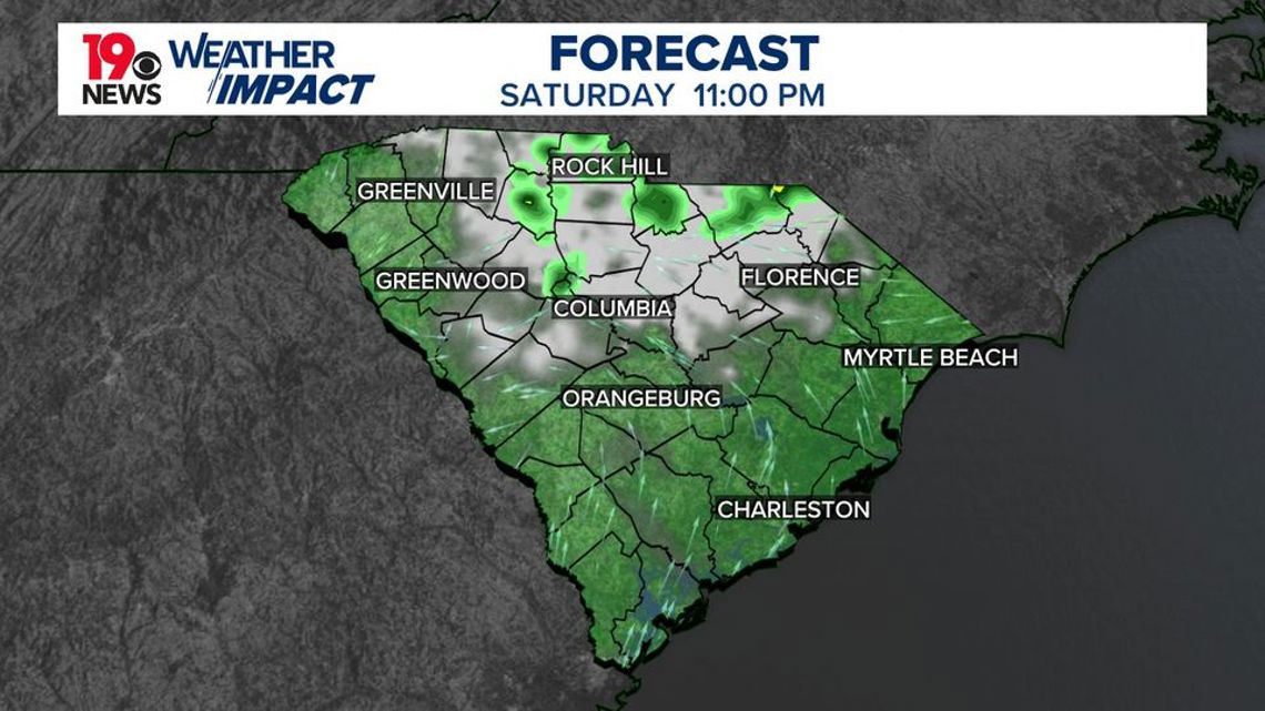
Saturday will start with plenty of sunshine, warming afternoon temperatures above normal due to a west-northwest breeze. As the evening approaches, the cold front will advance, bringing mild overnight temperatures and a slight rise in humidity. Scattered showers may develop in areas mainly north of I-26 and the northern Midlands, with a few isolated showers possible in the Pee Dee area. Any rain that does fall will likely stay light, around a tenth of an inch, but it’s a welcome change to the recent drought.

Looking ahead to Sunday, the cooler air behind the front will settle in, bringing noticeably lower temperatures with a breeze from the northeast, making it feel even cooler. Any morning showers should clear by midday, but lingering clouds will help keep temperatures about 13-17 degrees lower than today. This cool-down will stabilize the weather as high pressure builds in from the north.
By Monday, temperatures will start to inch back up as skies clear and winds calm, setting the stage for another stretch of dry, warm days throughout the week.