
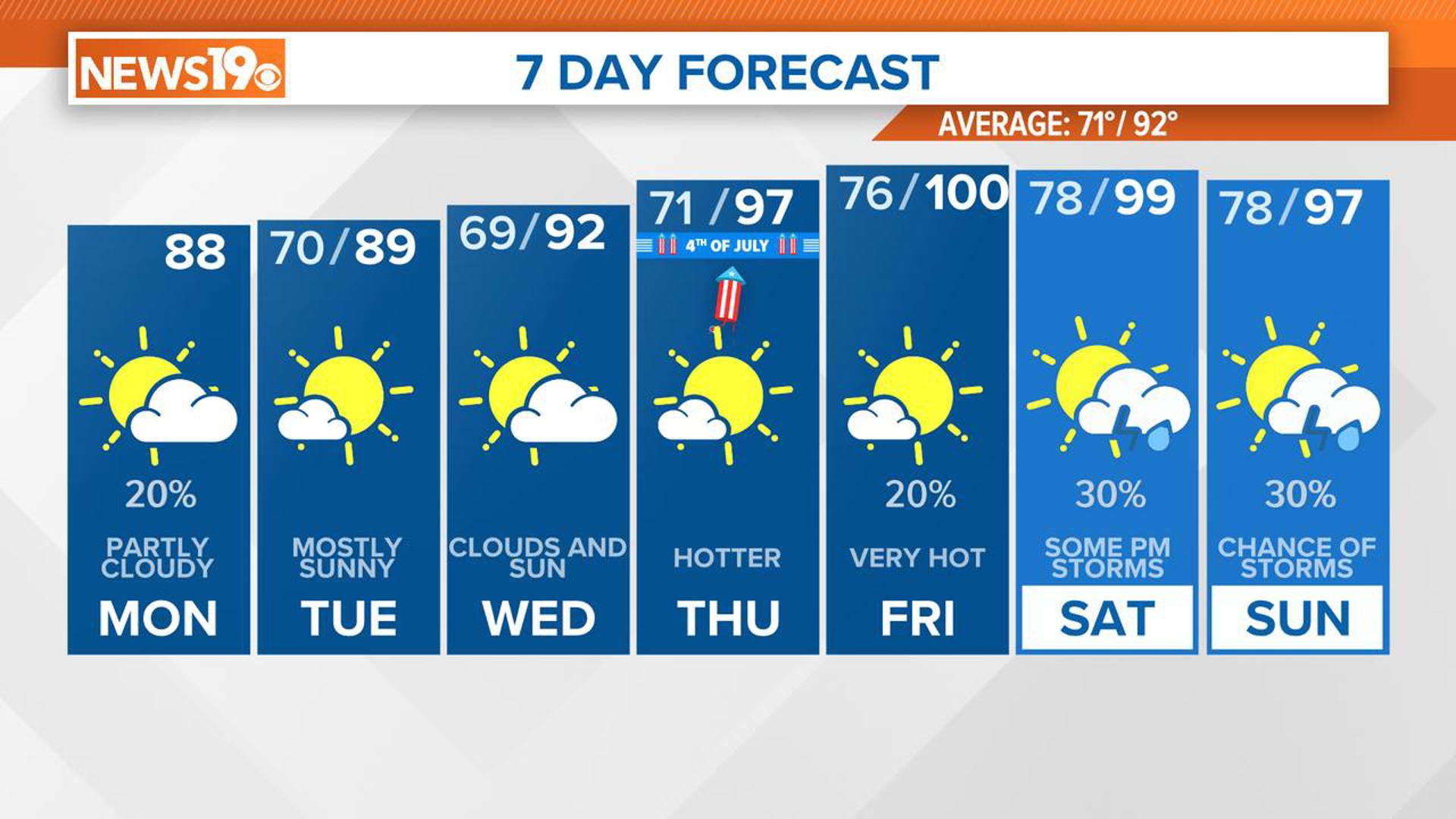
COLUMBIA, S.C. — A cold front is currently moving through South Carolina, bringing slightly cooler and drier conditions to kick off the workweek. However, do not get too comfortable, as high pressure is expected to build back up, leading to temperatures nearing the century mark by the end of the workweek.
This afternoon, scattered showers and thunderstorms are expected, especially in the southern parts of South Carolina. An initial cold front pushed through last night, drifting southward. This caused winds to shift from the north and brought some cloud cover.
However, today, a secondary cold front will move through from the north and northeast. This will create another chance for showers and storms, mainly in the southern counties. The best chance for storms will be along and south of I-20 this afternoon, with drier air moving in behind the front tonight.


Highs today will be in the upper 80s and lower 90s, while tonight's lows will be in the upper 60s. Severe weather is not expected for the Midlands, but there is a small chance in the Lowcountry of the state.
Tuesday and Tuesday night will bring a brief respite from the heat and humidity. The front will move south of the area, and cooler, drier air will filter in from the north. While an isolated shower is possible in the southern part of the region due to the proximity of the front, most areas will remain dry. Highs will be in the middle to upper 80s, with the air feeling slightly cooler due to the lower humidity. Lows will range from the middle 60s to around 70.
On Wednesday and Wednesday night, the upper ridge will start to build back eastward, and moisture will return to the region. Although the ridge's center will remain west of the area, rising temperatures will push afternoon highs back to around 90 degrees.


By Thursday and into the weekend, high pressure aloft will rebuild, leading to a noticeable increase in moisture and above-normal temperatures. Highs on Thursday and Friday will reach the mid to upper 90s, and by the weekend, temperatures will rise to the upper 90s to around 100 degrees. With the return of moisture, heat index values will climb to near heat advisory levels for much of the area. The ridge may weaken slightly by Sunday, possibly allowing a surface front to approach from the north, but confidence in this happening is low.
Rainfall-wise, expect isolated to scattered showers and thunderstorms starting on Friday and continuing through the weekend.