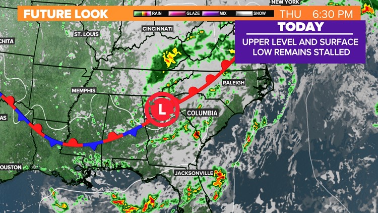
COLUMBIA, S.C. — A dynamic weather pattern is unfolding, driven by a slow-moving upper-level low situated to our northwest.
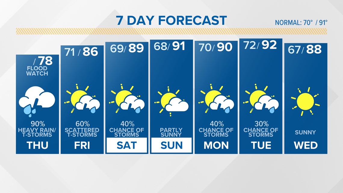
As we head into Friday, the upper low will shift northward and weaken, allowing drier air to move in. However, the southern and eastern areas may still experience lingering moisture.
As we look towards the weekend, significant weather changes are anticipated. The Midlands will experience the arrival of drier air, resulting in lower rain chances, increased sunshine, and a return to normal temperatures.
On Monday, an upper trough will swing through, introducing a chance of showers and thunderstorms.
However, by Tuesday and Wednesday, drier air is expected to return once again.
Future look forecast:


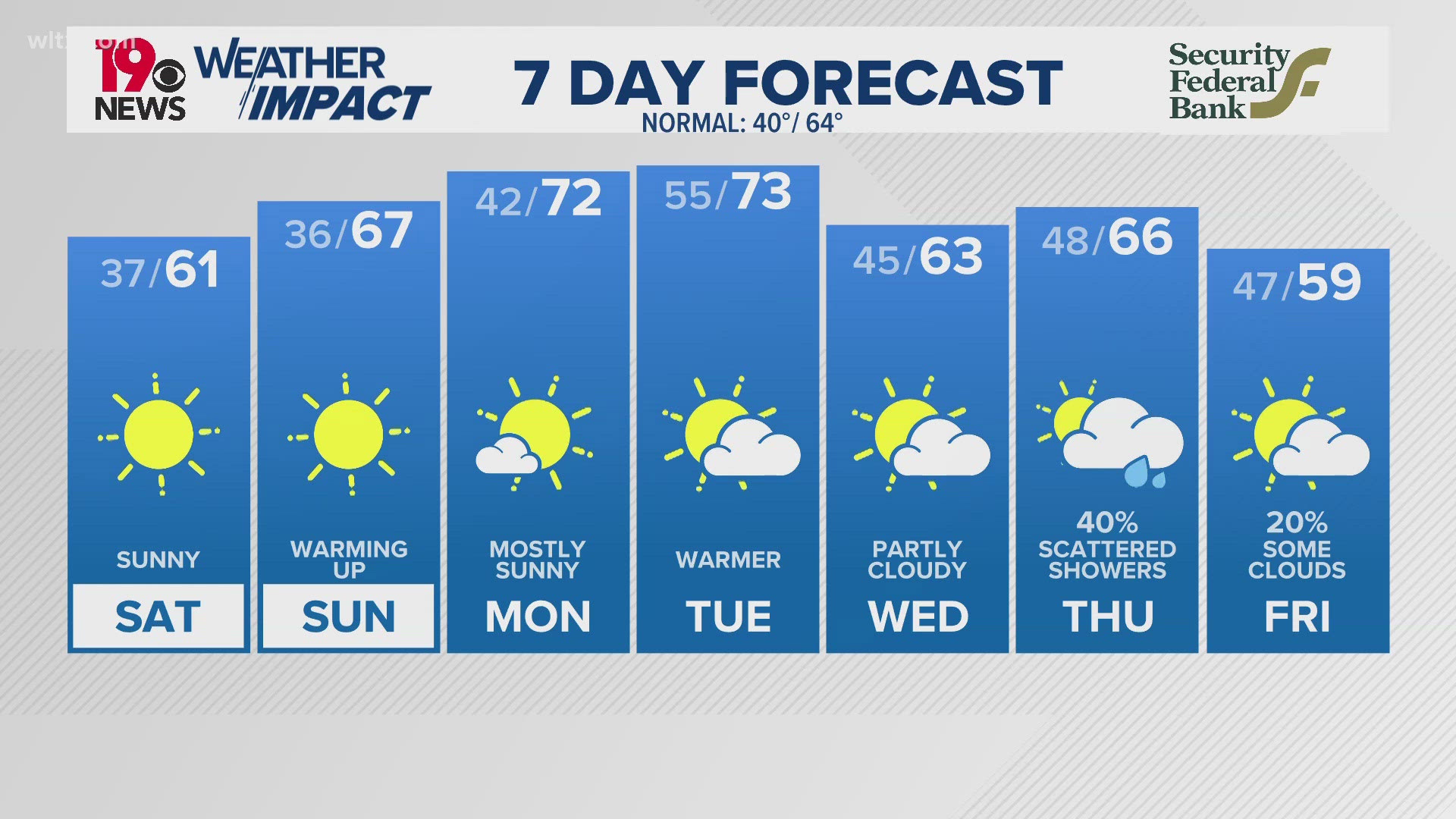
Weekend forecast:


Seven-day forecast:


