
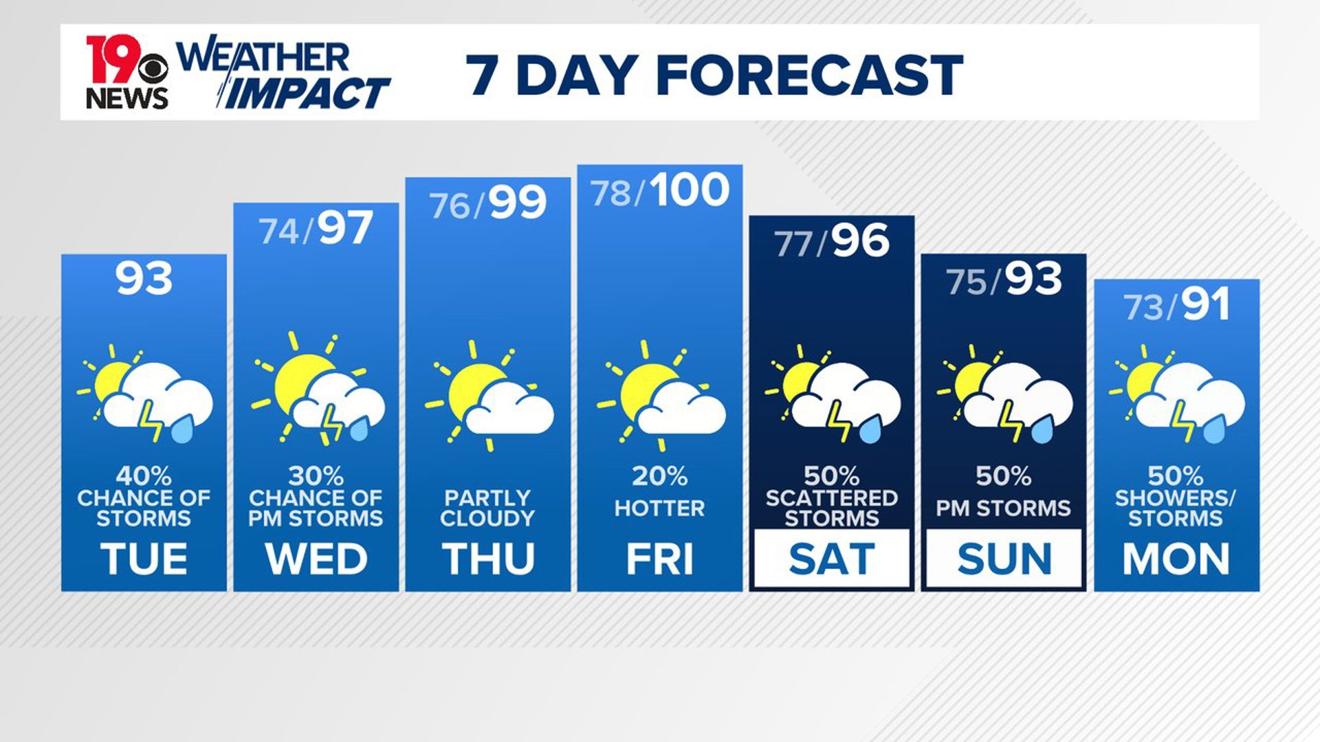
COLUMBIA, S.C. — Expect rising temperatures throughout the week, with heat index values climbing higher each afternoon. Scattered storms are expected almost every afternoon.
As the week progresses, temperatures will rise into the low to mid-90s. These warmer conditions will bring scattered afternoon storms, which may include isolated severe weather and flash flooding risks.
Regional radar indicates a mesoscale convective system is moving southeast through central Kentucky. This system will be a focal point today, with remnants expected to cross the central Appalachians aided by shortwave energy.
Temperatures will reach the lower to mid-90s, with the potential for damaging wind gusts in stronger storms. The area is at a marginal risk for severe storms, and there is a continued threat of flash flooding due to saturated soil conditions.

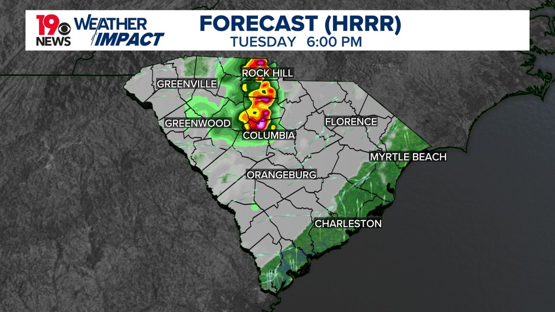
Scattered storms are expected, but the exact timing and locations are uncertain. High-resolution models show varying predictions, though there is some agreement on favoring the CSRA and southeast Midlands for late afternoon into early evening storms. These storms should diminish by midnight, with overnight lows in the lower to mid-70s.
Heat will intensify, with heat indices reaching around 102 on Tuesday and up to 109 on Wednesday. Isolated showers and storms will develop each afternoon, with the potential for damaging wind gusts in the strongest storms.
Upper-level high pressure will strengthen on Wednesday, pushing temperatures into the mid-90s. Southwest surface winds will keep dew points in the mid-70s, resulting in heat index values around 109 degrees. A heat advisory may be needed. Despite some mid-level dry air, showers and storm chances will be lower on Wednesday compared to Tuesday.

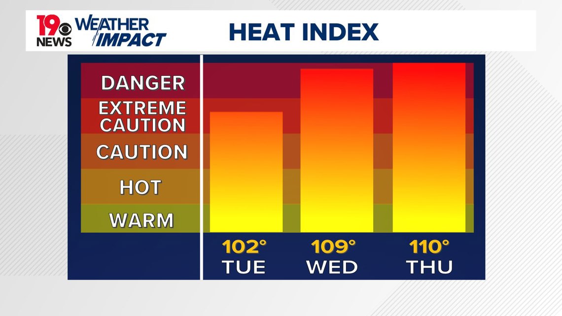
Thursday will see similar conditions, with slightly higher temperatures and heat indices up to 110 degrees. There is a significant probability of strong storms due to high instability and some drier air aloft, which could lead to severe downbursts.
Looking towards the end of the week, dangerous heat is expected with heat indices above 110. Scattered thunderstorms will develop each afternoon and evening, especially over the weekend.