
COLUMBIA, S.C. — This is the first week of Fall and it will start feeling like it soon after a few very warm days this past weekend.
In the Carolinas and Virginia, we experience a very unique weather setup called Cold Air Damming.
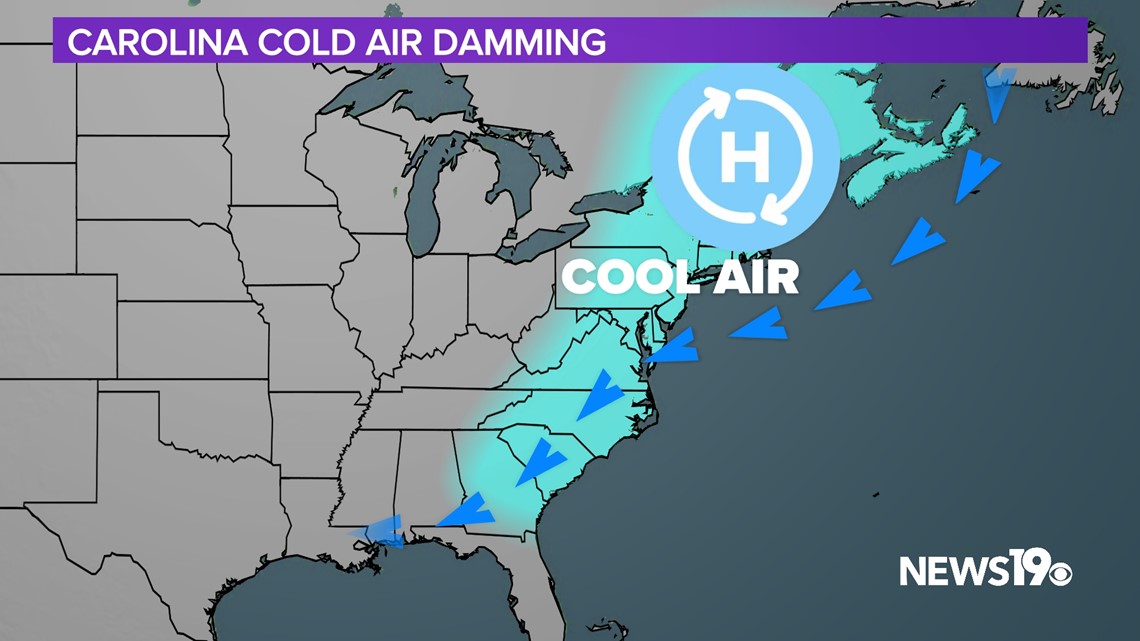
We typically see this occur when strong high pressure sets up around New England bringing in cooler and gloomy weather. To further understand why this occurs we first need to understand the air itself.

Density is “How much stuff is inside a given space”. When it comes to air warm air is less packed together while colder air is much more dense. This makes cold air “heavier” than warm air.
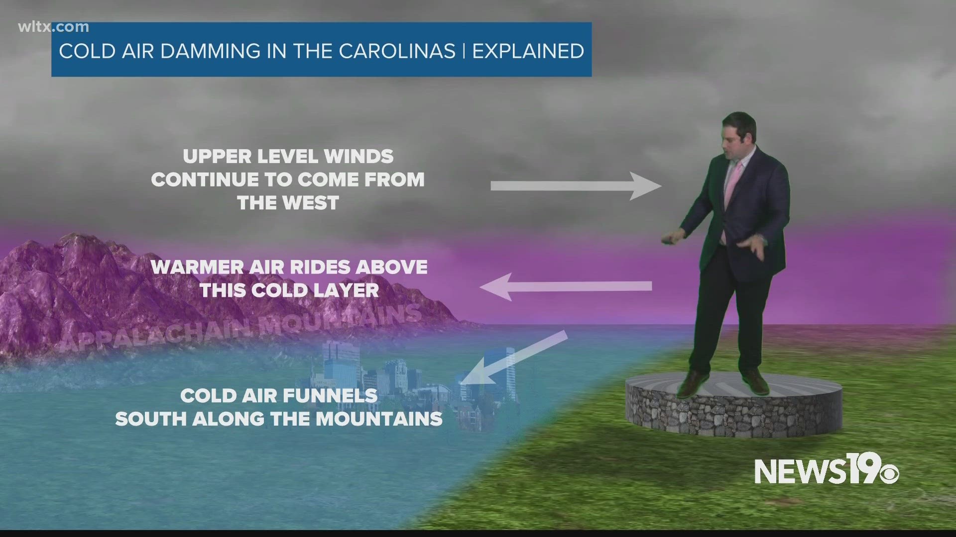
This sets the stage for what we end up seeing. Colder air is funneled against the Appalachians and since it cannot rise over the mountains, it is pushed southward in a shallow layer near the surface. Meanwhile, at the mid-levels warmer air rides above this shallow cold pool.

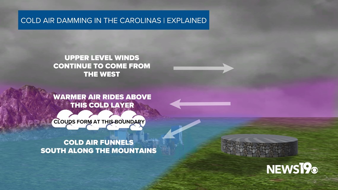
The interaction between these two layers is typically where we see a thick blanket of clouds with light rain and drizzle form in our strongest cold air-damming days.
While it is Fall right now, this mixing of temperature layers is how we often get messy winter weather setups in the colder months.

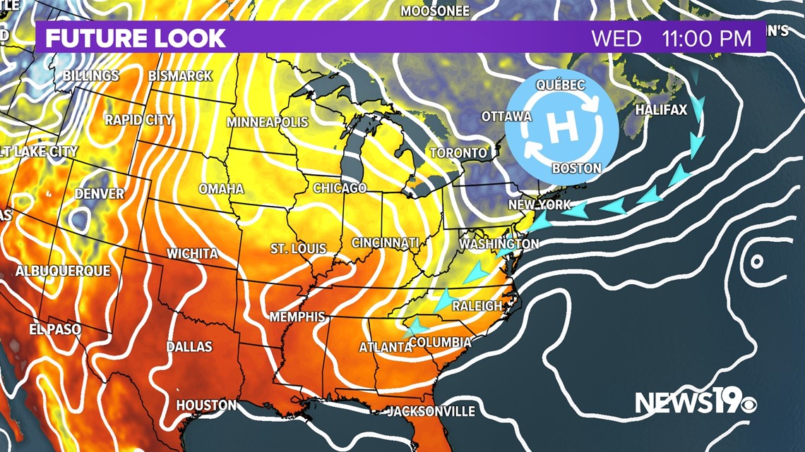
As for cold air damming we will be starting Wednesday seeing the pattern in full force and lasting through the end of the week, resulting in cooler air being pushed into our area with highs likely in the 70s through the weekend.