
COLUMBIA, S.C. — The first official day of astronomical fall is Monday, September 23rd, but the Midlands will get a taste of cooler weather a few days early.
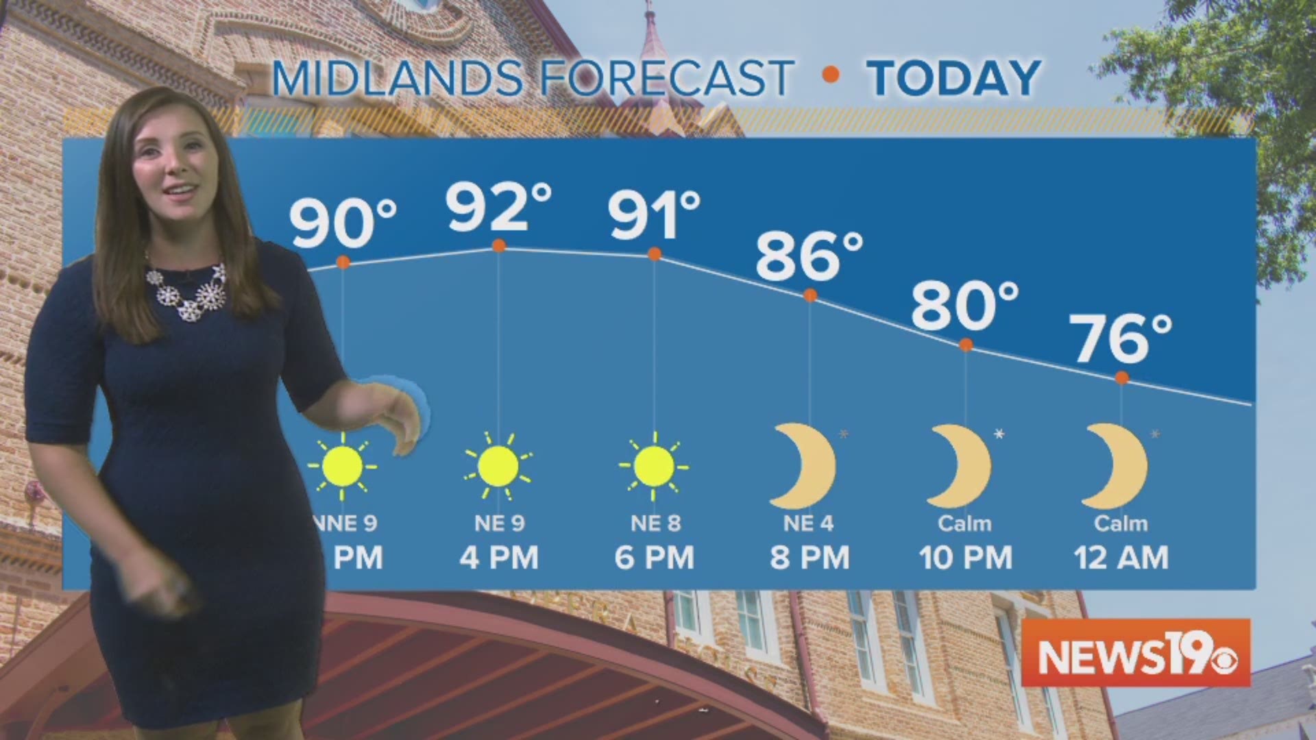
The start of the work week will remain famously hot with temperatures topping out in the 90s, well above our average for this time of year of 86°. While temperatures will be hot, at least skies will be mostly sunny for Monday and Tuesday.
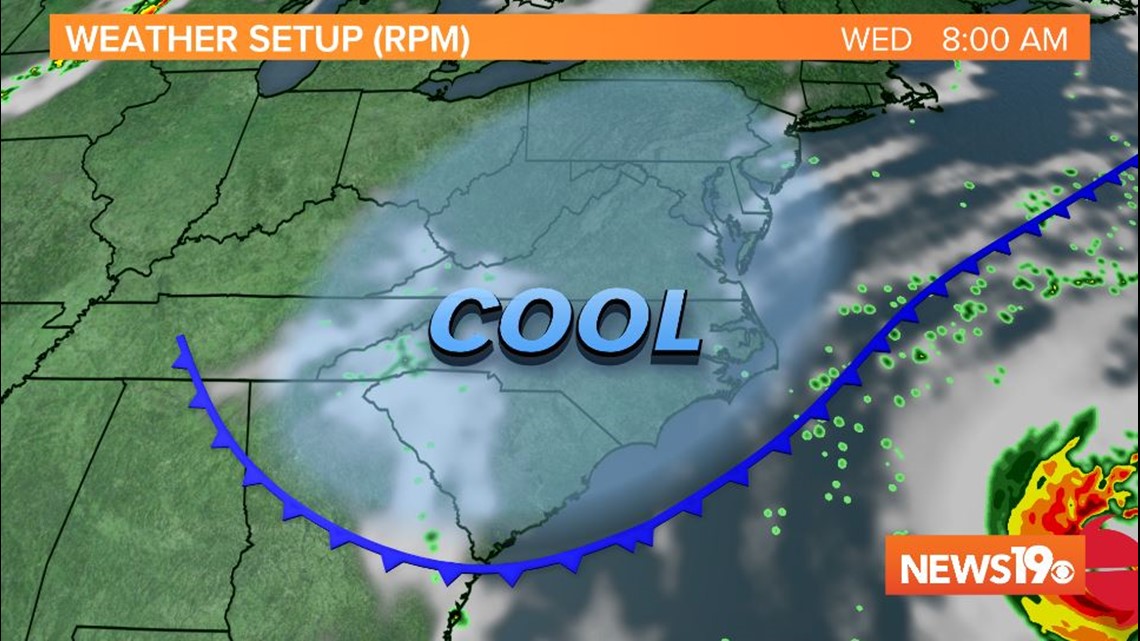
Overnight Tuesday into Wednesday morning, a backdoor cold front will sink into the Southeast from the Northeast, ushering in cooler and drier air. As the front sinks south, there is a small chance for an isolated shower late Tuesday or early Wednesday. That threat will quickly diminish Wednesday afternoon.

Highs on Wednesday will be in the low to mid 80s across the Midlands, with temperatures dropping into the 60s overnight into Thursday.
Not only does this front provide a much needed cool down, but it will also help keep Hurricane Humberto out to sea with it's northeastward track.
Conditions will remain clear and beautiful for Thursday, which will be the pick of the week. Temperatures will stay in the low 80s to upper 70s for those in the northern Midlands.
Thursday night into Friday morning will be even cooler with temperatures dropping into the upper 50s to low 60s across the region.
Unfortunately, the cooler weather will not last for too long. Temperatures will be back close to 90° for the weekend with dew points and humidity increasing as well