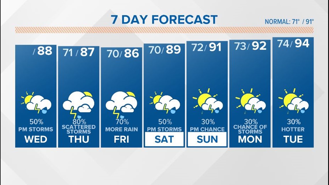
COLUMBIA, S.C. — Scattered showers and storms will be possible this afternoon and this evening. More rain is on the way for Thursday and Friday.
Moisture will increase across the Midlands today. The chance for rain will be higher than yesterday.
Showers and storms will develop in the heat of the day. The threat of severe weather is low, but a strong storm could produce some damaging wind gusts.
High temperatures this afternoon will be in the upper 80s with some areas possibly reaching the lower 90s with more sunshine.
Some rain may linger tonight, but any shower or thunderstorm activity should decrease around midnight.
Lows Thursday morning will be in the upper 60s and lower 70s. Some fog will be possible again Thursday morning for some areas.
There will be a better chance for rain Thursday. Showers and storms will be likely. Severe weather is not expected, but heavy rainfall will be possible.


High temperatures with the clouds and rain in place will top out in the middle to upper 80s.
Showers and storms will be likely Friday too. Heavy rainfall will be possible with some the storms. The rain chances decrease after sunset. High temperatures will again be a little below normal.
Gradually, the rain chances will decrease as we go through the weekend. There still will be a chance for a few showers and storms both Saturday and Sunday though.
Temperatures will start to increase as the opportunity for rain decreases. Highs over the weekend will be near normal, topping out in the upper 80s and lower 90s.
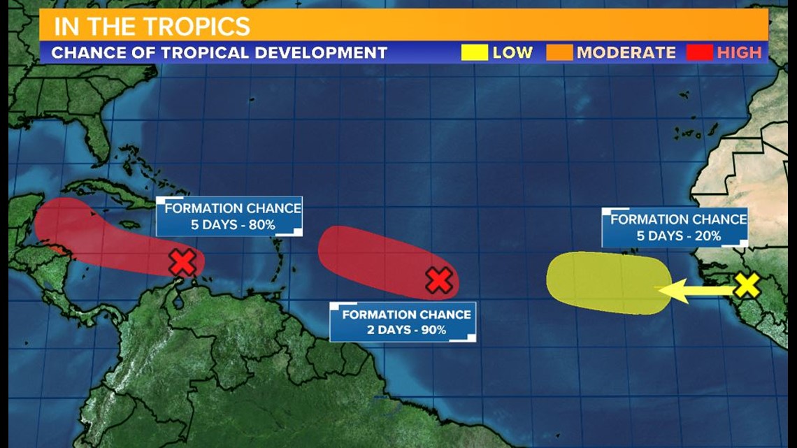
Tracking the Tropics:
There are no named storms right now, but three areas are being watched in the Atlantic for possible tropical development.
The disturbances are not a threat to the mainland United States in the short term, but they will have to be monitored.


