Temperatures will continue to warm through the workweek and into the weekend. There may be a few showers possible starting Sunday.
It was another chilly start to the day. Temperatures fell into the middle and even lower 30s in some of the typically cooler locations.
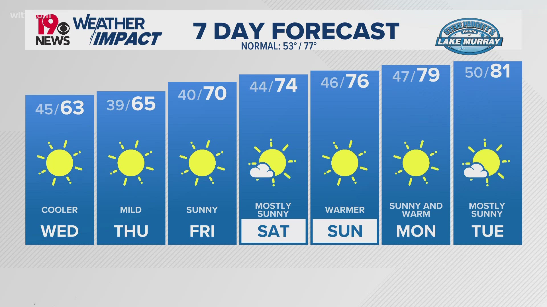
Temperatures were seasonable Wednesday afternoon. Highs topped out in the upper 60s and lower 70s. Our average high temperature in Columbia this time of the year is 71 degrees.
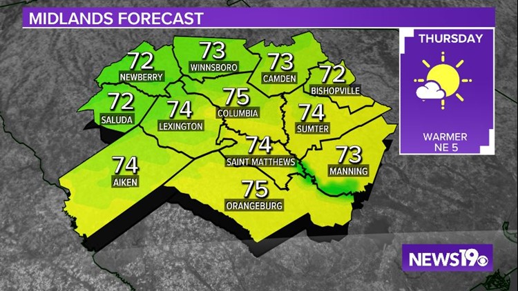
Thursday morning will be clear and cool. Lows will be in the lower to middle 40s. Things will be warming up Thursday afternoon. Highs will top out in the lower to middle 70s under mostly sunny skies.
A few more clouds will be possible Friday. High temperatures will remain in the middle 70s. It should be a dry end to the workweek.
The moisture will begin to increase over the weekend as Eta moves northward. No rain is expected Saturday, but a few isolated showers will be possible Sunday.
The chance for rain will stick around Monday through Wednesday, but that forecast will depend on what happens in the tropics.
Tracking the Tropics:
We are still in hurricane season and we may have to watch the remnants of Hurricane Eta. The National Hurricane Center now has parts of Florida in the cone of uncertainty.

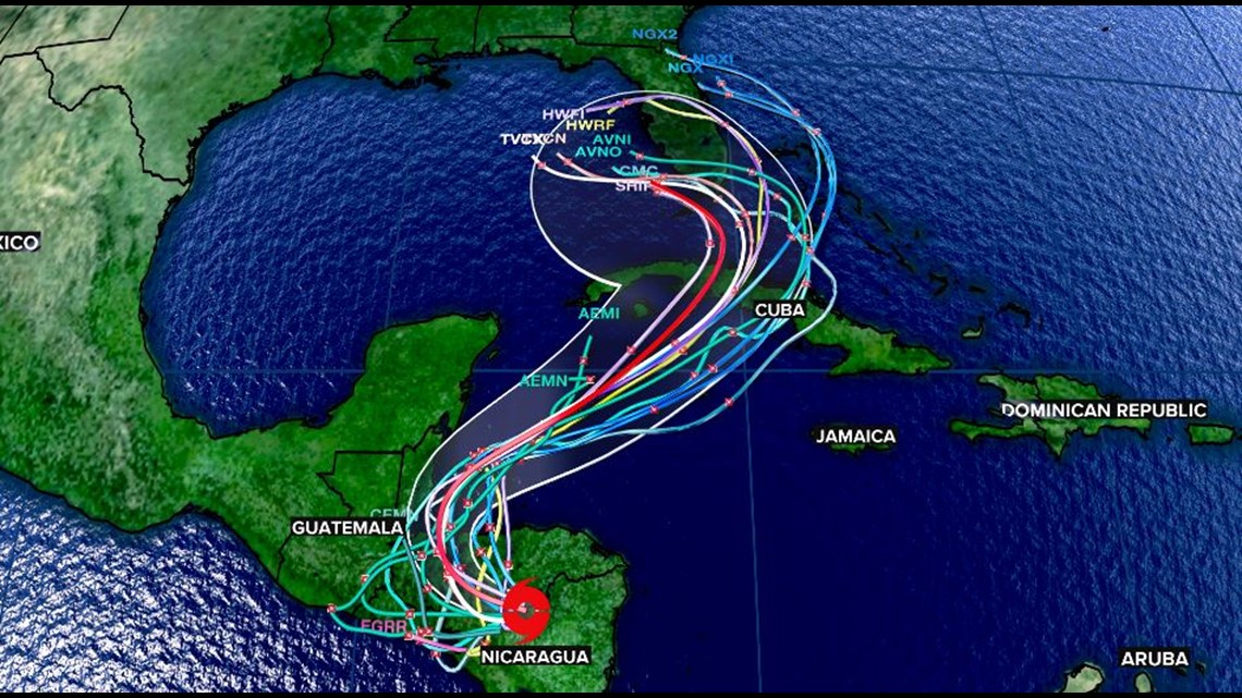
Some of the longer-range models push the system back into the Gulf of Mexico. The current forecast may increase the moisture for us in South Carolina. Right now, we have small chances of showers in the forecast Sunday through Wednesday.
There is low confidence in this forecast. Small changes in the intensity, path or timing of Eta could have major impacts on our weather.
Looking Ahead:
Looking ahead, the warmer-than-normal weather will likely continue according to the Weather Prediction Center.

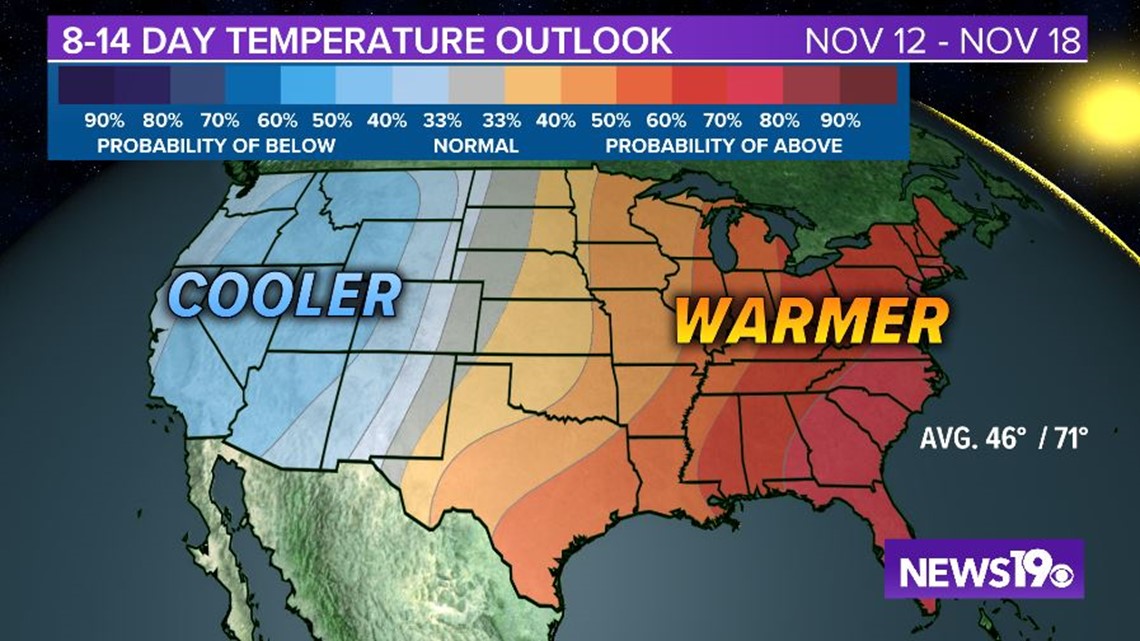
Warm weather is in the forecast November 11 through November 17.