
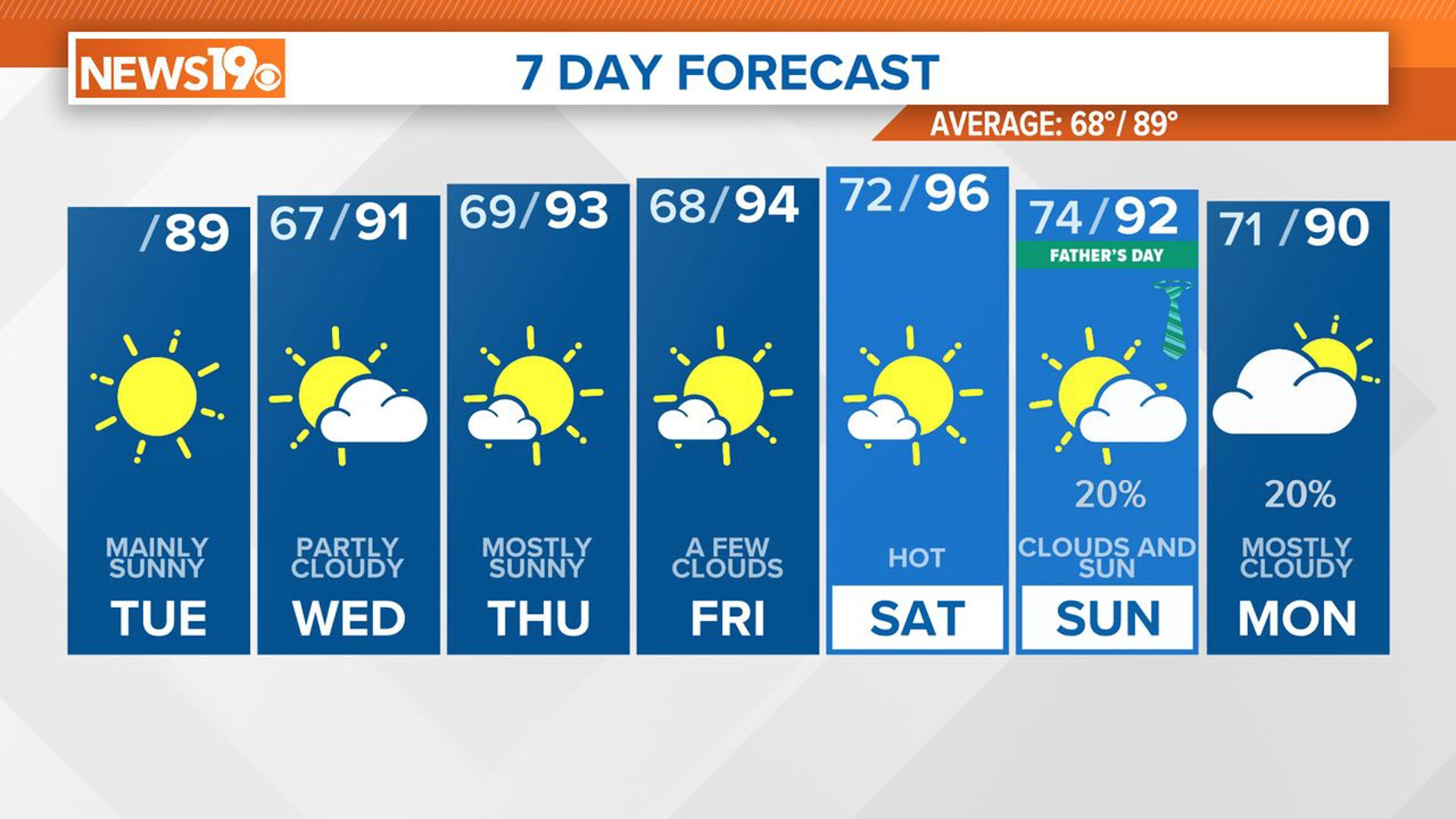
COLUMBIA, S.C. — As we move through the middle of the week, drier air is spreading into our region, thanks to high pressure building in from the north. This high-pressure system will bring clear skies and pleasant weather for the next few days. However, by the weekend, moisture will start to return, leading to higher chances of afternoon and evening showers and thunderstorms. Expect temperatures to rise above normal, especially by the weekend.
Low clouds will continue to develop and spread westward throughout the early morning. These clouds should dissipate, leading to mainly sunny skies. High pressure will build over the region, leading to slightly warmer temperatures than yesterday, with highs in the mid to upper 80s.
High pressure will persist tonight and tomorrow. A trough to the west might bring some high clouds, potentially limiting fog development. Overnight temperatures will be slightly below normal, with lows in the lower to mid-60s.
High pressure will remain northeast of our area, keeping drier air in place. A potential weak circulation off the Southeast US coast could develop by late Wednesday, but it will likely not affect us significantly.
With light surface winds from the southeast, moisture will increase very slowly, and the chances of any significant rain or thunderstorms remain low. Expect high temperatures in the upper 80s to low 90s on Wednesday and in the low 90s on Thursday. Overnight lows will generally be in the mid-60s.
Models show good agreement for the long term, with a weak surface boundary dropping southward through the eastern US on Friday, bringing some moisture from the Gulf. By Saturday, this boundary will likely dissipate, with high pressure becoming centered over the eastern Great Lakes and gradually increasing easterly flow and moisture over our area.
An upper-level ridge will build over the central US on Friday and move eastward over the weekend, bringing chances for showers and thunderstorms on Sunday and Monday. Expect above-normal temperatures, especially on Saturday.