

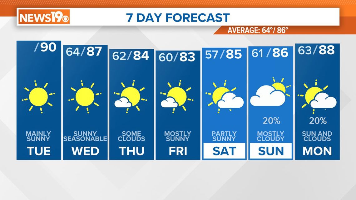
COLUMBIA, S.C. — Expect a welcome change in the weather as cooler and drier conditions move in behind a cold front. High pressure building in from the upper Mississippi Valley will dominate the region, bringing high temperatures in the 80s for most of the week and into the weekend. However, prepare for a shift back to more humid conditions by the weekend, with a chance of showers and thunderstorms early next week.
The cold front, currently situated in the Upstate, will continue to push southeastward and is expected to reach the Coastal Plain by the afternoon. Behind the front, drier air will move in, significantly reducing moisture levels.

An upper trough currently to our west will cross the forecast area this afternoon. While high-resolution guidance suggests isolated showers or storms may develop near the front during peak heating, especially over the Coastal Plain, most of this activity is expected to be east of our area.
There is a slight chance of an isolated shower in the eastern Midlands, where deeper moisture and some instability may linger, but generally, we anticipate a rain-free day. Despite the front, temperatures will remain warm, with highs ranging from the upper 80s to the lower 90s.
Overnight, clearing skies will support good radiational cooling, though not ideal as the center of the surface high remains to the west. Expect overnight lows to be cooler, dropping to the lower 60s.
On Wednesday, high pressure will build into the area from the northwest, bringing dry weather and mostly sunny skies. Cooler air from the north will result in lower temperatures than the past few days, with highs in the mid-80s to around 90. Overnight lows will further drop, reaching the upper 50s to low 60s.
From Thursday through Saturday, northwesterly flow will persist, maintaining dry weather and near or slightly below normal temperatures. High pressure over the area will keep rainfall unlikely through the workweek and into Saturday. Daytime highs will generally be in the mid-80s.
As the weekend approaches, an upper-level trough will move offshore, and surface high pressure will also shift offshore. This transition to a more zonal flow pattern and increasing atmospheric moisture will bring a higher chance of showers and thunderstorms from Saturday night into early next week.
Long-range ensemble forecasts indicate increased cloud cover and precipitation may keep temperatures around normal for the weekend, with highs in the mid to upper 80s.