
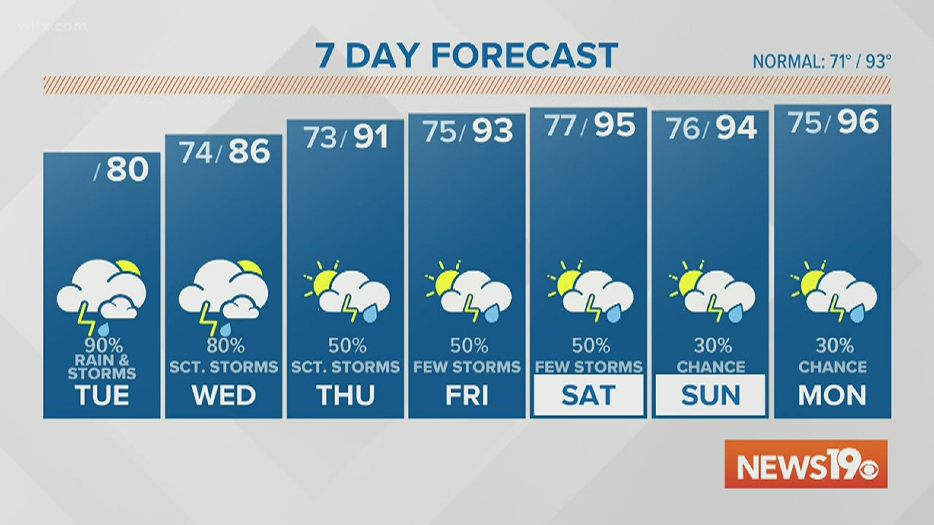
COLUMBIA, S.C. — Widespread rain across the Midlands continues this afternoon as an area of low pressure moves across the state.
This comes after a rainy Monday, where many locations picked up an inch to two inches of rain.
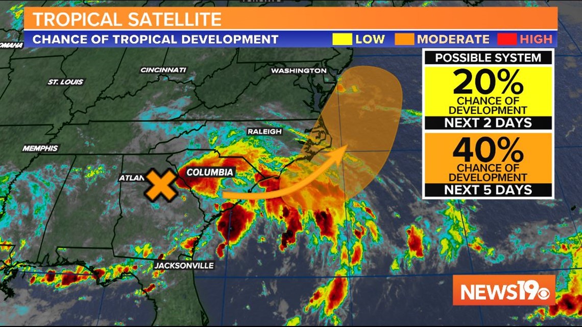
As the small area of low pressure tracks closer to the coast, rainfall and some storms will persist. Because of this continued heavy rain, a flash flood watch has been issued for Aiken, Saluda, and Newberry counties, among the other counties shaded in green.
The flash flood watch will continue until midnight Wednesday.


Low lying areas that typically flood should be monitored. There may also be ponding on roadways. Make sure if you do see a flood road, turn around, don't drown.
Models forecast some breaks in the rain through the afternoon and evening, but overall the day will be overcast.
High temperatures will struggle to reach 80 degrees this afternoon due to the rainfall and cloud cover.


Some scattered showers and storms will continue on Wednesday as the low pressure moves over the ocean.
There is the potential that the low develops tropical characteristics as it moves over water. The National Hurricane Center gives it a 40 percent chance of development over the next five days.

The heat will return across the Midlands by the end of the week. Rain chances will also switch for all day rain to more afternoon storms driven by the heating of the day.
RELATED: Local Forecast