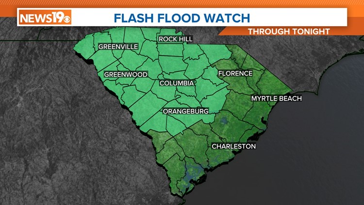
COLUMBIA, S.C. — A flash flood watch is in effect through tonight. Through the evening, there will likely be significant rainfall in the area. Totals of 2-4" of rain are predicted, with possibly higher amounts locally. There is also a chance of severe weather this afternoon. If a severe storm forms, its main threat will be damaging winds.
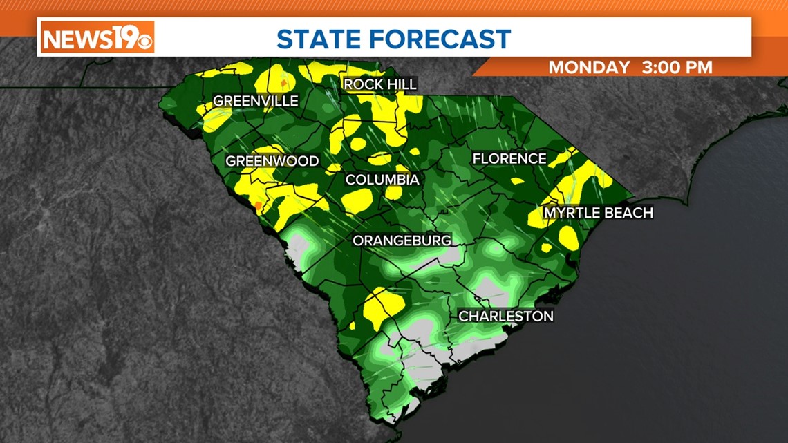
The Midlands will continue to see showers today. Excessive rainfall continues to be possible through tonight, which could lead to flash flooding. The flash flood watch includes all of the Midlands and most of South Carolina.
The Storm Prediction Center puts South Carolina at slight risk (Level 2 out of 5) for severe storms today. This means that scattered severe storms are possible; they will be brief and/or localized, and isolated intense storms are possible.

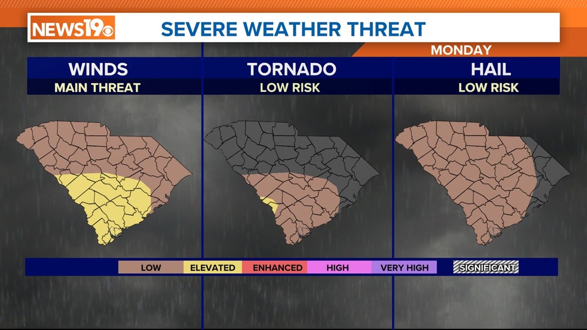
The threat of severe weather is highest in the southern half of the Midlands this evening as a cold front moves through the state. Once the front moves through, the threat of severe weather will end. The showers and storms should exit the area by midnight.

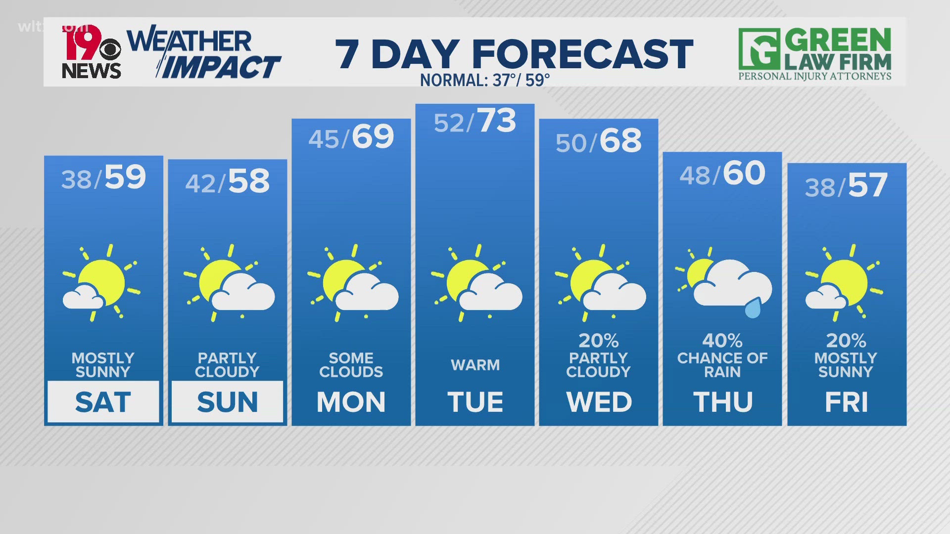
High temperatures today will be in the middle to upper 60s, even with the clouds and rain in place.
Strong, gusty winds will develop behind the cold front. Winds will be out of the west at 15–25 mph tonight and Tuesday. Sunny skies will return to the state on Tuesday. Highs will be in the lower 60s.
The weather will be dry through Friday, but the chance of rain will return to the Midlands over the weekend.