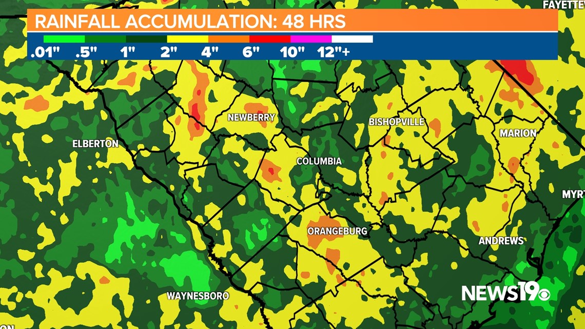
COLUMBIA, S.C. — We saw heavy rain move in overnight going into Wednesday morning, this has helped rainfall totals reach anywhere from 2-4 inches already in portions of the Midlands. We could add another 1-3 inches by the end of the week as low pressure brings more rounds of heavy rain.

Looking at the radar estimated rainfall over the past few days, we have seen a healthy amount of rain but, thankfully so far, rainfall rates have been low enough that we have avoided any flash flood threats although that looks like that could change as we go later into Wednesday afternoon and evening.

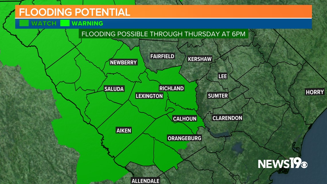
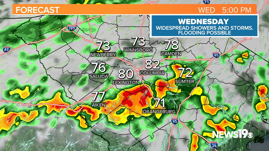
As of right now, isolated storms will be likely during the first half of the day. Rain chances look to greatly increase as we head into the evening hours. A group of storms is expected to move from the south to the north dropping heavy rain. This is where we could run into some flooding concerns and is the reason there is a flood watch issued.

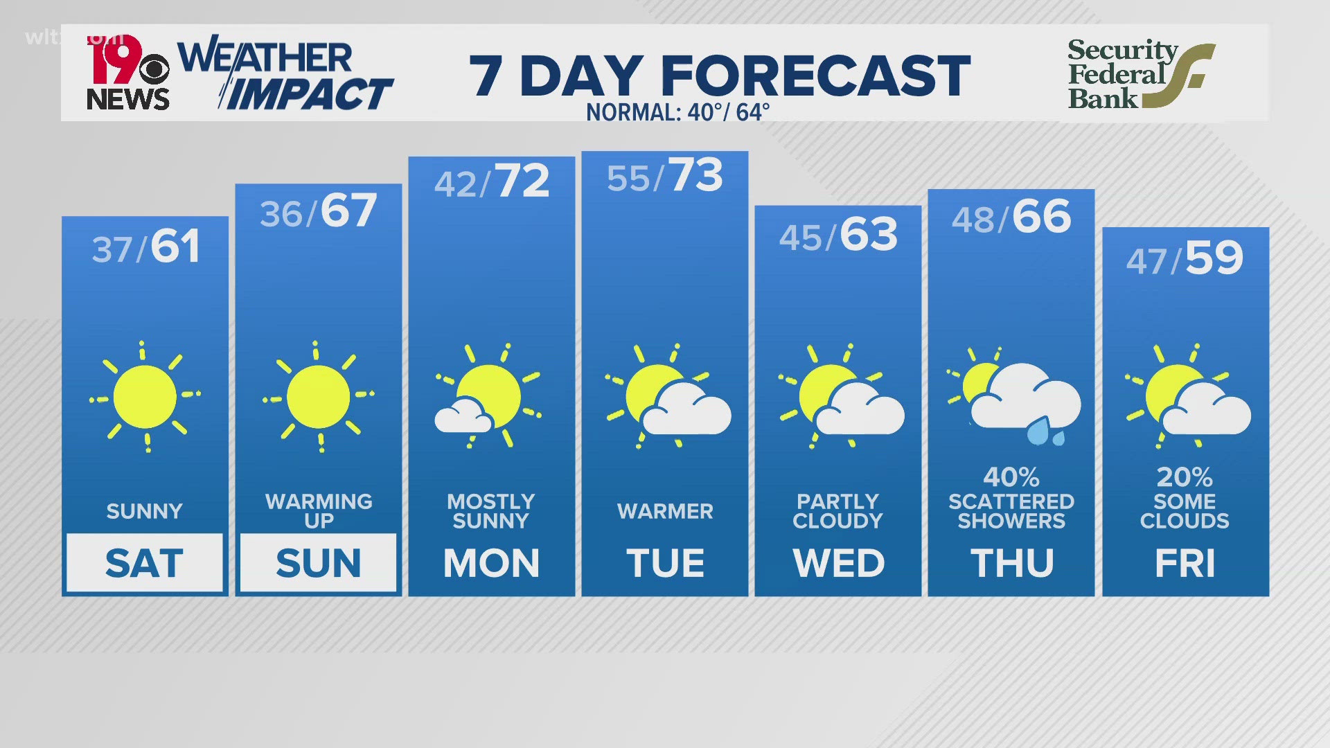
Thursday, it looks like we could continue to see the threat of heavy rain in the area which could lead to more flooding chances. By the time we get to Friday, we could pick up another 1-3 inches of rain in the Midlands on top of what we already have seen.
This weekend, the low should be further north. This will make for somewhat drier weather. Storms will still be possible on Saturday and Sunday but more isolated in nature. Temperatures should be closer to the 90s during this time as well.