COLUMBIA, S.C. —
The Midlands of South Carolina should see several days of relatively calm weather after two extremely difficult days in a row thanks to Tropical Storm Helene.
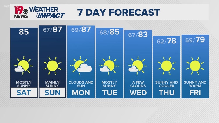
The remains of Helene are currently stalled over western Kentucky and Tennessee, and they will move very slowly east overnight, reaching central Kentucky by Sunday morning. As this system moves, we can expect clouds to increase, with a few showers possible in the Northern Midlands and Pee Dee areas on Sunday.

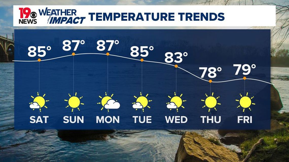
By Monday, the system will pass to the north of us, and a weak cold front will move through midweek. However, the chances of rain with this front are low. Later in the week, high pressure will take over, bringing dry weather on Thursday and Friday. Temperatures throughout this period will remain near or slightly above normal.

Looking at the immediate forecast, the next 24 hours should be relatively calm. However, there are a few things to keep in mind. Wind gusts of up to 20 mph could still knock down tree limbs, particularly those that were weakened by the remnants of Helene. It’s important to avoid driving around road closures and allow utility crews to work safely. Those going outdoors, especially near trees, should be cautious and check overhead for any loose limbs.
Another issue is rising river levels, as water from upstream continues to flow into the area. Many rivers are already above normal and are expected to keep rising through the night, especially in areas that are already experiencing flooding. If you’re near rivers or creeks, stay alert and avoid flooded areas.


Temperatures today will reach the mid to upper 80s, which should be comfortable for those heading to weekend activities. However, make sure to stay hydrated, take breaks, and watch for signs of heat-related issues. Tonight, temperatures will drop to the mid to upper 60s.
As we move into Sunday and Monday, the upper-level system will continue to shift eastward. Expect mostly sunny skies and daytime temperatures to be slightly above normal, making for a relatively pleasant end to September.