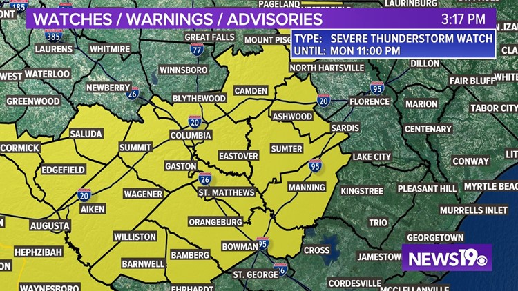
COLUMBIA, S.C. — A severe thunderstorm watch is now in effect for most of the Midlands as a system continues to bring rain and storms to the area.
The watch is in effect for the following counties until 11 PM Monday: Richland, Lexington, Saluda, Orangeburg, Calhoun, Sumter, Lee, Clarendon, and Kershaw Counties. A watch means conditions are favorable to severe weather, which is different from a warning, which would mean a severe storm has been confirmed over the warning area.
A disorganized tropical disturbance is moving through the southeast bringing heavy rainfall and strong thunderstorms into South Carolina. Already the system has triggered multiple severe thunderstorm warnings.
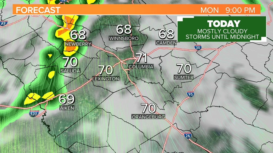
Heavy rain is expected and a few storms will be capable of producing damaging wind, localized flooding, and excessive lightning. H
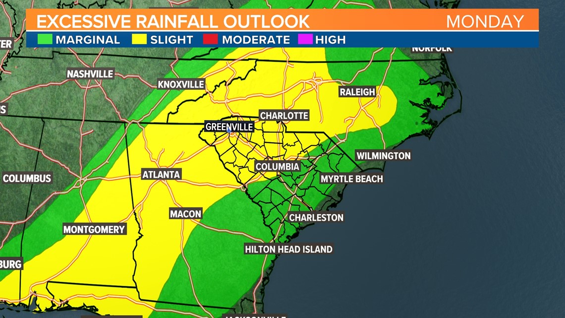
The Weather Prediction Center issued a slight risk (Level 2 out of 4) for Excessive Rainfall for the South Carolina Midlands from the I-20 corridor north and west into the Upstate and North Carolina. A "Slight Risk" means there's a 15% chance for flooding within 25 miles within the risk area. The rest of the Midlands is in the lower (1 out 4) marginal risk for excessive rainfall where the potential still exists for isolated instances of ponding on the roadways.

Timing
The best risk for heavy rainfall is now through 7 PM. A final round of heavy rain is possible in the early overnight hours before things settle down for the evening.

What else to expect
The criteria for a "severe" thunderstorm is one that produces at least 58 mph winds, hail at least 1" in diameter, or is capable of producing a tornado. The Storm Prediction Center has issued a level 1 out of 5 risk for severe thunderstorms in the Midlands on Monday afternoon.
Storms that are not severe can still produce damaging, and the storms on Monday in particular are feeding on very humid air which is why excessive rainfall is today's biggest threat.
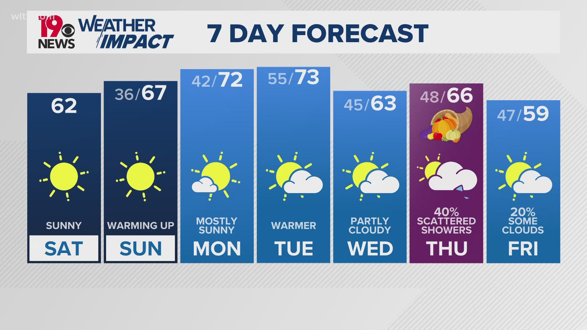
This humid air mass will persist in the Midlands for most of the work week bringing daily chances for rain. We're expecting humidity to drop behind a Friday cold front which should clear things out for the start of Memorial Day weekend.