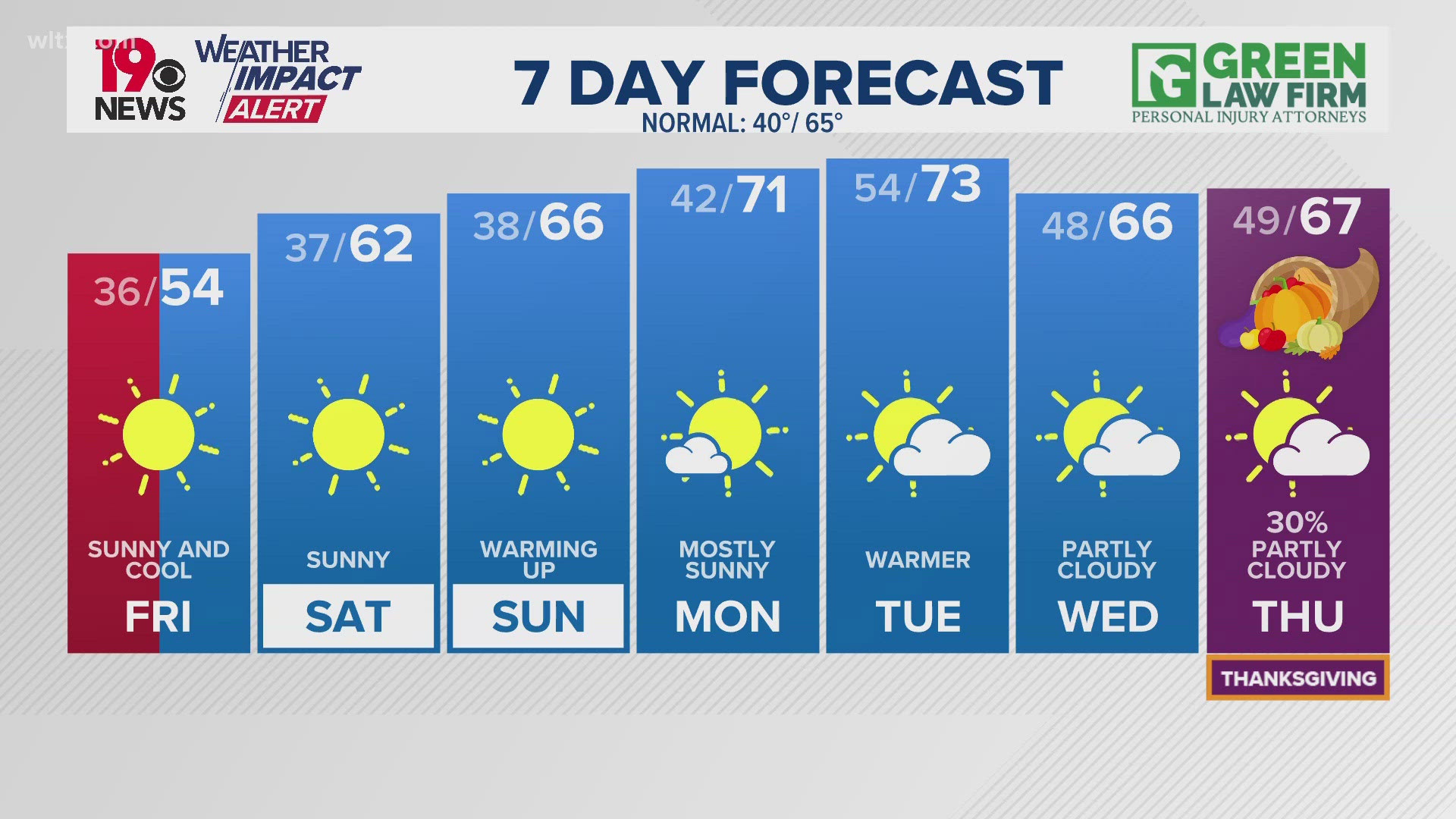
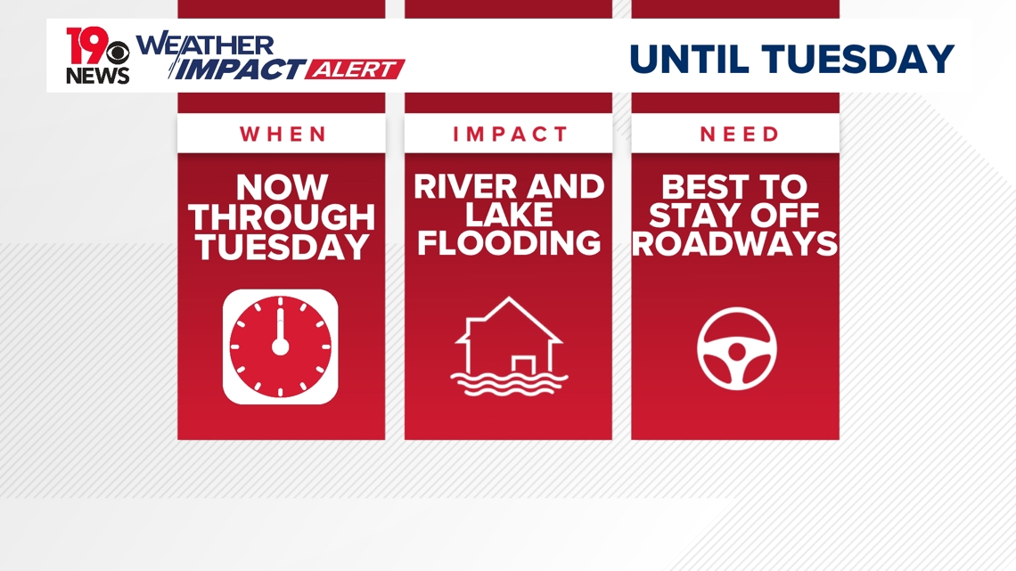
COLUMBIA, S.C. — The News19 Weather Team has issued Weather Impact Alert days for Monday and Tuesday due to rising levels of rivers and lakes across the Midlands.
Many rivers will not drop below action stage for the next several days. Some rivers are forecast to reach historic levels. Those historic levels are from the 2015 historic South Carolina floods. This increase in water levels is due to runoff from excessive rainfall caused by Hurricane Helene.
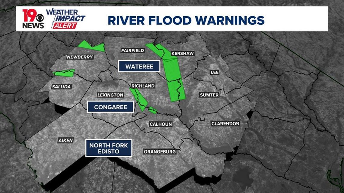
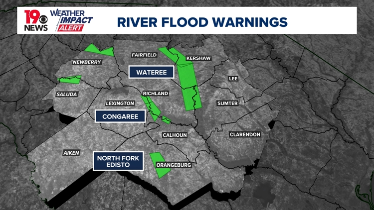
River flood warnings are in effect for the Enoree, Pee Dee, Saluda, Wateree, and Congaree Rivers. The issued warnings last from Tuesday to Friday depending on location. Residents in these areas should monitor conditions and instructions from emergency officials.

Below is a list of all river flood warnings across the Midlands:
Enoree River Flood Warning until Until Tuesday at 2:51 AM in Newberry County: As of 9:45 Am EDT Monday, The Stage Was 26.4 Feet. At 25.0 Feet, River Bottomland Near And Downstream From Whitmire Become Flooded. At 28.0 Feet, The Coleman Aughtry Road Along The River Becomes Flooded. Do Not Drive Into Flooded Roadways.
Saluda River Flood Warning until Wednesday 4:05PM in Newberry and Saluda Counties: As of 9:15 Am Edt Monday The Stage Was 22.1 Feet. At 18.0 Feet, The Saluda River Campground Including The Campground Store Downstream From Chappells Becomes Flooded. Campers Should Move To Higher Ground. At 21.0 Feet, Extensive Flooding Occurs. Farmland And River Bottomland Around And Downstream From Chappells Become Flooded. Much Of The Saluda River Campground Downstream From Chappells Become Flooded.
Congaree River Flood Warning until Thursday 1:22 AM in Lexington, and Richland Counties: As of 9:00 Am Edt Monday The Stage Was 30.6 Feet. .At 21.0 Feet, Extensive Swampland And Large Areas Of Farmland And Pasture Land Downstream From Columbia Are Flooded. At 24.0 Feet, Flooding Also Occurs In The Cayce Quarry. At 28.0 Feet, Flooding Begins In Low Lying Areas Of The Riverland Park Subdivision In Cayce. At 30.0 Feet, The Enclave Apartments Along The Broad River And I-20 Become Flooded.
Congaree River Flood Warning until Thursday 10:30 AM in Calhoun, Lexington, and Richland Counties: At 127.0 Feet, Portions Of The Carolina Eastman Facility Have To Be Evacuated. At 8:00 Am EDT Monday The Stage Was 126.9 Feet.
Congaree River Flood Warning until Thursday 10:30 AM in Calhoun and Richland Counties: At 18.0 Feet, Several Homes In The Sandy Run Subdivision Along The River Become Flooded. At 18 Feet The River Covers The Weston Lake Overlook In The Congaree National Park. Between 18 And 18.5 Feet The River Begins To Cover Sections Of The Elevated Boardwalk. As of 9:00 Am Edt Monday The Stage Was 19.1 Feet.
Wateree River Flood Warning until Thursday 10:30 AM in Fairfield, Kershaw, and Lexington Counties: As of 8:00 Am EDT Monday The Stage Was 105.3 Feet. At 102.5 Feet, Roadways Near Beaver Creek Become Flooded. At 103.0 Feet, Home Owners On Low Lying Property Have To Move Belongings Out Of Basements Or From Under Raised Houses. Boat Launch On U.S. Highway 1 At The Lake Closed Due To Flood Water. At 105.0 Feet, Roads And Homes Nearest The Lake Shore Flood. Flooded Roads Isolate Areas Extending From The Lake Shore.
Wateree River Flood Warning until Friday 9:12 AM in Kershaw County: As of 9:00 Am EDT Monday The Stage Was 37.4 Feet. At 35.0 Feet, Fairview Plant Road Near The River Floods. Flood Water Backs Up Into Five And Twenty Mile Creek West Of Camden. At 39.0 Feet, Southern Railroad Traffic Downstream From Camden And In The Eastover Area May Be Affected.