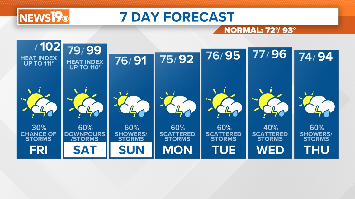
COLUMBIA, S.C. — The Midlands of South Carolina can expect another dangerous hot day Friday as the heat index will soar well into the triple digitals.
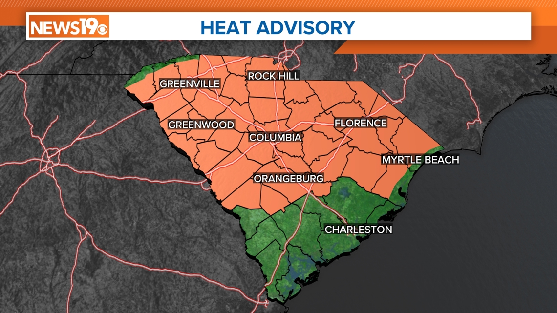
The National Weather Service has issued a heat advisory for much of South Carolina, including all Midlands counties, until 8 p.m. Friday. As a reminder, the National Weather Service office in Columbia issues a Heat Advisory when Heat Index Values are expected to be 108° or greater.
The actual air temperature could reach 102 degrees. We won't get much relief after the sun sets, as the temperature even at 11 p.m. could still be in the mid to upper 80s.
![](https://media.wltx.com/assets/WLTX/images/bad46ff4-fe80-4f19-a2d6-403e53406d92/20240705T153719/bad46ff4-fe80-4f19-a2d6-403e53406d92_16x9.jpg)
![](https://media.wltx.com/assets/WLTX/images/bad46ff4-fe80-4f19-a2d6-403e53406d92/20240705T153719/bad46ff4-fe80-4f19-a2d6-403e53406d92_1140x641.jpg)
Saturday's forecast will likely warrant a Heat Advisory as well as high temperatures are expected to get up to 99 degrees, with heat index values much higher than that.
![](https://media.wltx.com/assets/WLTX/images/a0c6cd49-dff9-42b8-b6d5-aa63596acf63/20240705T153946/a0c6cd49-dff9-42b8-b6d5-aa63596acf63_16x9.jpg)
![](https://media.wltx.com/assets/WLTX/images/a0c6cd49-dff9-42b8-b6d5-aa63596acf63/20240705T153946/a0c6cd49-dff9-42b8-b6d5-aa63596acf63_1140x641.jpg)
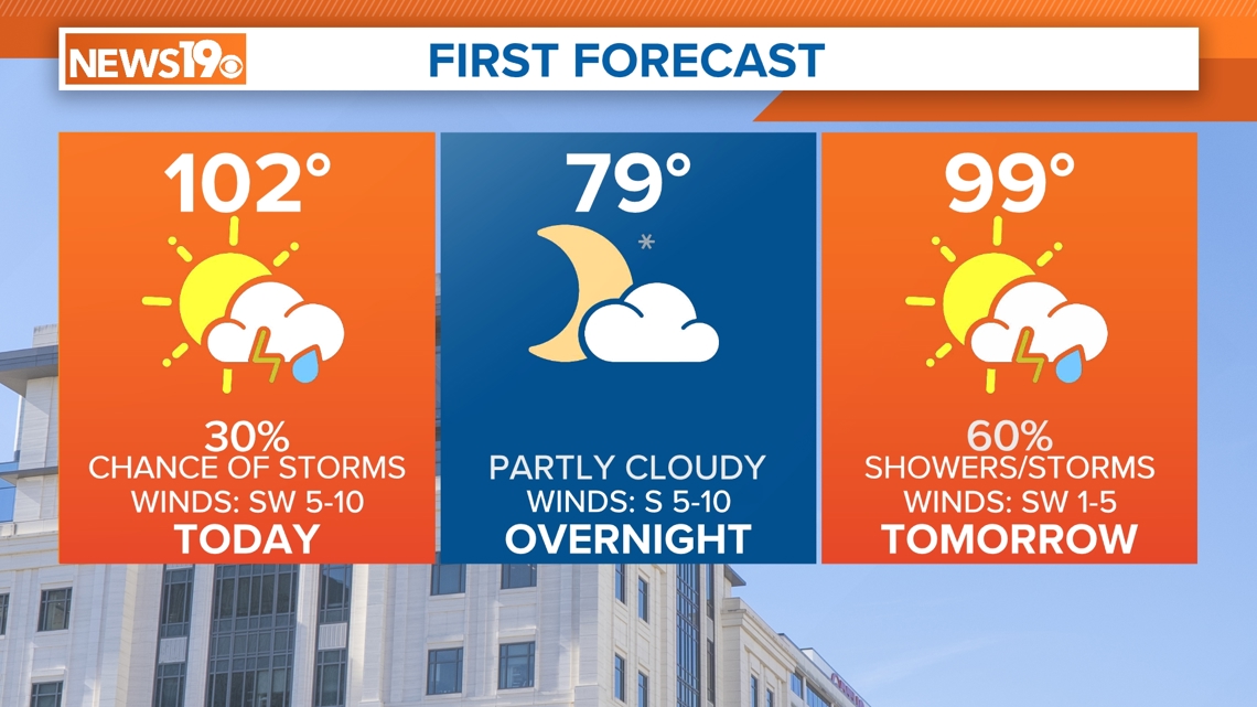
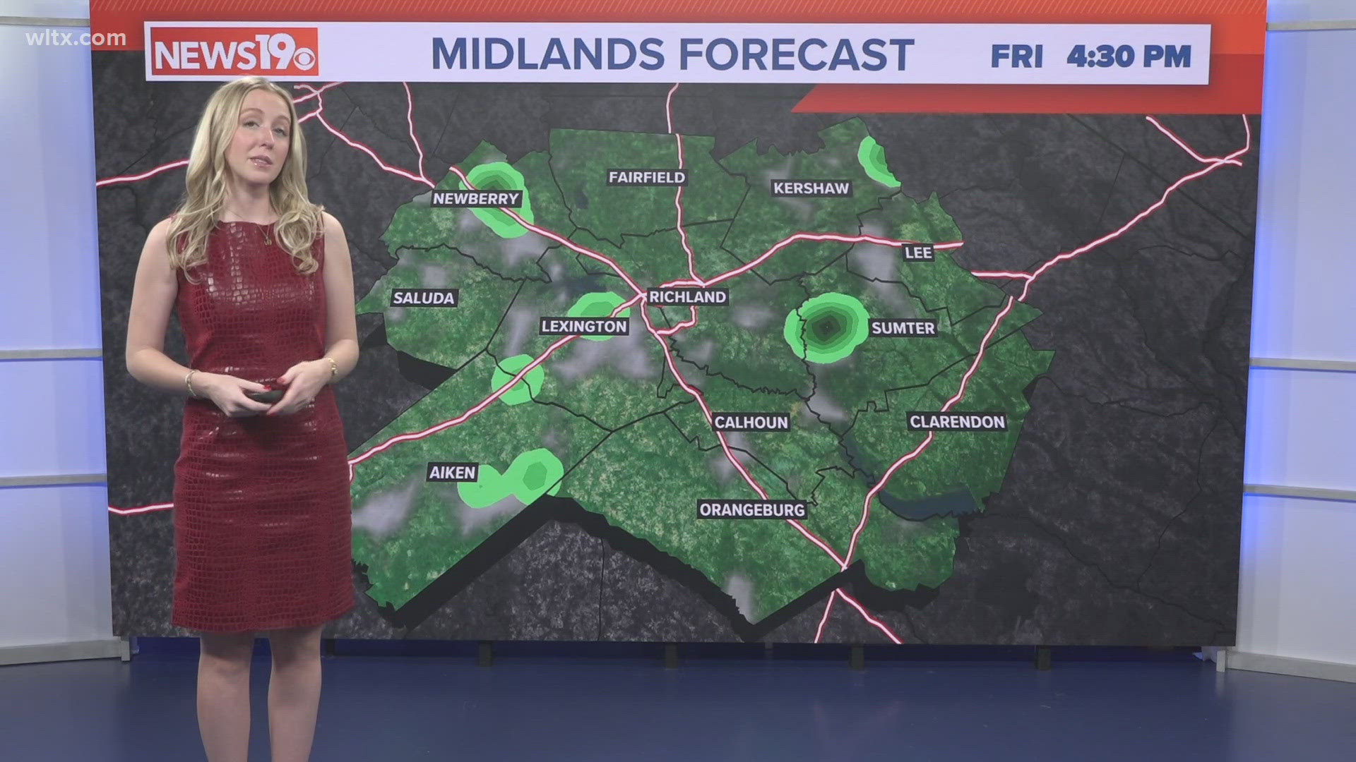
According to our forecast models, there will be a chance of showers and storms that could develop late Friday evening, but if they do develop, they will be spotty. The areas that do will begin to cool down a little bit
The Midlands will see a better chance for afternoon showers and storms come Saturday.
![](https://media.wltx.com/assets/WLTX/images/ce1eab2c-e128-4dd5-aad2-803ecdcd721b/20240705T154126/ce1eab2c-e128-4dd5-aad2-803ecdcd721b_16x9.jpg)
![](https://media.wltx.com/assets/WLTX/images/ce1eab2c-e128-4dd5-aad2-803ecdcd721b/20240705T154126/ce1eab2c-e128-4dd5-aad2-803ecdcd721b_1140x641.jpg)
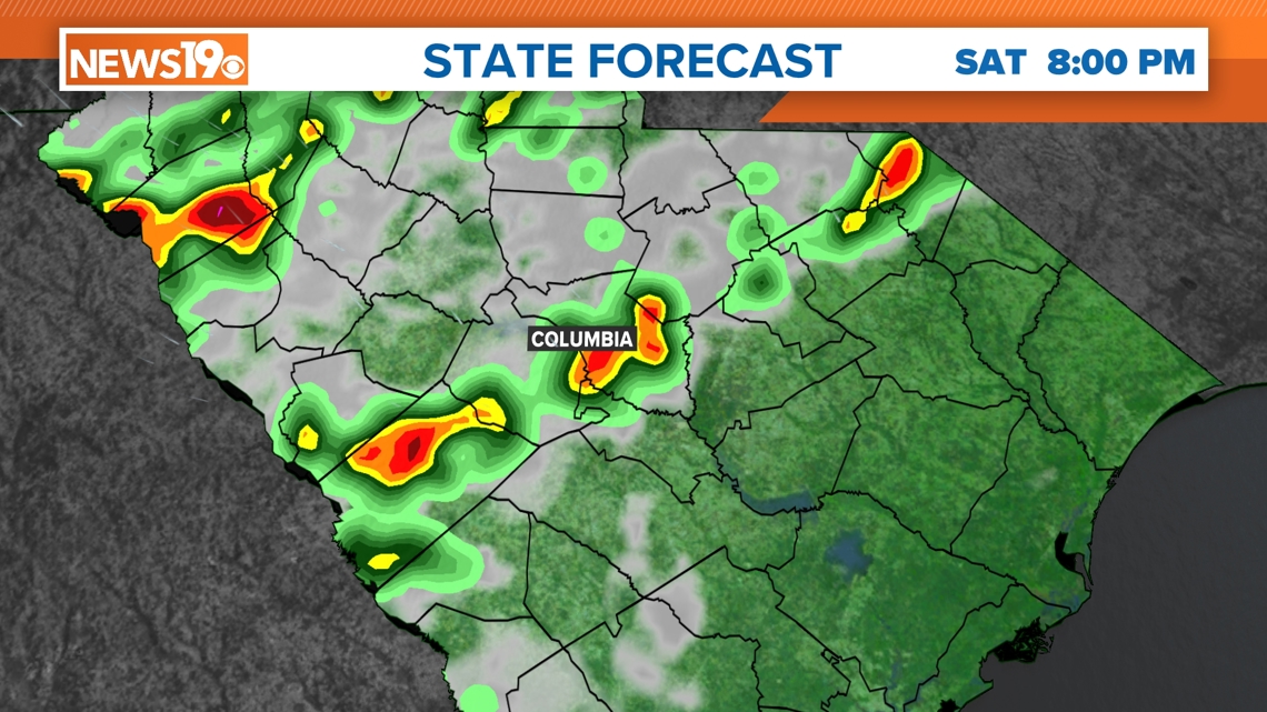
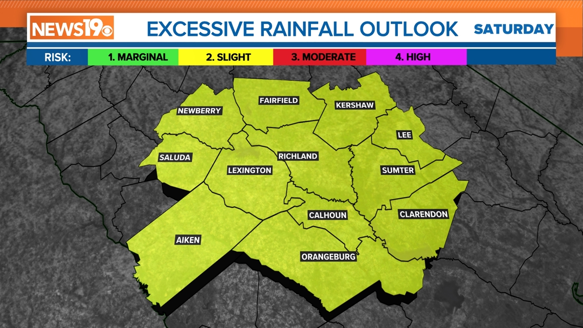
Some of those storms may have high rain rates. The Weather Prediction Center has placed the Midlands under a slight risk to see excessive rainfall.
![](https://media.wltx.com/assets/WLTX/images/e18c6cf5-77b1-481f-a8ac-3a9b33aab097/20240705T155003/e18c6cf5-77b1-481f-a8ac-3a9b33aab097_16x9.jpg)
![](https://media.wltx.com/assets/WLTX/images/e18c6cf5-77b1-481f-a8ac-3a9b33aab097/20240705T155003/e18c6cf5-77b1-481f-a8ac-3a9b33aab097_1140x641.jpg)
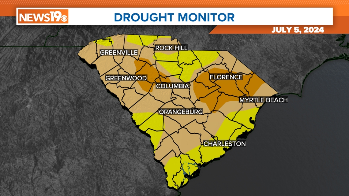
Rain is welcomed as all of South Carolina is in some form of drought.
![](https://media.wltx.com/assets/WLTX/images/c10f45a3-545d-4ab2-af09-14724b3ff77d/20240705T155050/c10f45a3-545d-4ab2-af09-14724b3ff77d_16x9.jpg)
![](https://media.wltx.com/assets/WLTX/images/c10f45a3-545d-4ab2-af09-14724b3ff77d/20240705T155050/c10f45a3-545d-4ab2-af09-14724b3ff77d_1140x641.jpg)
Due to the passing of a cold front, high temperatures will be closer to normal (93°) by Sunday.
![](https://media.wltx.com/assets/WLTX/images/fb386fdc-bdbb-49d2-a1c0-78ff359a347d/20240705T155141/fb386fdc-bdbb-49d2-a1c0-78ff359a347d_16x9.jpg)
![](https://media.wltx.com/assets/WLTX/images/fb386fdc-bdbb-49d2-a1c0-78ff359a347d/20240705T155141/fb386fdc-bdbb-49d2-a1c0-78ff359a347d_1140x641.jpg)