
COLUMBIA, S.C. — A heat advisory is in effect for today across a large part of South Carolina, with heat index values expected to reach up to 108 degrees in the Midlands. Additionally, isolated storms may develop along the sea breeze late this afternoon, adding to the mix of weather conditions. The combination of high temperatures and high humidity will make it feel particularly oppressive, especially in areas closer to the coast.
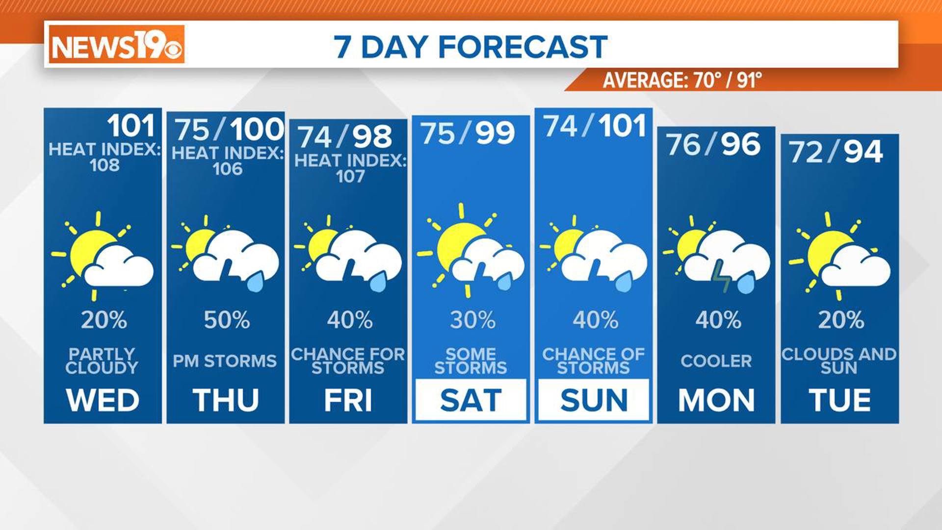
Summer is in full swing, and the heat is showing no signs of letting up. Over the next several days, temperatures are expected to soar, with heat index values and air temperatures climbing at or near 100 degrees.

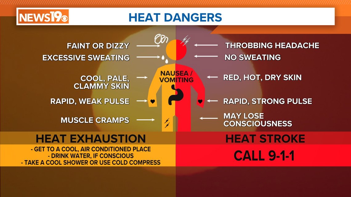
This means it will feel extremely hot and muggy, so it is essential to take precautions to stay cool and hydrated. This persistent heat wave calls for everyone to be mindful of heat-related illnesses and to take steps to protect themselves from the scorching sun.
In addition to the heat, the afternoons and evenings will bring isolated to scattered showers and thunderstorms. These will be particularly prevalent in the eastern Midlands and coastal areas. On Thursday, as a front approaches, we can expect more widespread showers and thunderstorm activity.
Today's weather setup features a boundary of moist air draped over the region, creating a mix of dry conditions in central Georgia and more humid conditions along the coast of South Carolina. This setup will lead to very high temperatures, pushing highs to around 100 degrees across the Midlands. The hottest conditions will be in the east due to the higher humidity. Tonight, winds will continue from the southwest, keeping temperatures mild in the mid-70s.

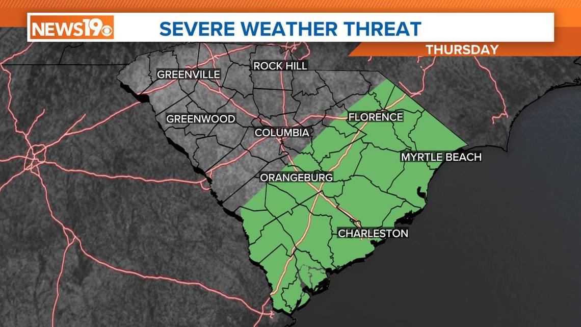
Looking ahead to Thursday, we can expect scattered showers and thunderstorms in the afternoon and evening, with some potentially becoming severe. The primary threat from these storms will be wind damage. The eastern Midlands and coastal areas will be the most likely locations for severe weather. Despite the increased moisture and instability, temperatures will be slightly cooler than previous days, with highs in the upper 90s and a few areas hitting the triple digits.
As we move into the weekend, the heat will ramp up again, with heat index temperatures climbing between 105 and 110. Scattered afternoon thunderstorms will remain a daily occurrence, providing brief respites from the heat. The pattern of hot and humid conditions will continue into early next week, with another weak front potentially bringing more showers and thunderstorms on Monday.
With the heat and humidity, it is crucial to drink plenty of water, avoid strenuous activities during the hottest parts of the day, and stay in air-conditioned places whenever possible. Be prepared for sudden thunderstorms and possible severe weather, especially in the afternoons and evenings. Stay cool, stay hydrated, and keep an eye on the weather for any updates to ensure you stay safe during this prolonged period of extreme heat.