
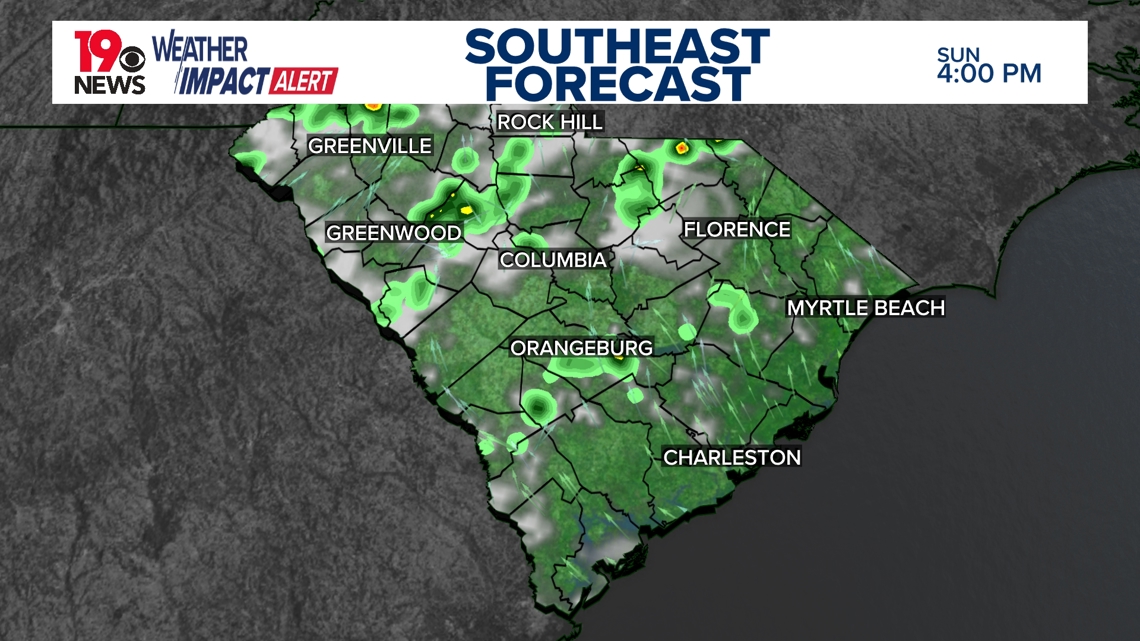
COLUMBIA, S.C. — Hot and humid weather will continue throughout Sunday, with scattered showers and thunderstorms expected to develop this evening.
Most scattered showers and storms are expected to remain north of I-20 and occur between 2 and 9 p.m. The primary risks are strong winds and heavy rain.

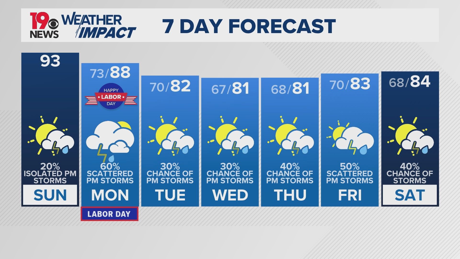
As a cold front slides south heading into Monday, rain chances are expected to increase across the Midlands, leading to more widespread showers and storms.

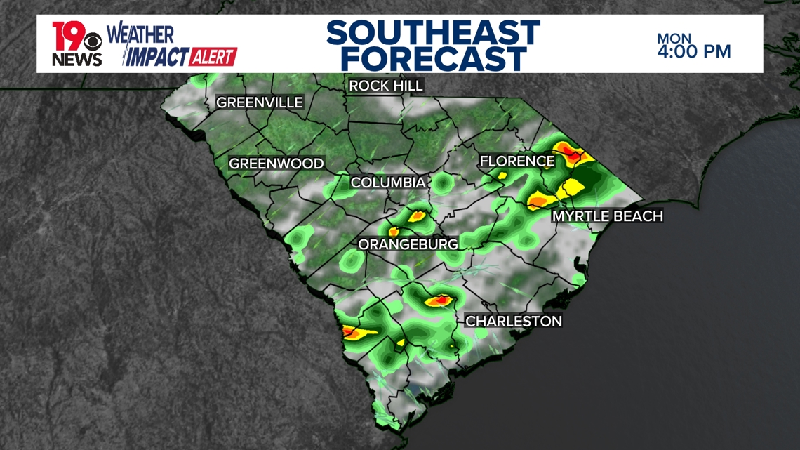
As the front slides through, highs will also drop into the 80s and lows into the 60s, providing relief from high temperatures and humidity.

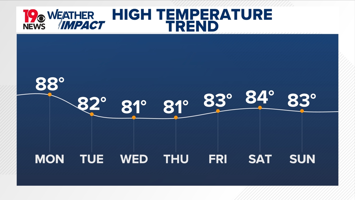
Highs will remain below average through the week as an area of High pressure to the north will continue to steer winds out of the Northeast, providing a wedging set-up that will keep cloud cover and cooler-than-average temperatures in place.