
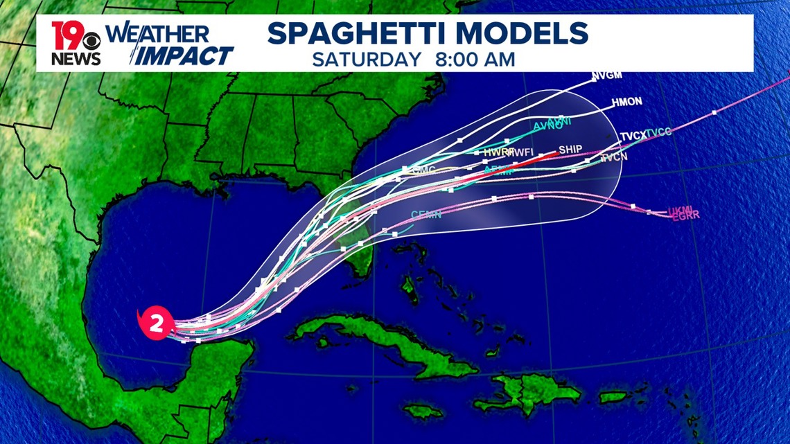
COLUMBIA, S.C. — A strong surface high-pressure system continues to dominate the weather today, but changes are on the horizon as a cold front is expected to move through tonight. This front will bring cooler and drier air for the remainder of the work week, giving a refreshing break from recent conditions. Meanwhile, Hurricane Milton is forecasted to pass to the south and east of the area, potentially bringing breezy conditions by mid-week.
A cold front is expected to cross the area this evening. While a few isolated light showers could develop, most places will remain dry. Behind the front, cooler and drier air will settle in tonight, with lows dropping into the upper 50s in northern areas and the low 60s elsewhere. Dewpoints will also fall significantly, making for a comfortable, crisp night.

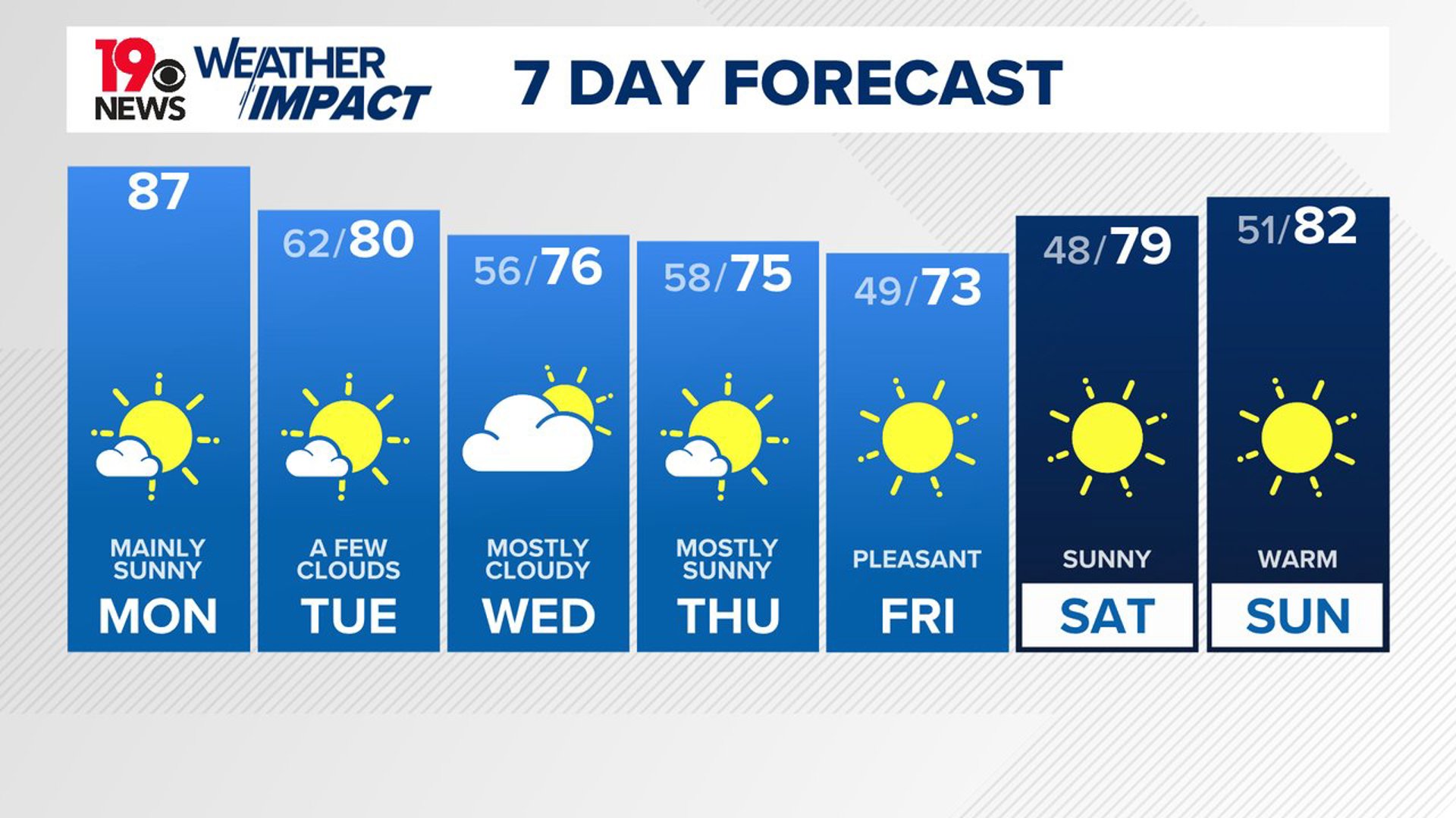
Looking ahead to Tuesday and Wednesday, the cold front will move southeast of the area, and dry high pressure will dominate. Clear skies and mild conditions are expected, with highs reaching the upper 70s and low 80s on Tuesday.
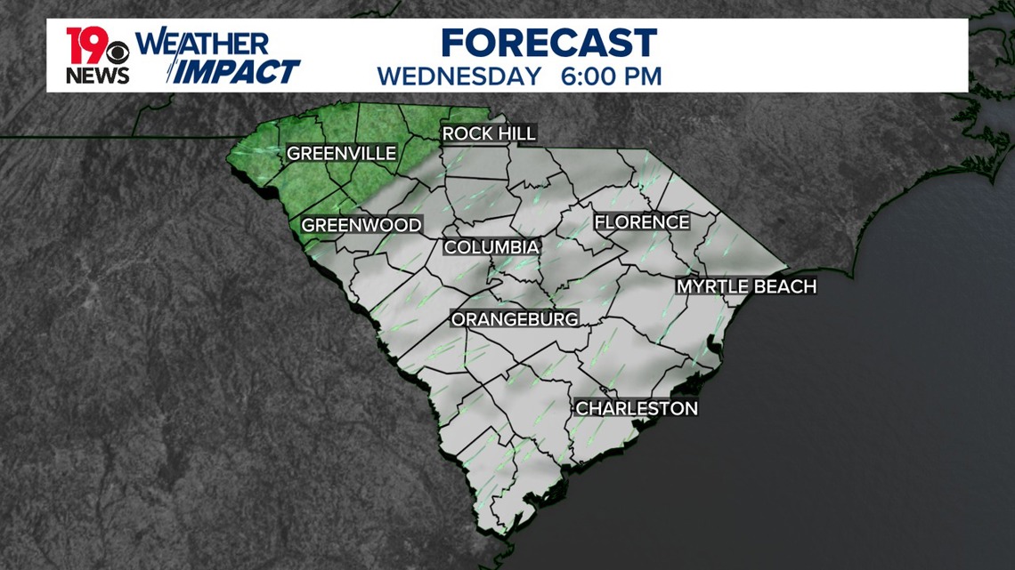
Overnight, the cool, dry air will keep temperatures in the mid to upper 50s. By Wednesday, the clouds will begin to increase as Hurricane Milton passes to our south. These clouds will help keep temperatures cooler, with highs only in the mid-70s. Overnight lows will again dip into the mid to upper 50s, maintaining the pleasant fall-like feel.
As we move into the long term from Wednesday night through the weekend, fall-like conditions will continue. Thursday will likely begin with significant cloud cover due to Hurricane Milton, though the extent of this depends on the storm's exact track.
Current forecasts have Milton passing through central Florida, allowing skies to clear from west to east, leading to a pleasant day for us in South Carolina. High pressure will fully settle over the region, with temperatures below average and dry conditions prevailing.

Expect highs in the low to mid-70s on Thursday and Friday, with dewpoints dropping into the 40s and 50s. This setup will bring a real taste of fall, with cool nights and pleasant days. Temperatures will gradually warm into the low 80s by the weekend, but the dry air will result in significant temperature swings between day and night, with overnight lows dipping into the upper 40s and low 50s.

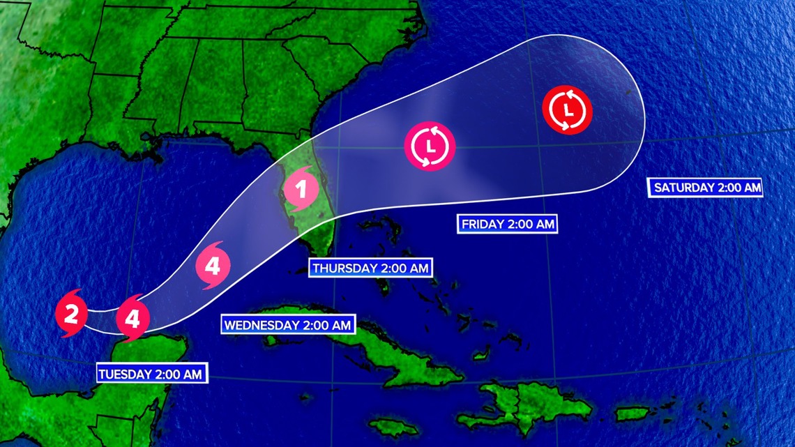
While there is a slight chance that Hurricane Milton could take a more northern track, which could bring light rain to southern areas on Thursday, this scenario remains unlikely based on current ensemble forecasts. For now, expect dry, fall-like weather to dominate for the rest of the week.