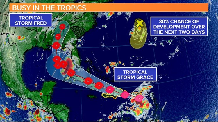
COLUMBIA, S.C. — Tropical Storm Grace formed early Saturday morning. It is the seventh named storm of the season. Fred is becoming better organized, it is forecast to make a landfall this week.
The Fred was located 390 miles south-southeast of Pensacola, Fla. It had winds of 40 mph. The low was moving north-northwest at 8 mph.
A tropical storm watch has been issued for portions of the north-central Gulf Coast from the Alabama/Florida border east to the Ochlockonee River, Florida.
Although Fred is somewhat disorganized, the forecast models show the circulation becoming better defined over as the cyclone moves over the Gulf of Mexico in slightly lower wind shear conditions.

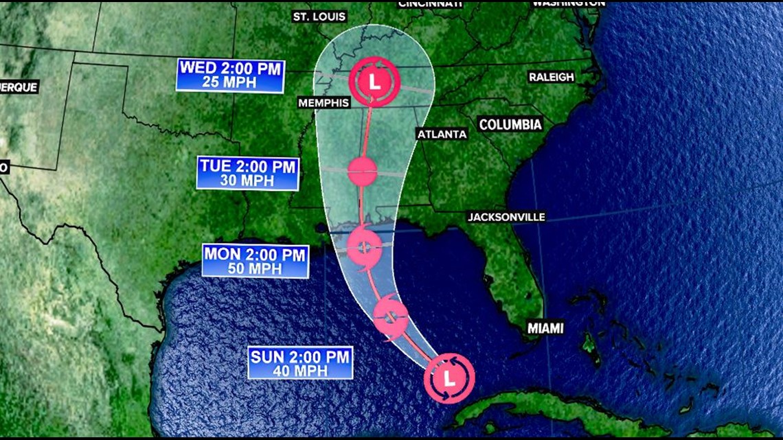
The storm is expected to strengthen some, but significant intensification is unlikely as southerly shear is anticipated to increase before the system reaches the Gulf coast on Monday.
After landfall, steady weakening is forecast, and Fred is likely to dissipate by the middle of next week.
Grace was located about 60 miles east-southeast of St. Croix. It had winds of 40 mph. The tropical storm was moving west-northwest at 16 mph.
A tropical storm warning is in effect for Saba, Sint Eustatius, Sint Maarten, St. Martin and St. Barthelemy.
Warnings are also in effect for the U.S. Virgin Islands, Puerto Rico, including Vieques and Culebra and the Dominican Republic from the southern Haitian border to Samana.
A tropical storm watch is in effect for the north coast of the Dominican Republic from the Haitian border to Samana and the entire coast of Haiti

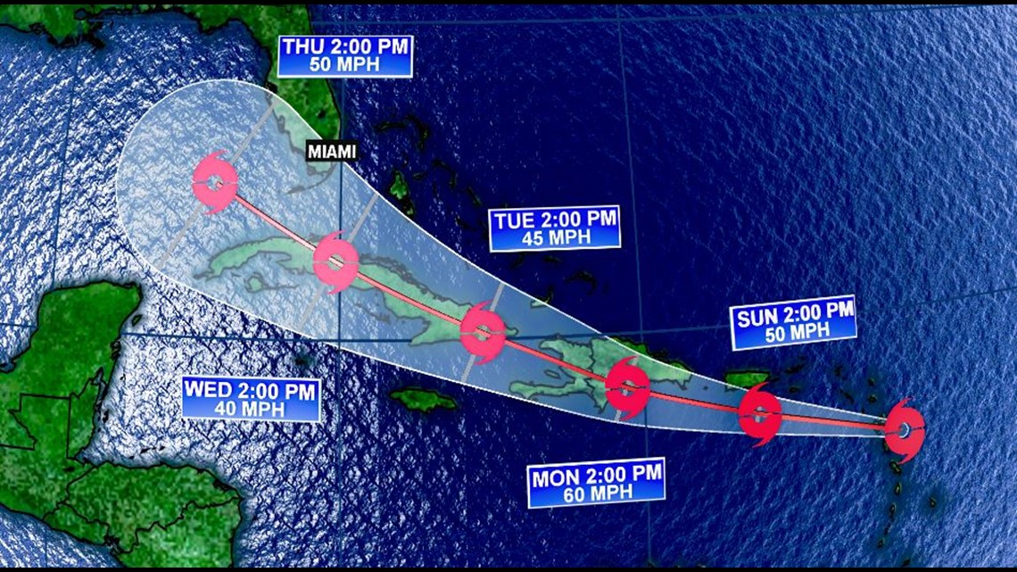
Slight weakening is indicated in the National Hurricane Center's intensity forecast as the system crosses the northern portion of the Dominican Republic early next week.
Moderate to strong northerly shear is forecast to impact Grace as the system moves into the flow on the western side of an upper-level trough over the western Atlantic. This shear should prevent any further strengthening through the end of the forecast period.
Elsewhere in the Tropics:
There is another area being watched in the Atlantic. A small but well-defined low pressure system located about 200 miles north-northeast of Bermuda is producing disorganized showers and thunderstorms mainly to the south and southwest of the center.
Some gradual development is possible over the next couple of days while the system moves slowly southward near or to the east of Bermuda. By Tuesday, however, environmental conditions are forecast to become less conducive for tropical cyclone formation
Midlands Forecast:
A front will approach the area and will slowly move through the state on Sunday. Showers and storms will be likely Sunday through Tuesday.
Fred may help enhances the moisture across the South, including for us here in the Midlands. Severe weather is not expected, but heavy downpours will possible.

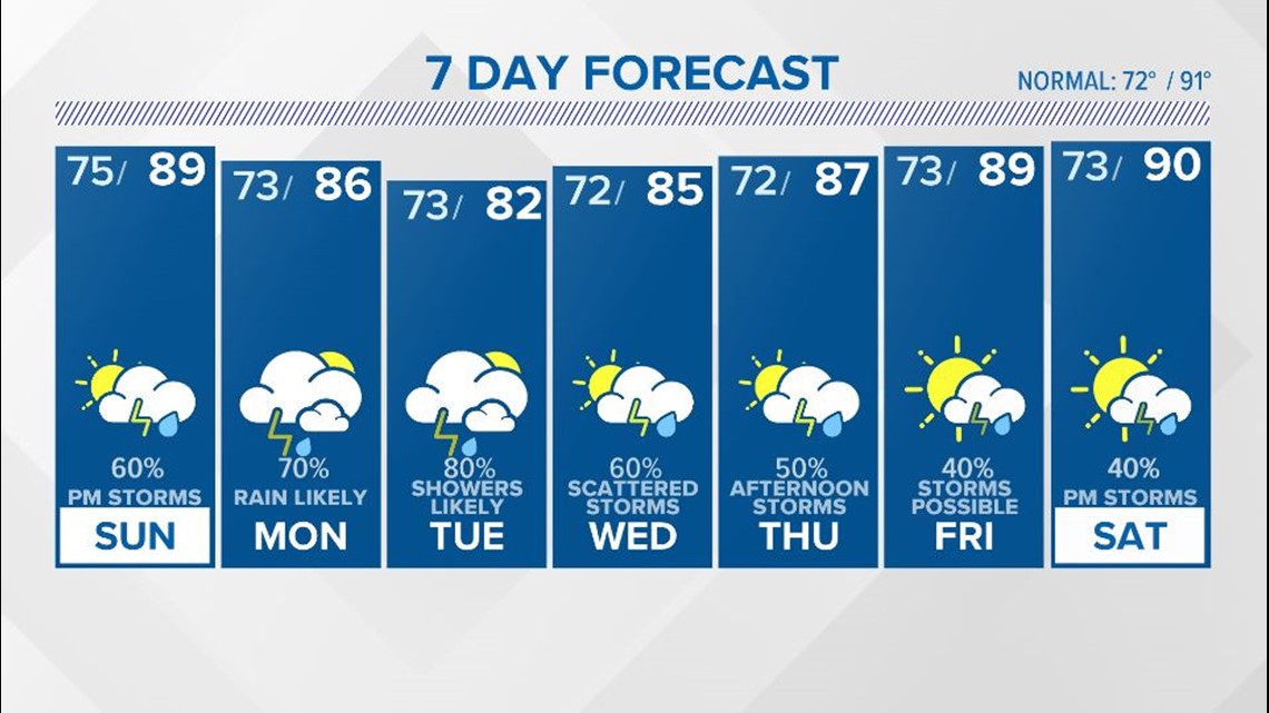
Scattered showers and storms are expected Wednesday through Friday. High temperatures through the workweek will be in the middle to upper 80s.
The chance for rain will hang around over the weekend. Temperatures will rebound into the upper 80s to near 90 degrees.