COLUMBIA, S.C. — Hurricane Ian will affect South Carolina's weather all day Friday, as the storm will be the first landfall from a hurricane in the state since 2016's Hurricane Matthew.
Right now, the storm is expected to strike the coast early in the afternoon but its effects will be felt hours earlier. So when and what can you expect? Here's the latest thinking.
South Carolina Hurricane Ian Forecast
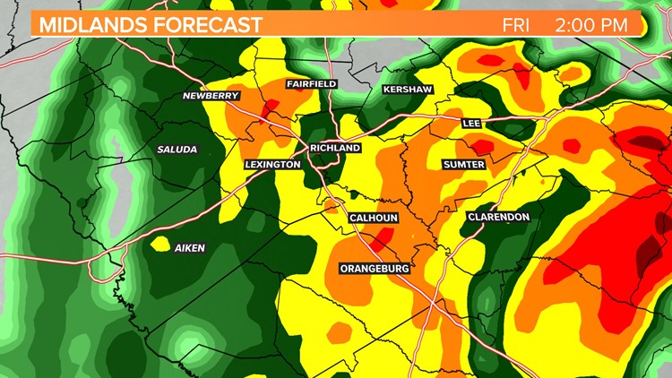
Heavy rainfall, flash flooding will be the greatest threat as the rain moves in early Friday. Widespread rainfall totals of 3 to 6 inches is forecast. Some isolated areas will probably get more than that. According to the Weather Prediction Center, the southeastern half of the Midlands is in a moderate risk for excessive rainfall.
Gusty winds are expected as Ian nears the coast Friday. While tropical-storm-force winds are not expected, tropical-storm-force gusts, winds above 50 mph will be possible. The strongest winds are likely on the east to northeastern part of what is left of the storm’s circulation center.
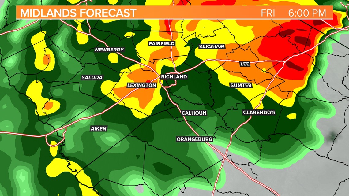
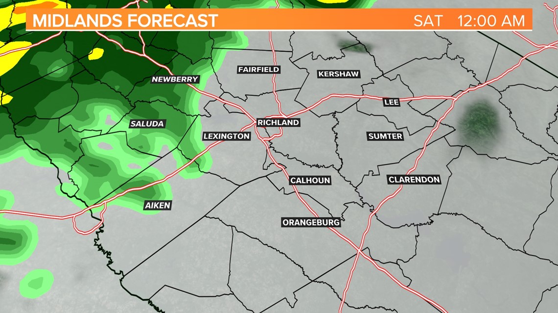
Our in-house forecast model takes the rain out of the area later in the day on Friday.
Midlands Timeline:
Midlands Impacts:
Heavy rainfall, flash flooding will be the greatest threat as the rain moves in early Friday. Widespread rainfall totals of 3 to 6 inches is forecast. Some isolated areas will probably get more than that. According to the Weather Prediction Center, the southeastern half of the Midlands is in a moderate risk for excessive rainfall.
Gusty winds are expected as Ian nears the coast Friday. Tropical-storm-force winds are possible, especially in the eastern parts of the Midlands. The strongest winds are likely on the east to northeastern part of what is left of the storm’s circulation center.
Friday afternoon:
Heavy rainfall continues for a large portion of the state, but the rain starts to taper off along the coastal region of South Carolina. Winds will still be strong at times, out of the northeast at 20-30 mph with gusts stronger around 40 to 50 mph.


Friday evening:
Our in-house forecast model starts to bring the rain to an end along the coast. The global models keep the rain around through at least early Saturday.


Friday night:
The rain lifts out of the area as Ian's remnants move out of the state. Skies will be mostly cloudy overnight. it will remain a bit breezy.


Download the free WLTX app to stay up with the latest news and weather information.


