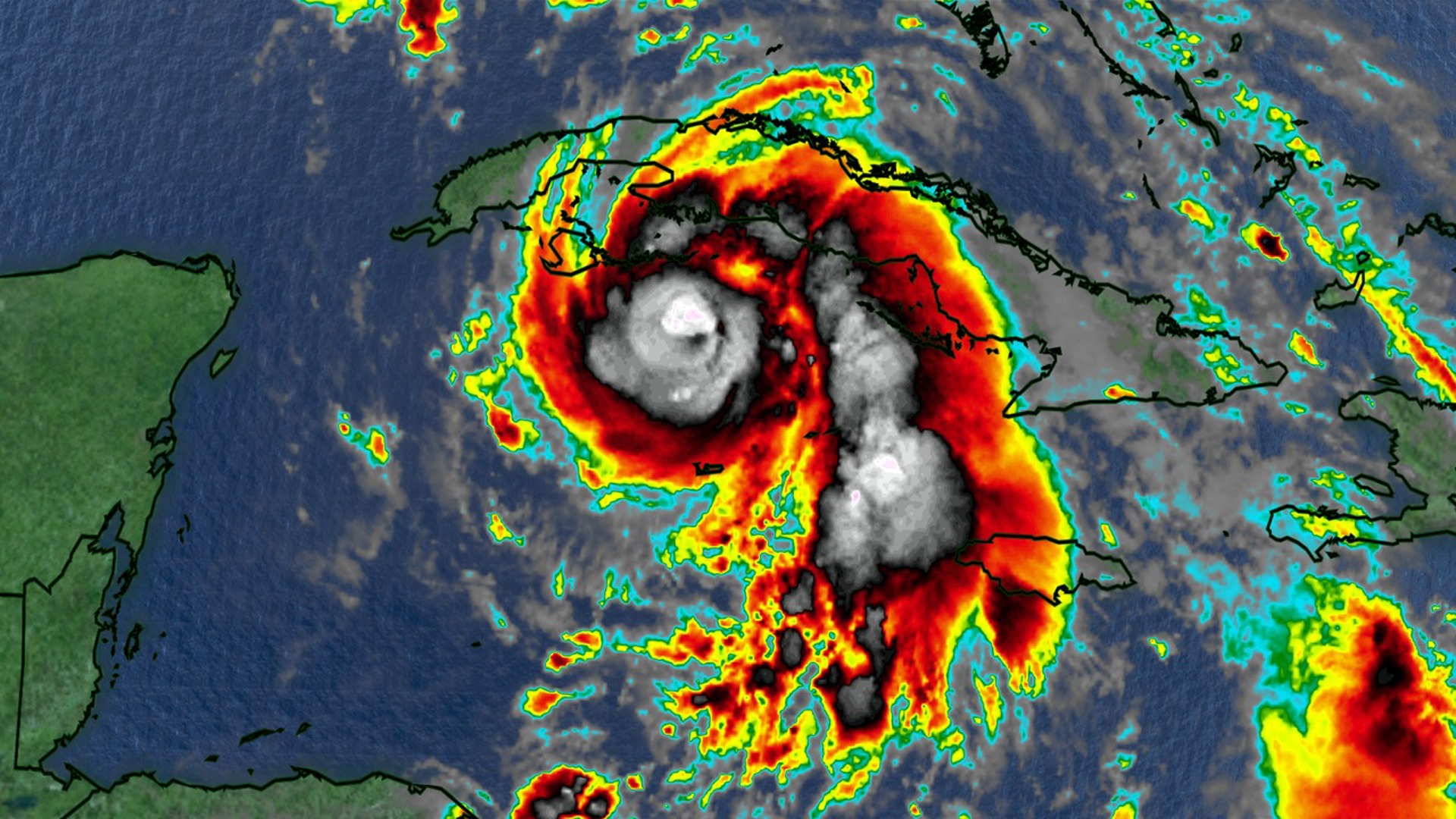
COLUMBIA, S.C. — Hurricane Rafael continues to rapidly strengthen as it moves closer to western Cuba. The storm’s core is showing intense activity, with deep thunderstorms surrounding the eye and powerful convective bands. The storm will increase the moisture across the Southeast.
Air Force reconnaissance flights have reported a closed eyewall, with the hurricane's central pressure dropping significantly, signs of ongoing intensification. Rafael’s sustained winds were around 90 mph this morning, with hurricane-force winds extending about 25 miles from its small eye.
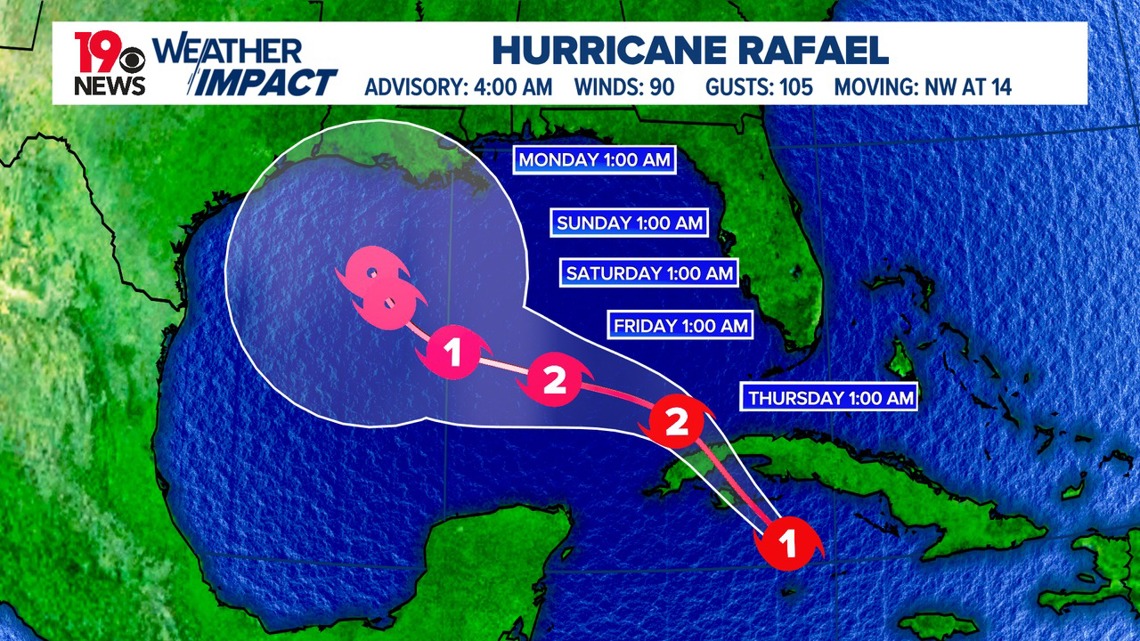
Rafael is traveling northwest at about 14 mph and is expected to maintain this course over the next day or two, entering the southeastern Gulf of Mexico by Thursday night.


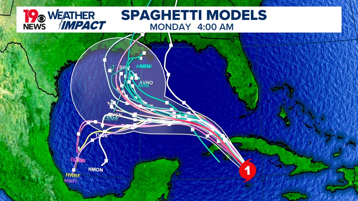
Looking ahead, weather models differ in their predictions, with some suggesting a shift toward a west or southwest direction. The official forecast has adjusted slightly to the west, with the possibility of further updates as new data emerges.
Rafael is moving through highly favorable conditions, warm ocean waters, low wind shear, and abundant moisture. That may push it close to major hurricane strength by the time it reaches Cuba.


However, as Rafael enters the Gulf of Mexico, conditions are expected to become less favorable, with increased wind shear, drier air, and cooler sea temperatures, which could lead to gradual weakening.
As Hurricane Rafael intensifies, areas like western Cuba and the Isle of Youth are expected to experience severe impacts. The storm may approach near major hurricane strength, bringing powerful winds, a dangerous storm surge, and large waves. A hurricane warning is currently in effect for these regions, urging residents to prepare for hazardous conditions.
In the lower and middle Florida Keys, tropical storm conditions are likely today and tonight, with strong winds and heavy rain expected.
For residents along the northern Gulf Coast, the exact impact of Rafael remains uncertain, so it is important to stay updated as the storm’s path develops.

