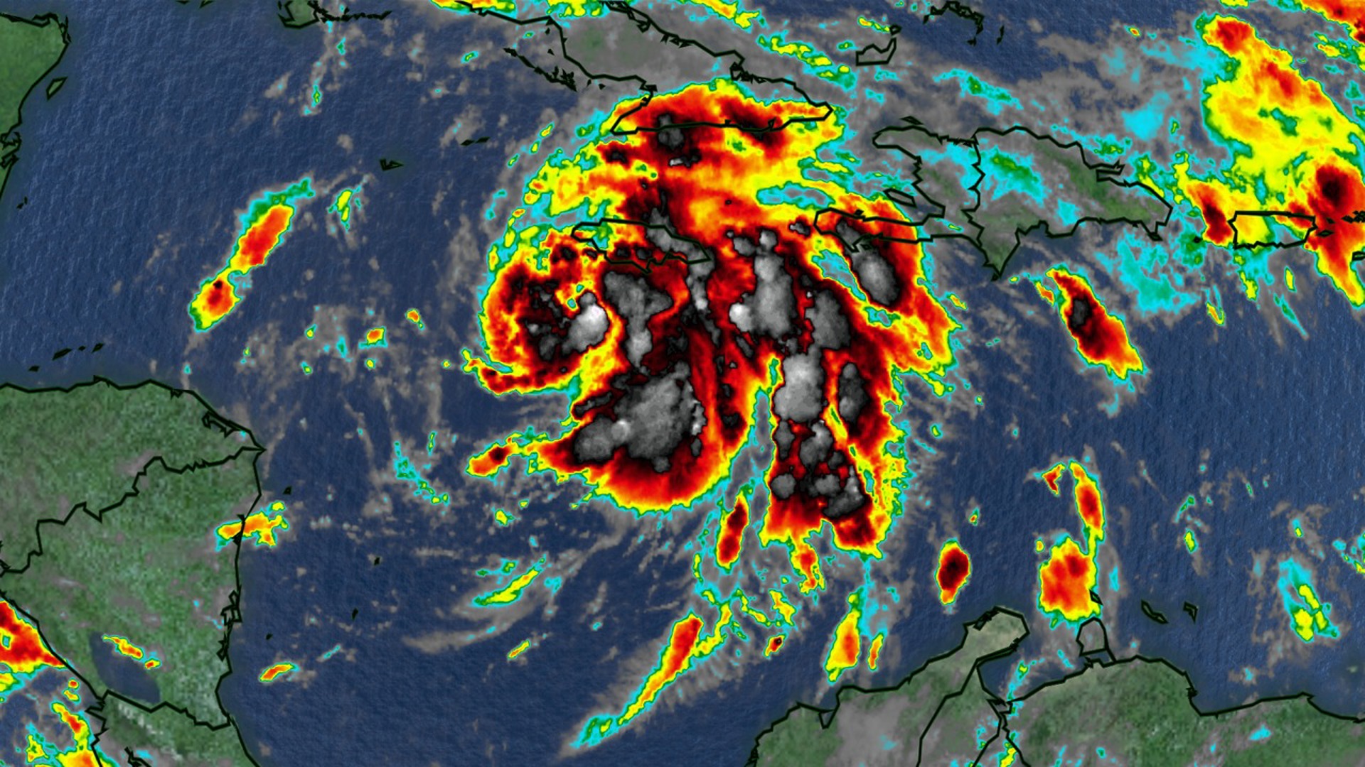
COLUMBIA, S.C. — Satellite imagery reveals that Tropical Storm Rafael is becoming increasingly organized as it continues to get stronger. Rain bands are growing more distinct, particularly on the eastern side, although the central part of the storm remains somewhat limited in structure.
The storm will help increase the moisture across the Southeast as it continues to move towards the northwest.
Data from a recent Hurricane Hunter aircraft mission detected that Rafael’s central pressure is dropping and maximum winds have reached about 60 mph. Another Hurricane Hunter mission scheduled for later this morning will provide more precise data on Rafael’s current strength.
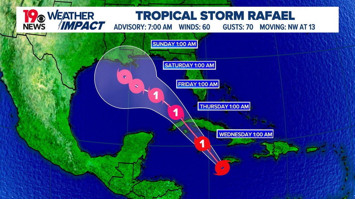
Rafael is moving northwest, and this general direction is expected to continue over the next couple of days. The storm is projected to cross over western Cuba and then enter the southeastern Gulf of Mexico.


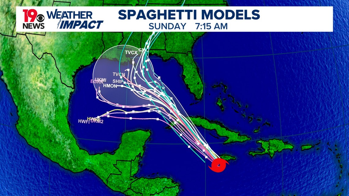
The forecast models largely agree on this track for the first 48 hours. Beyond that, however, there is a bit of uncertainty. One model suggests that Rafael may continue to the western Gulf due to a strong ridge of high pressure, while another model indicates that this ridge might weaken, allowing the storm to curve northward. Given these possibilities, the official forecast splits the difference between these two potential paths, but the long-range prediction still has some uncertainty.
Rafael is situated in an environment very favorable for further strengthening. With warm ocean waters, low wind shear, and high humidity, conditions are ripe for Rafael to intensify quickly over the next 24 hours.


After moving into the Gulf of Mexico, however, the storm may encounter drier air and stronger wind shear, which would likely slow down or halt its strengthening. The official forecast suggests that Rafael may come close to hurricane strength within the next three to five days, aligning with the higher end of predictions.
As Rafael continues to move northwest, areas in its path can expect increasingly severe weather conditions. The Cayman Islands may see the storm near hurricane strength by tonight, bringing strong winds, high storm surges, and large, destructive waves.
On Wednesday, the storm is expected to reach western Cuba, where it could bring similar risks. Jamaica is currently experiencing tropical storm conditions, which are expected to last through early this afternoon. By Wednesday evening, these conditions could extend to parts of the lower and middle Florida Keys.


The storm will also bring significant rainfall to the western Caribbean, particularly affecting Jamaica, the Cayman Islands, and portions of southern and western Cuba. This heavy rain could lead to flash flooding and mudslides, especially in mountainous areas.
As Rafael moves north, rainfall is expected to spread into Florida and parts of the southeastern United States by the middle of the week, potentially causing flooding in those areas.
With Rafael’s path and strength still evolving, residents in potentially affected areas are encouraged to stay informed and monitor updates. The exact track may shift as new data becomes available, but Rafael is anticipated to bring impactful weather to multiple regions in the coming days.

