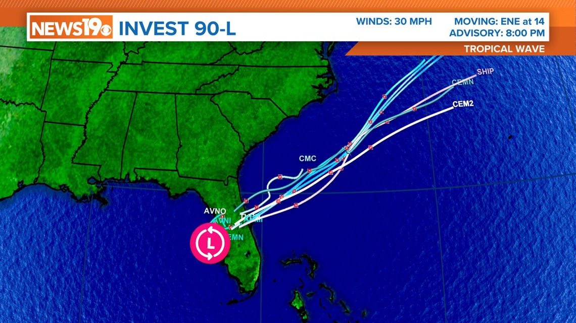
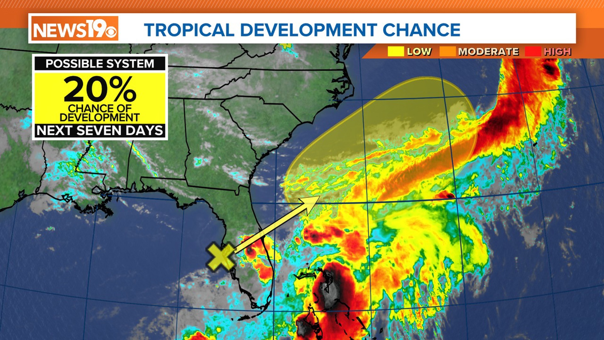
COLUMBIA, S.C. — As we continue to move through the 2024 Atlantic hurricane season, there is a developing weather situation to keep an eye on. A broad and elongated area of low pressure, currently located near the west-central coast of Florida, is stirring up a large area of disorganized showers and thunderstorms.
This system, identified as AL90, has not moved much recently but is expected to begin its journey northeastward across Florida. Within the next day or so, it is predicted to move offshore, heading towards the Southeast.
While the upper-level winds are only marginally conducive to development, there is still a chance, although small, that this system could slowly develop as it moves offshore. However, whether it develops into a more organized tropical system or not, the immediate concern is the heavy rainfall it is expected to bring to Florida.


Portions of the Florida peninsula should brace for continued heavy rainfall over the next few days. Flooding could become an issue in low-lying areas, so residents should stay informed and be prepared for potential water accumulation.
This year's Atlantic hurricane season is shaping up to be particularly active. Forecasters predict a higher-than-average number of storms due to warmer sea surface temperatures and favorable atmospheric conditions.
While the chances of this system developing into a significant tropical storm are currently low, it is always a good idea to stay vigilant during hurricane season. Keep an eye on the forecast and ensure you have a plan in place for any severe weather that might come your way.

