COLUMBIA, S.C. — The National Hurricane Center is monitoring three areas in the Atlantic that could develop into tropical storms.
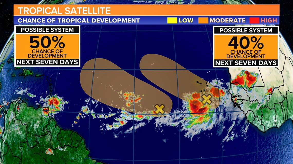
The first area is a tropical wave in the Central Tropical Atlantic that is producing disorganized showers and storms about 750 miles west-southwest of the Cabo Verde Islands.
It has a low chance of development, 20% over the next two days, and a medium chance of development, 50% over the next week. According to the NHC, a tropical depression could form over the next few days and move west or west-northwest at about 10 mph.
The second area is a tropical wave moving off the west coast of Africa that is causing a large area of showers and thunderstorms in the Eastern Tropical Atlantic.


According to the NHC, the system is expected to move west-northwest at 15 mph, with a low pressure area forming in a day or two near or just to the west of the Cabo Verde Islands. Forecasters predict that a tropical depression will form over the weekend before environmental conditions deteriorate next week.
The NHC gives the system a 20% chance of developing in the next two days and a 40% chance of developing in the next week.
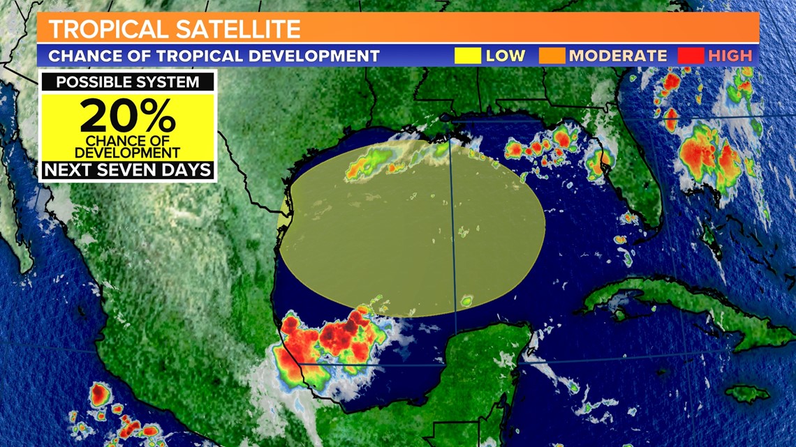
The third area of concern is much closer to home. By the beginning of next week, a broad area of low pressure could form in the central or western Gulf of Mexico.


Following that, this system may develop slowly as it moves westward and approaches the western Gulf of Mexico coastline by the middle of next week.
This area has a low chance of developing over the next seven days.

