
COLUMBIA, S.C. — A broad area of low pressure in the western Caribbean Sea is causing widespread, disorganized showers and thunderstorms with a low chance of development. In the central tropical Atlantic, a tropical wave west-southwest of the Cabo Verde Islands will likely develop into a tropical depression or storm as it moves toward the Windward Islands. Another tropical wave in the eastern tropical Atlantic has a low chance of developing over the next week.
In the western Caribbean Sea, a broad area of low pressure is causing widespread but disorganized showers and thunderstorms as it moves west-northwest at about 15 mph. This low-pressure system is spreading quite a bit of rain across the region, but the showers and storms are not currently well organized.

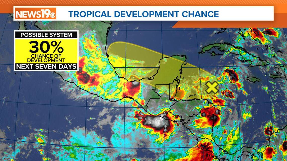
While there is some chance for this system to develop into something more significant over the next few days, the likelihood remains low. It is worth keeping an eye on this area, especially for those living or traveling in the northwestern Caribbean Sea or the southwestern Gulf of Mexico, as conditions can change.
- Chance of formation in the next 48 hours: 20%
- Chance of formation in the next seven days: 30%
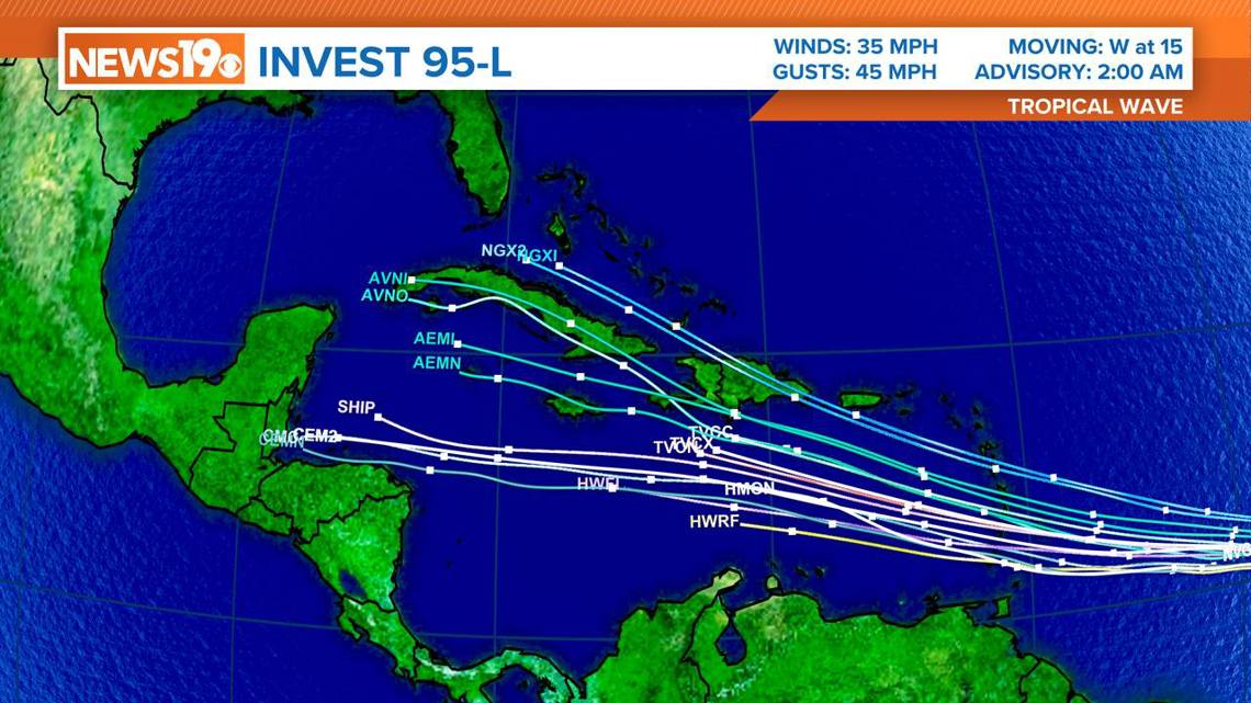
In the central tropical Atlantic, a tropical wave is located several hundred miles west-southwest of the Cabo Verde Islands. This system is showing signs of organization, with ongoing showers and thunderstorms.

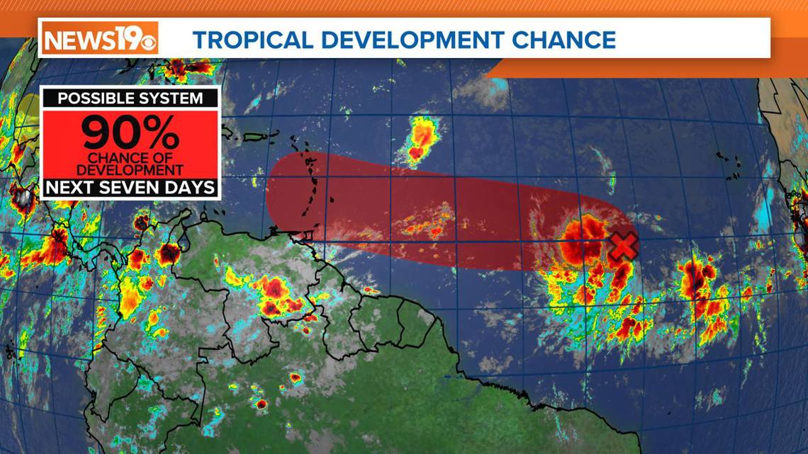
The environmental conditions around this system seem favorable for further development, and a tropical depression or storm will likely form in the next day or two. If or when it becomes a named storm, it will be known as Beryl.
This system is expected to move west at 15 to 20 mph toward the Windward Islands. Those living in or planning to travel to the Lesser Antilles should monitor it and stay updated with the latest information.

- Chance of formation in the next 48 hours: 80%
- Chance of formation in the next seven days: 90%
In the eastern tropical Atlantic, another tropical wave is located a few hundred miles south-southwest of the Cabo Verde Islands. This wave is currently producing disorganized showers and thunderstorms.
While the system is not very organized now, there is a slight possibility of slow development early next week as it moves generally westward across the central and western tropical Atlantic at 15 to 20 mph. The chances of development are low, but it is still something to watch, especially for those with interests in the Atlantic.
- Chance of formation in the next 48 hours: near 0%
- Chance of formation in the next seven days: 20%
As we monitor these three systems, it is important to stay informed and prepared, especially for those in areas that might be affected. Tropical weather can change rapidly, and staying up-to-date with the latest forecasts and advisories is crucial.