
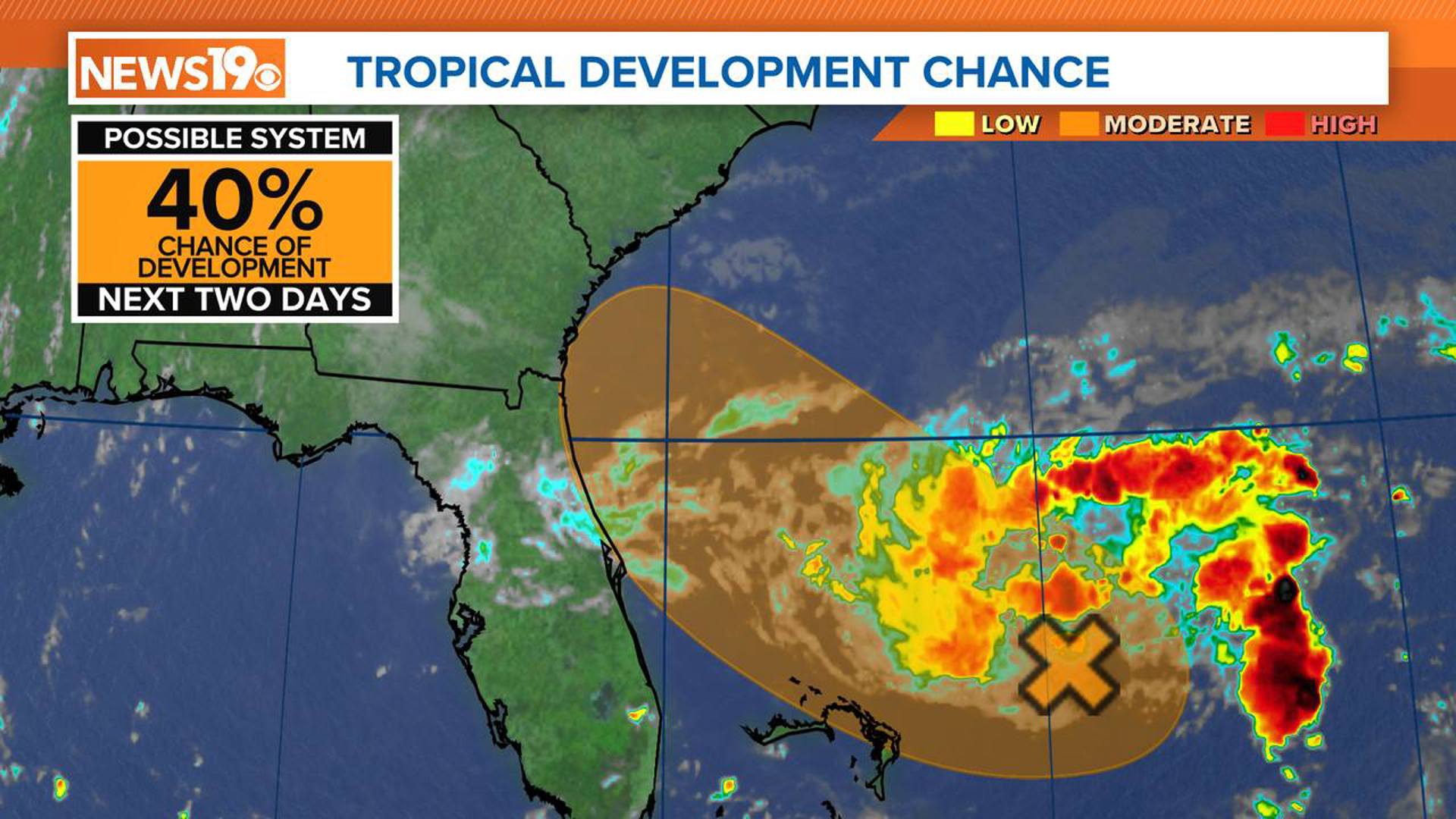
COLUMBIA, S.C. — A small area of low pressure, currently located about 150 miles east of the northernmost Bahamas, is under close watch as it exhibits disorganized shower and thunderstorm activity. Despite the presence of nearby dry air that has marginally conducive environmental conditions, there remains a possibility of further development of this system into a tropical depression.
The system was stationary earlier today. It had winds of 35 mph. It is expected to move west-northwest at 10 to 15 mph.
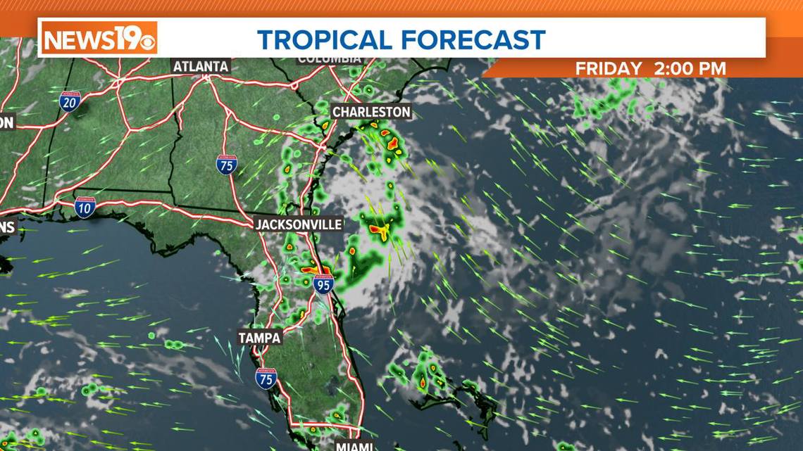
By early Friday, it could approach the northeastern coast of Florida or the Georgia coast, potentially bringing increased rainfall and gusty winds to these areas.

Given the current state of the system, the National Hurricane Center has increased the chances of further development over the next two days. According to the NHC, there is a medium, or a 40%, chance of further development.
To gain more precise data on the system, an Air Force Reserve reconnaissance aircraft is on standby and scheduled to investigate the system this afternoon if conditions warrant it. This mission would provide critical information to help forecasters better understand the system's potential development and impact.
Residents along the northeastern coast of Florida and the Georgia coast are advised to stay informed through official updates as this tropical wave moves towards the US.

This disturbance will bring more moisture to South Carolina. This will lead to the chance of rain on Friday afternoon and Friday evening.
As the hurricane season progresses, it remains crucial to maintain preparedness for any potential tropical developments.
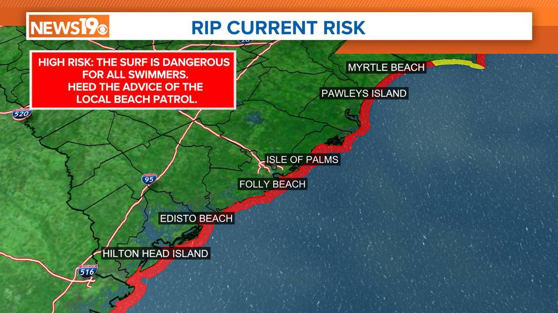
Dangerous rip currents are expected along the South Carolina coast over the next several days. Always swim near lifeguards and heed the advice of the local beach patrol.
Before you go to the beach, check the Surf Zone Forecast for local beach conditions. Surf zone forecasts will contain rip current outlooks using the following three-tiered set of qualifiers:
- Low risk of rip currents. The risk of rip currents is low, however, life threatening rip currents often occur in the vicinity of groins, jetties, reefs, and piers.
- Moderate risk of rip currents. Life-threatening rip currents are possible in the surf zone.
- High risk of rip currents. Life-threatening rip currents are likely in the surf zone.