

COLUMBIA, S.C. — The National Hurricane Center continues to issue advisories for Tropical Storm Franklin, which is located over the east-central Caribbean Sea; Tropical Depression Gert, which is located a few hundred miles east-southeast of the northern Leeward Islands; and Tropical Storm Harold, which was recently upgraded and is located over the western Gulf of Mexico.
Tropical Storm Harold
Through early Wednesday, Harold is expected to dump 3 to 5 inches of rain across South Texas, with isolated higher amounts of 7 inches. Scattered flash flooding is possible.
Tropical storm conditions are expected in the warning area and are possible in the watch area beginning early today. Normally, dry areas near the coast will be flooded by rising waters moving inland from the shoreline as a result of storm surge and tide. Several tornadoes are possible across south Texas this afternoon.

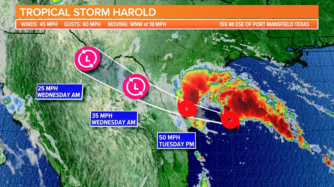
The maximum sustained wind speed is around 45 mph, with higher gusts. Before Harold reaches the Texas coast, it may strengthen slightly. Winds of tropical storm force extend up to 115 miles from the center.
Tropical Storm Franklin
Franklin is expected to bring 1 to 3 inches of rain to Puerto Rico and Vieques through Thursday, with local storm totals of 6 inches. Rainfall amounts of 5 to 10 inches, with isolated higher amounts of up to 15 inches, are expected across parts of Hispaniola through Wednesday.
Tropical storm conditions are expected to develop within the warning area tonight and continue through Wednesday. and are possible within the watch area beginning Wednesday.

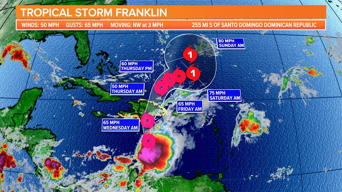
The maximum sustained wind speed is around 50 mph, with higher gusts. Before Franklin reaches Hispaniola, some strengthening is expected. Winds of tropical storm force extend up to 70 miles from the center.
Tropical Depression Gert
Gert is barely a tropical depression. The system is expected to dissipate today.
Eastern Tropical Atlantic
A tropical wave is causing disorganized showers and thunderstorms a few hundred miles west of the Cabo Verde Islands. Environmental conditions appear to be favorable for this system's gradual development, and a tropical depression could form later this week as it moves west-northwestward across the eastern tropical Atlantic.
The NHC gives this area a medium chance of further development.
Central Tropical Atlantic
Former Tropical Storm Emily's remnants are located several hundred miles east-northeast of the Leeward Islands in the central tropical Atlantic, with limited associated shower activity.
When the system moves northward over the subtropical central Atlantic later this week or this weekend, environmental conditions may become more favorable for redevelopment.