
COLUMBIA, S.C. — Hurricane Beryl, a major storm, is currently approaching the Windward Islands, while Tropical Storm Chris is impacting eastern Mexico. Both storms bring the threat of heavy rainfall, strong winds, and dangerous surf conditions, demanding close monitoring and preparation in the affected regions.
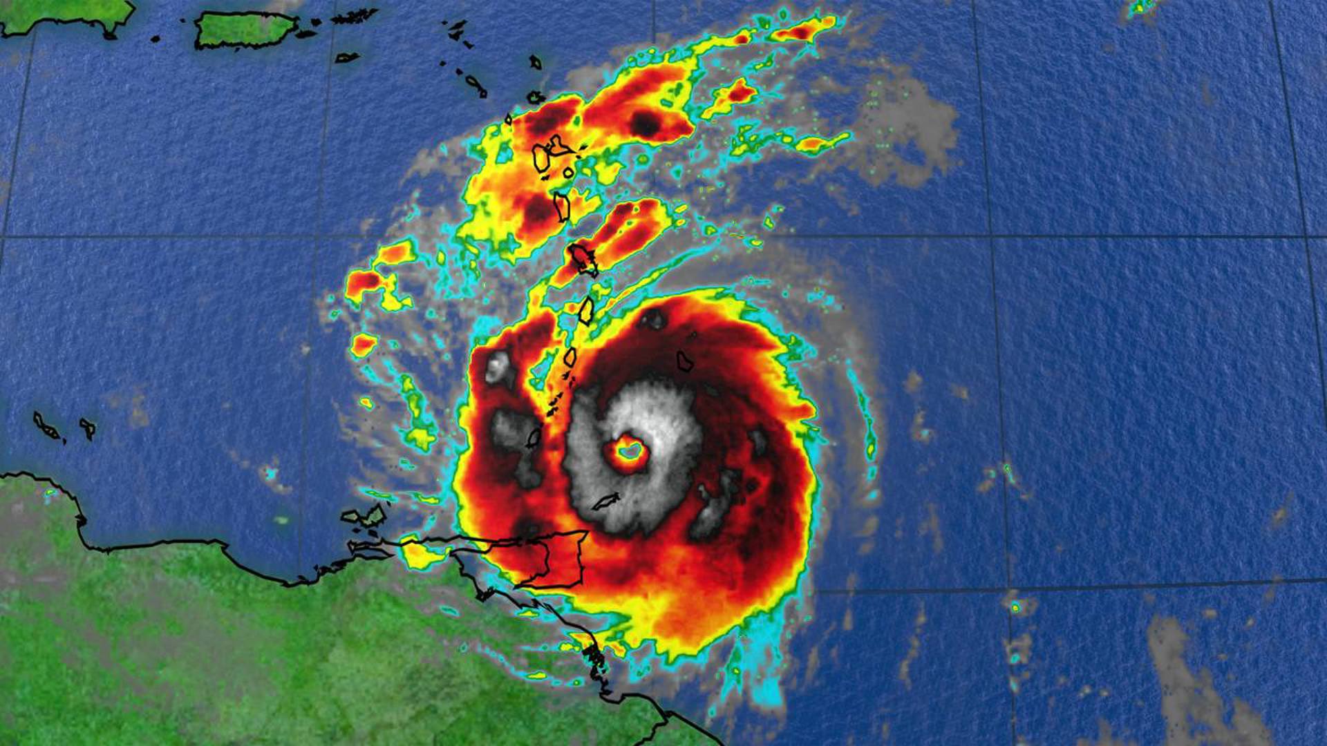
With maximum sustained winds reaching 150 mph and gusts even higher, Beryl is a very dangerous Category 4 hurricane. The hurricane is expected to continue its quick westward to west-northwestward movement over the next few days.

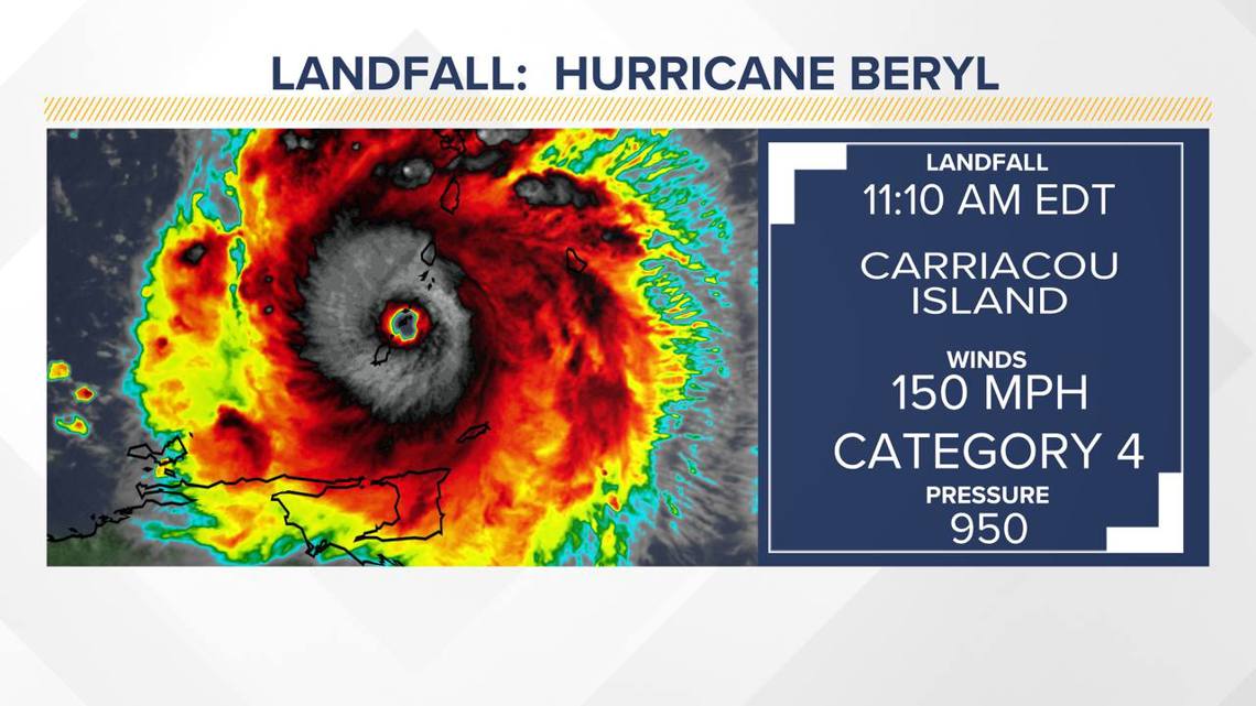
A Category 4 hurricane on the Saffir-Simpson Hurricane Wind Scale, Beryl may experience fluctuations in strength over the next day or so but is expected to remain a dangerous major hurricane as it progresses through the Windward Islands into the eastern Caribbean. The storm is expected to weaken in the central Caribbean by midweek, though Beryl is still forecast to retain hurricane status.
Heavy rainfall and localized flooding are expected in the Windward Islands today. Large swells generated by Beryl will continue to affect the Windward and southern Leeward Islands over the next couple of days. These swells will also likely reach the southern coasts of Puerto Rico and Hispaniola soon, posing life-threatening surf and rip current conditions.
Tropical Storm Chris
Tropical Storm Chris is now a remnant low-pressure system. It is expected to continue moving inland over eastern Mexico today, weakening as it progresses, and likely dissipating over higher terrain later today. Heavy rainfall from Chris will likely cause flooding in eastern Mexico, with mudslides possible in higher terrain areas.

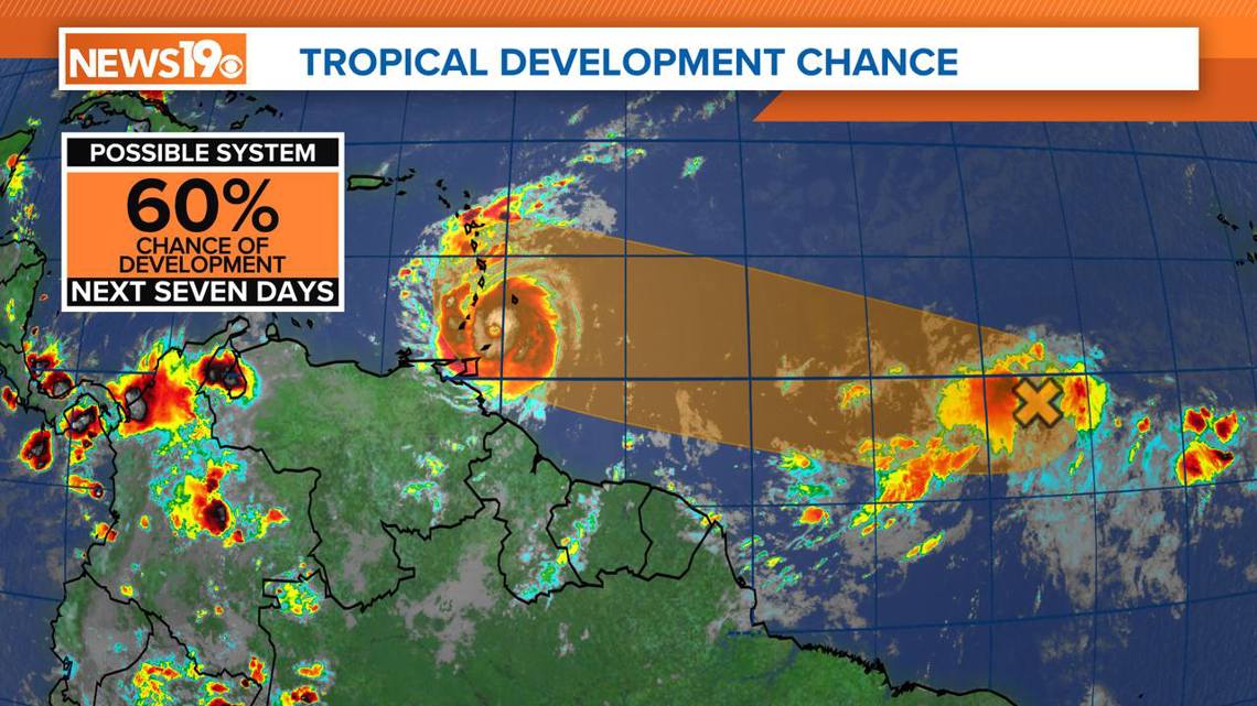
Central Tropical Atlantic (Invest AL96)
Showers and thunderstorms are continuing in association with a low-pressure area, located about 1000 miles west-southwest of the Cabo Verde Islands.
Environmental conditions appear conducive for further development, and a tropical depression may form by midweek as the system moves westward at 17 to 23 mph across the central and western tropical Atlantic.
Those in the Lesser Antilles should monitor this system, which has a medium chance of tropical cyclone development in the next 48 hours and a medium chance over the next seven days.