
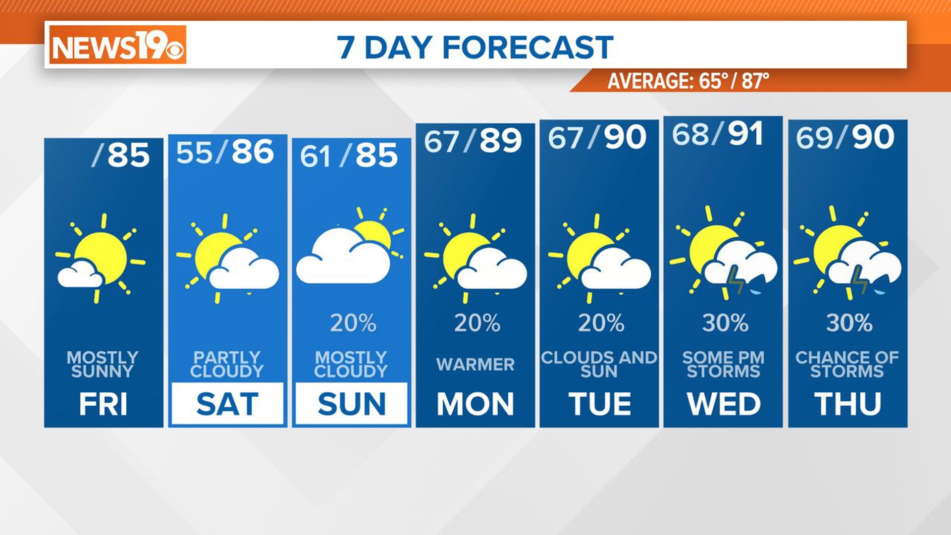
COLUMBIA, S.C. — A high-pressure system will keep our weather dry and cooler than normal over the next couple of days, with temperatures dipping, especially at night. High pressure will shift offshore over the weekend, ushering in moisture and warmer temperatures early next week. Expect a few showers and thunderstorms, mainly in the afternoons and evenings, through midweek.
Today, a ridge of high pressure is building in our region, nestled between a weather system to our west and a trough off the east coast. This setup brings cooler, northerly winds down the eastern side of the Appalachians.
Morning temperatures started off in the mid-50s, with mostly clear skies. Mostly sunny conditions are expected this afternoon, allowing daytime highs to reach the middle 80s. Tonight will see more cooling, with lows again in the 50s due to radiational cooling.

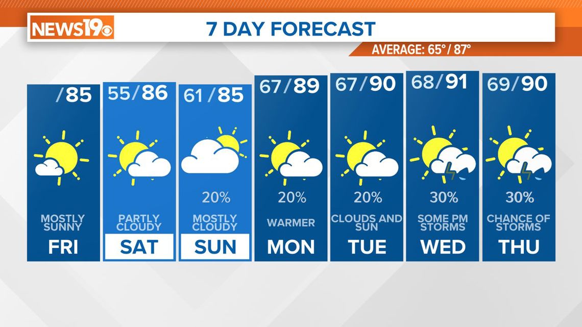
On Saturday, the ridge of high pressure will move to the coast by the afternoon as a trough of low pressure approaches from the Mississippi River Valley. This trough will lift northeastward toward the Ohio Valley.
Meanwhile, the Bermuda high offshore will extend its influence, bringing a weak southeast flow. While deeper moisture will stay to the west, our area will see some increase in humidity by evening. High, thin clouds will also spread in the afternoon. Daytime highs will be in the mid-to-upper 80s, with overnight lows more typical for this time of year, in the low-to-mid 60s.
Hurricane season officially begins Saturday, June 1. No tropical activity is expected over the next seven days, but there are several tropical waves being watched in the Atlantic. The hurricane season continues through November 30, and it is expected to be very busy.
The weather pattern will begin to change on Sunday. An upper-level trough over the Ohio and Tennessee valleys will move east but weaken somewhat. On Sunday, we could see some showers, especially in the western part of the area, where the air will be more unstable.

Widely scattered showers and thunderstorms are expected mainly in the afternoons, with forcing for these storms remaining limited. By Tuesday, a cold front will approach from the northern plains, increasing moisture and instability and leading to scattered thunderstorms. Temperatures will return to normal for this time of year.