
COLUMBIA, S.C. — Today and continuing through Thursday, we are expecting dry conditions, with temperatures staying around for this time of year. However, as the weekend approaches, moisture moving in from the Atlantic will raise the chances of some much-needed rain.
A strong upper-level high is currently dominating our weather, though it is expected to weaken over the Southeastern US tonight. This ridge, combined with high pressure southeast of Nova Scotia, will keep our weather dry in the Midlands.
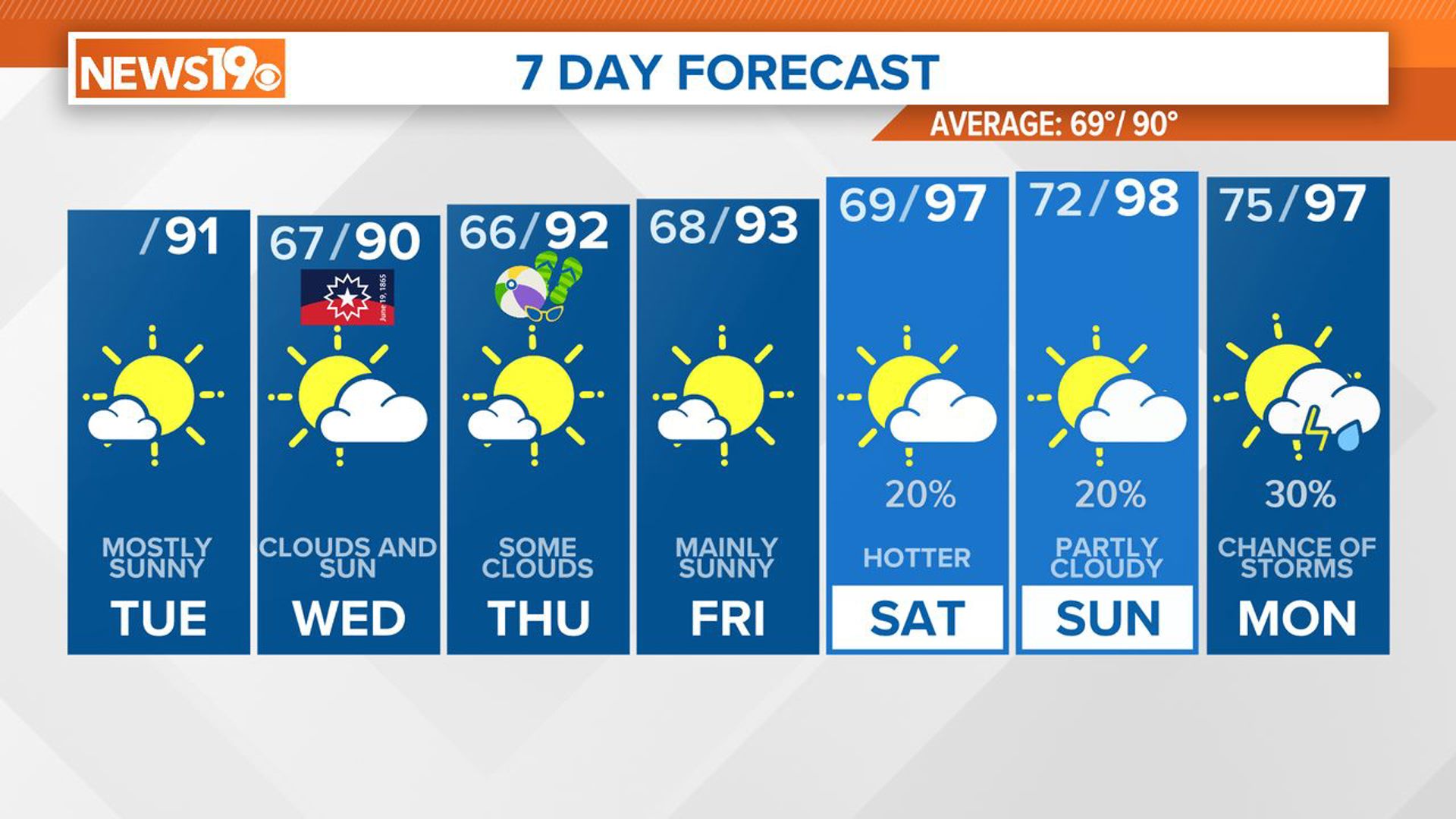
Moisture levels are lower than yesterday and will continue to decrease, leading to dry conditions. Easterly winds might be gusty at times, and we will see partly to mostly sunny skies with highs around 90 degrees. Tonight, as the high-level clouds linger, low clouds will start to creep in from the east, with temperatures dropping to the middle to upper 60s.


As we move into the middle of the week, high pressure will still be in control, ensuring continued dry conditions. High temperatures Wednesday and Thursday will be in the upper 80s to lower 90s.
By Friday, the surface high will begin to move offshore, and the upper ridge will start to weaken. This change will allow moisture to come back into the Carolinas from the Atlantic. This will lead to increased chances for showers and thunderstorms from Saturday through Monday.
The National Hurricane Center is watching an area moving towards the southeastern coast. They currently give this disturbance a low chance of developing into a tropical cyclone, but it is still something to keep an eye on towards the weekend.
Temperatures will start to rise over the weekend, with highs reaching the mid-90s by Saturday and Sunday. We will be watching the potential for heat advisories as we get closer to the weekend. Nighttime temperatures will also remain warm, staying above 70 degrees in many areas from Saturday night into early next week.