COLUMBIA, S.C. — The sun may be shining overhead, but recent heavy winds have brought with them a chance of flooding along parts of the Congaree River.
The Columbia office of the National Weather Service has issued three flood warnings along the river due to the risk of waters rising to a minor flood stage.
One of the warnings, valid until 10:24 p.m. on Sunday, will impact the river at Congaree National Park in Gadsden. Forecasts show waters likely to rise to flood stage late in the evening and crest at 16 feet on Monday evening then fall below flood stage by late Wednesday morning.
The flood stage is 15 feet, which is capable of flooding lower portions of the boardwalk at the park.
While not expected, waters rising above 17 feet would cause issues for the Sandy Run subdivision.
Elsewhere on the river, near the Carolina Eastman facility, the river is expected to remain under a flood warning as the river rises to 117 feet by late Sunday morning. Minor flooding occurs at 115 feet and is capable of flooding low-lying areas of the Carolina Eastman facility and Congaree National Park.
While not expected to reach 119 feet, that level would increase flooding issues in the park and flood some farmland along with other portions of Carolina Eastman.
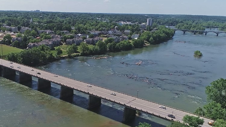
Meanwhile, the Congaree River as it passes through Columbia will remain under a flood advisory until 1 p.m. on Monday which could impact the waterway in both Richland and Lexington counties.
The river is already expected to surpass the 10-foot "action" stage and rise to 10.7 feet on Sunday morning before falling to 8.8 feet in the evening. It is then expected to rise once again to 9.5 feet on Monday morning before falling again.
While remaining below the official 19 food flood stage, flooding can still occur at 10 feet, particularly in flood-prone areas near and downstream from Columbia as well as along the Cayce and West Columbia river walks.
A portion of the West Columbia Riverwalk from Moffatt Street to the Gervais Street Bridge has already been temporarily closed to the public due to flooding.
And the weather had already postponed one event on the Cayce Riverwalk the previous day.