COLUMBIA, S.C. — We are starting things off on the cloudy side this morning here across the Midlands. After storms last night that brought heavy rain and lightning we are looking at another repeat when it comes to rain chances.
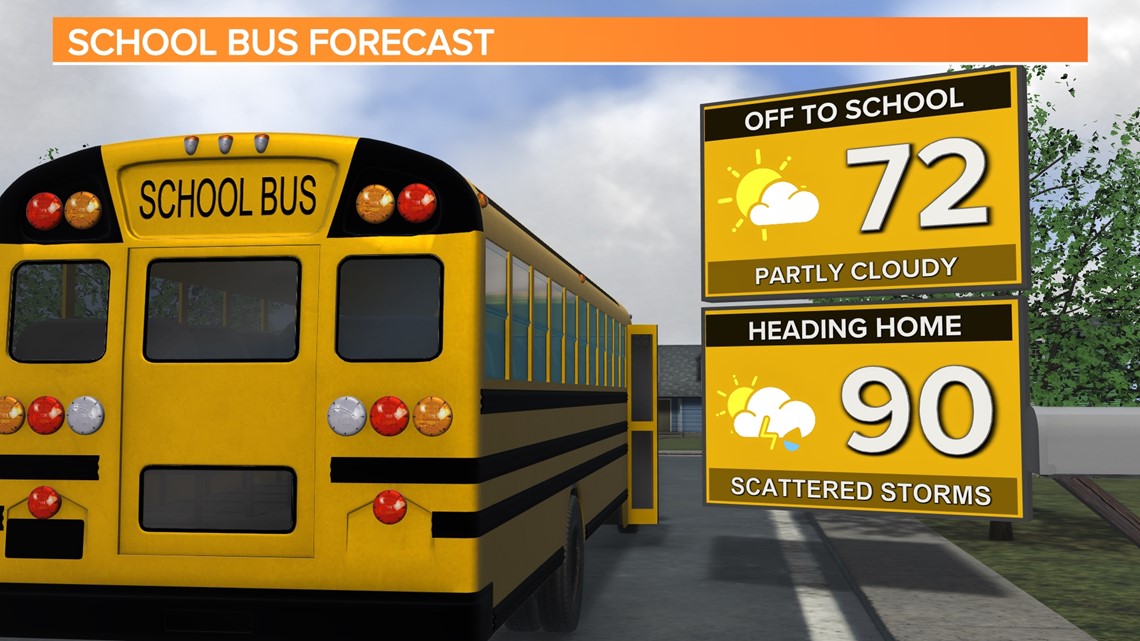
Most of Thursday should be dry with mostly cloudy conditions becoming partly cloudy as we head into the afternoon hours. Temperatures will be climbing into the upper 80s to 90 during the peak heating of the day. Storms will be isolated at this point of the day with a better chance of rain as we get around 7 PM and head into Thursday night. Most storms look to be centered south of of I-20.

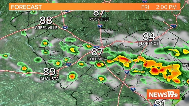
Friday a cold front will be moving through the area. This will bring another round of showers and storms around midday on Friday. Highs will likely be in the upper 80s for most of the Midlands.


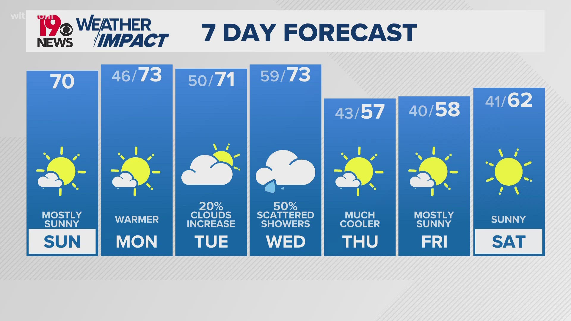
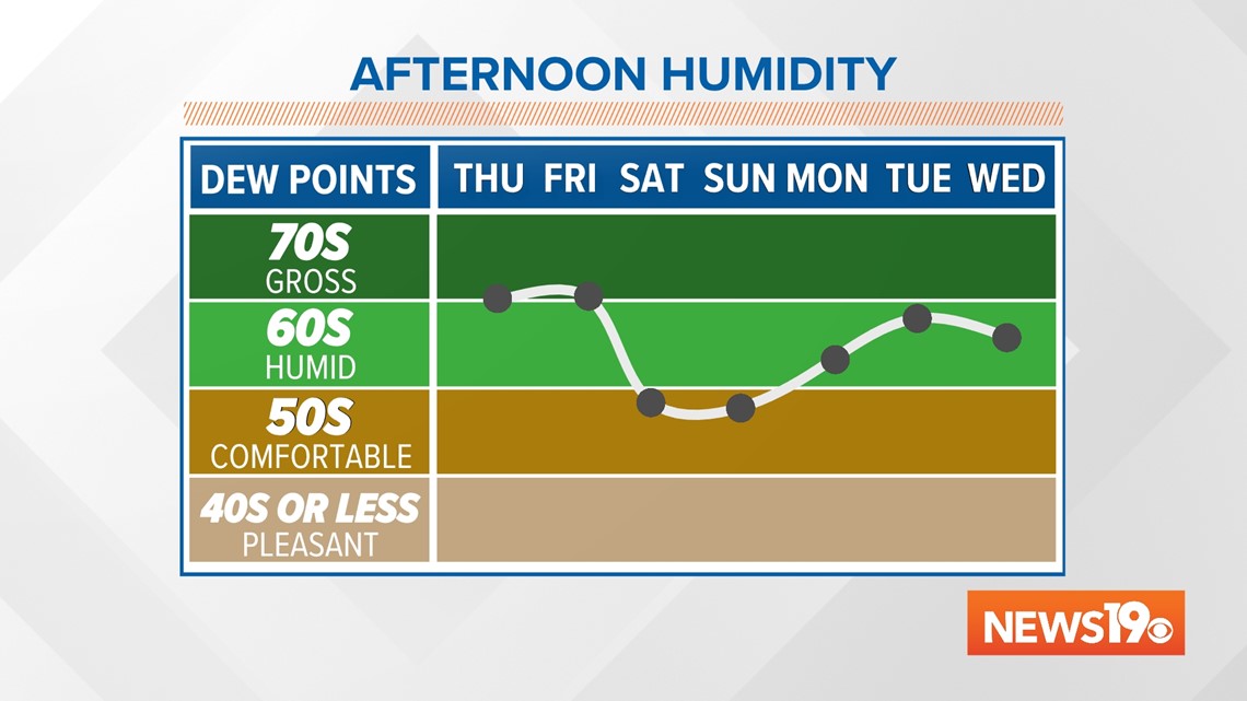
Behind this cold front we are looking at some really nice weather just in time for the weekend. While temperatures will be somewhat cooler with highs in the upper 80s, the biggest change will be in our humidity. Our dewpoints will be dropping from the 70s on Friday into the 50s this weekend. This will be only the 2nd time this entire summer we have seen air this dry across the region. This will allow for some really comfortable weather on Saturday and Sunday with plenty of sunshine.

As we look towards next week, the pattern looks to remain the same. Temperatures will remain below average with somewhat drier weather staying around in the forecast.