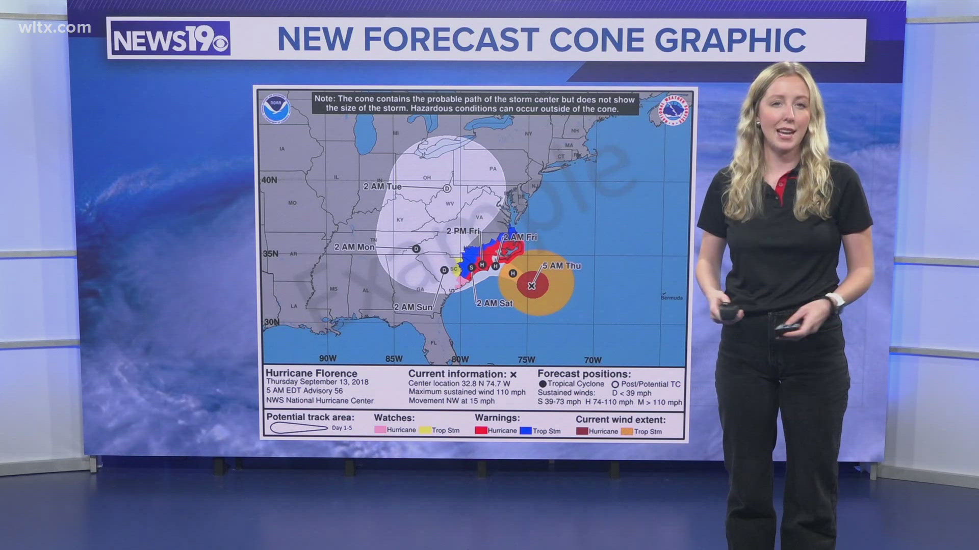
COLUMBIA, S.C. — This year, around August 15th, the National Hurricane Center, or NHC, will begin issuing experimental versions of the well-known forecast cone graphic.
Unlike the current version, this updated cone will include all related watches and warnings issued by both local National Weather Service offices and the NHC. This means the product will also show inland watches and warnings along with coastal alerts.
The goal is to combat the misunderstanding that tropical storms impact only coastal areas. Tropical conditions can occur much further than the storm’s landfall. By including all related watches and warnings, the new forecast cone provides a clearer picture of a storm's potential impact.
The National Hurricane Center says it hopes not to overcomplicate the current version of the forecast cone graphic.

