
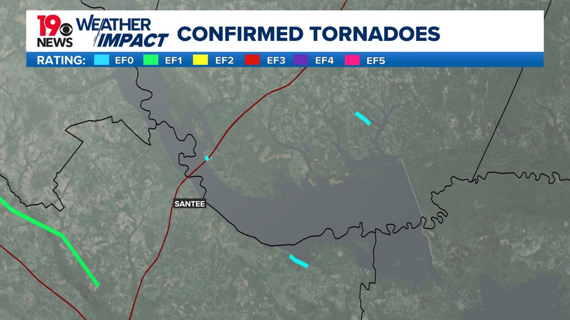
COLUMBIA, S.C. — The National Weather Service in Columbia has completed a damage survey for tornadoes associated with Hurricane Helene on September 26-27, 2024. A total of 11 tornadoes were confirmed across the NWS Columbia forecast area during the storm.
Nine of those tornadoes occurred in the News 19 viewing area. Here is a summary of the tornadoes that impacted our area.
Rowland, SC EF0
County: Clarendon
Path: 7 miles east-southeast of Summerton to 6 miles east of Summerton
Estimated Peak Wind: 80 mph
Length: 1.31 miles
Maximum Width: 0 yards
Cordova, SC EF1
County: Orangeburg
Path: 5 miles southwest of Rowesville to 6 miles west of Edisto
Estimated Peak Wind: 95 mph
Length: 13.36 miles
Maximum Width: 1100 yards
Staley Crossroad, SC EF1
County: Orangeburg, Calhoun, and Lexington counties
Path: 9 miles east-northeast of North to 2 miles east of Gaston
Estimated Peak Wind: 90 mph
Length: 13.97 miles
Maximum Width: 710 yards

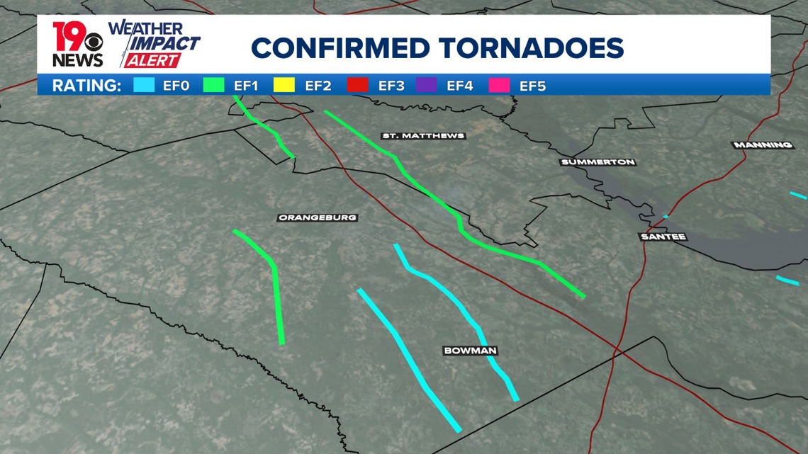
West Bowman, SC EF0
County: Orangeburg
Path: 3 miles north-northwest of Reevesville to 3 miles east-southeast of Wilkinson Heights
Estimated Peak Wind: 80 mph
Length: 17.04 miles
Maximum Width: 800 yards
Eutaw Springs, SC EF0
County: Orangeburg
Path: 2 miles east-northeast of Eutawville to 2 miles north-northeast of Eutawville
Estimated Peak Wind: 77 mph
Length: 1.53 miles
Maximum Width: 0 yards
West of Shaw AFB, SC EF0
County: Sumter
Path: 2 miles southwest of Cherryvale to 1 mile west-southwest of Stateburg
Estimated Peak Wind: 75 mph
Length: 4.56 miles
Maximum Width: 1000 yards
Orangeburg/Calhoun County Long-Tracked EF1
County: Orangeburg and Calhoun
Path: 6 miles north-northwest of Duncan Chapel to 9 miles west-northwest of St. Matthews
Estimated Peak Wind: 90 mph
Length: 33.11 miles
Maximum Width: 800 yards

Southeast Branchville, SC EF0
County: Orangeburg
Path: 4 miles west of Reeseville to 2 miles north of Rowesville
Estimated Peak Wind: 84 mph
Length: 13.77 miles
Maximum Width: 500 yards
North Santee, SC EF0
County: Clarendon
Path: 4 miles northeast of Santee to 4 miles northeast of Santee
Estimated Peak Wind: 75 mph
Length: 0.29 miles
Maximum Width: 0 yards