COLUMBIA, S.C. — This year, the National Weather Service is using new criteria for winter storm warnings for heavy snow across the country.
The standards for watches and warnings are based on snowfall thresholds. This means that before a winter storm watch or warning is issued, a specific amount of snowfall and/or sleet must be predicted in a given area.
In the past, each of the 122 NWS offices for their respective jurisdictions set the standards by which those watches and warnings were issued. According to the National Oceanic and Atmospheric Administration, which is in charge of the NWS, those jurisdictions normally encompass ten to twenty counties.


The main goal of altering the NWS snow criteria, according to NOAA, is to improve uniformity among nearby forecast offices. More uniformity will encourage more coordinated and efficient public and partner messaging regarding winter storms. Furthermore, the new criteria are based on improved standards of the scientific method.
The new criteria now apply to a winter storm event (up to 48 hours long) rather than the previous 12-hour or 24-hour timing criteria.
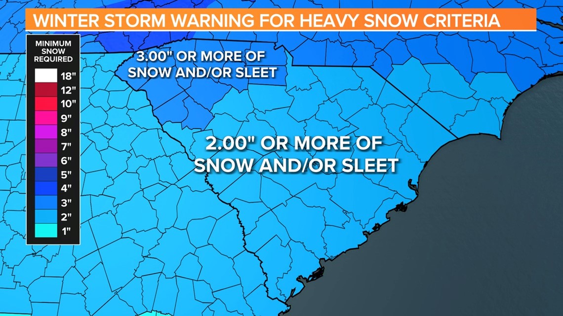
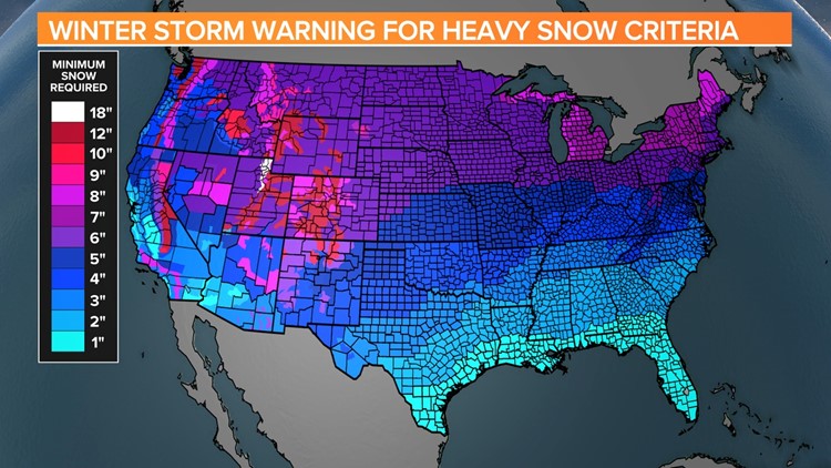
All regional NWS offices will adhere to the new standards this season, which are based on the thresholds that the main NWS office has set. The updated "Winter Storm Warning Criteria" map shows those thresholds.


Each location is color-coded based on a snowfall threshold established by the county or geographic area. For the Midlands, under the new criteria, the NWS will issue watches and warnings when 2 inches or more of snow and/or sleet is expected.


