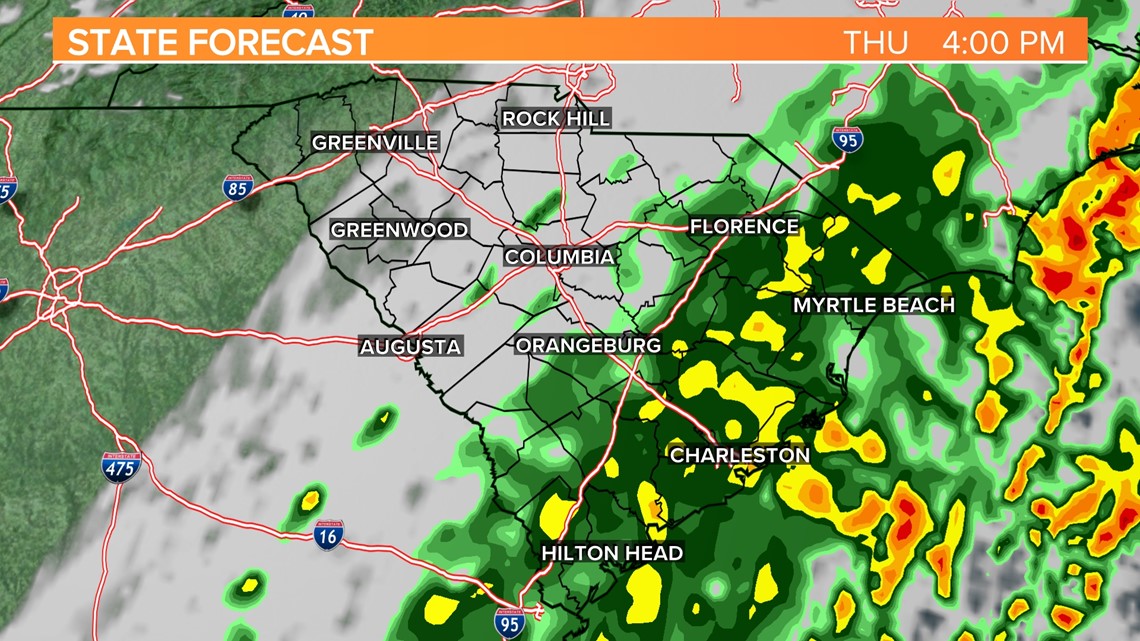
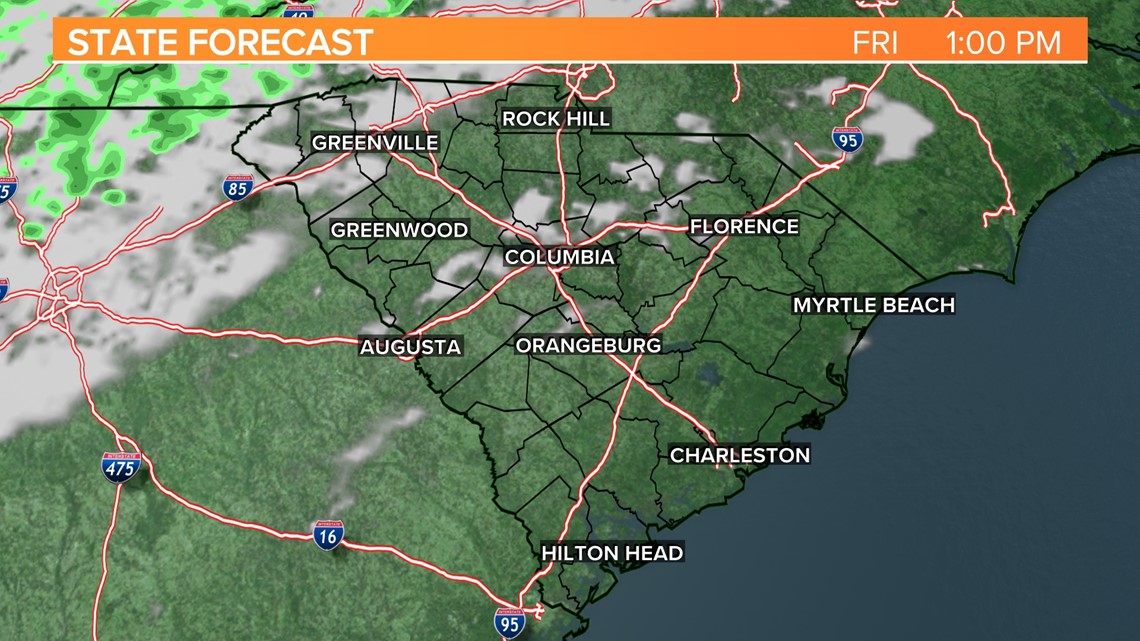
COLUMBIA, S.C. — A cold front will slowly move through the are today. Showers will continue to impact the eastern and southern parts of the Midlands this afternoon. The rain will gradually move east of the area tonight as dry air filters into the area for the last day of the workweek.
Temperatures started off warm. Lows only fell into the middle 60s earlier today.
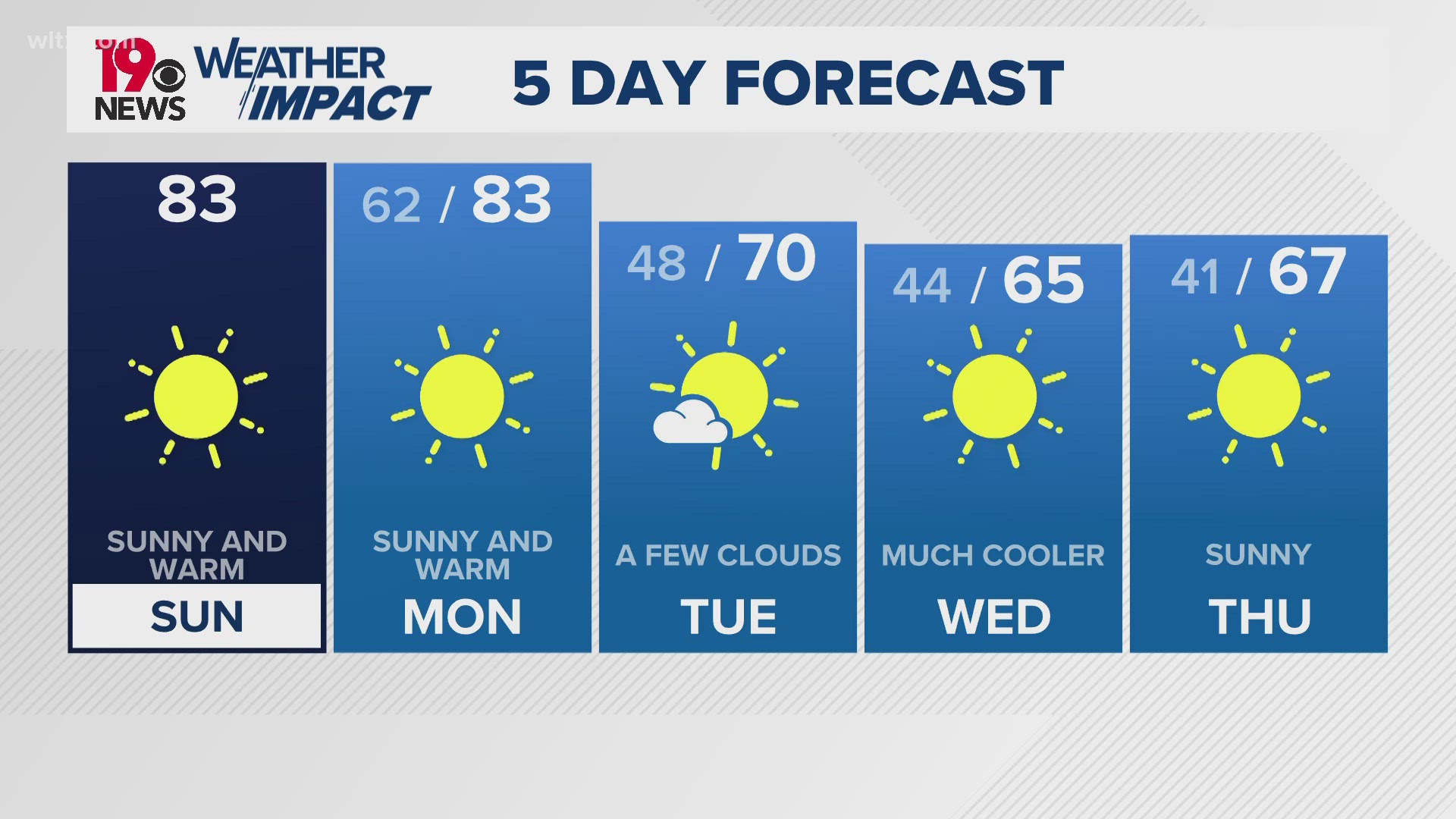
The cold front will slowly move through the state this afternoon. Showers will impact parts of the southern and eastern half of the Midlands. High temperatures will be in the middle to upper 60s today, but it will be cooling off later this afternoon.

Clouds will gradually decrease Thursday night and Friday will be mostly sunny, breezy, and dry. Highs will be seasonable for the last day of the workweek. High temperatures will top out in the upper 60s.
Saturday will be sunny and windy. Winds will be 20-25 mph with some stronger gusts. High temperatures will be in the middle 60s.

Clear skies, cool conditions are expected Sunday morning. Lows will drop into the upper 30s Sunday morning. Some frost will be possible in the traditionally cooler areas. Highs will be in the middle to upper 60s Sunday afternoon.
Temperatures will gradually warm-up during the workweek. Highs will be in the lower 70s Monday. Low to middle 80s Tuesday and Wednesday. There will be a small chance for rain Wednesday afternoon.

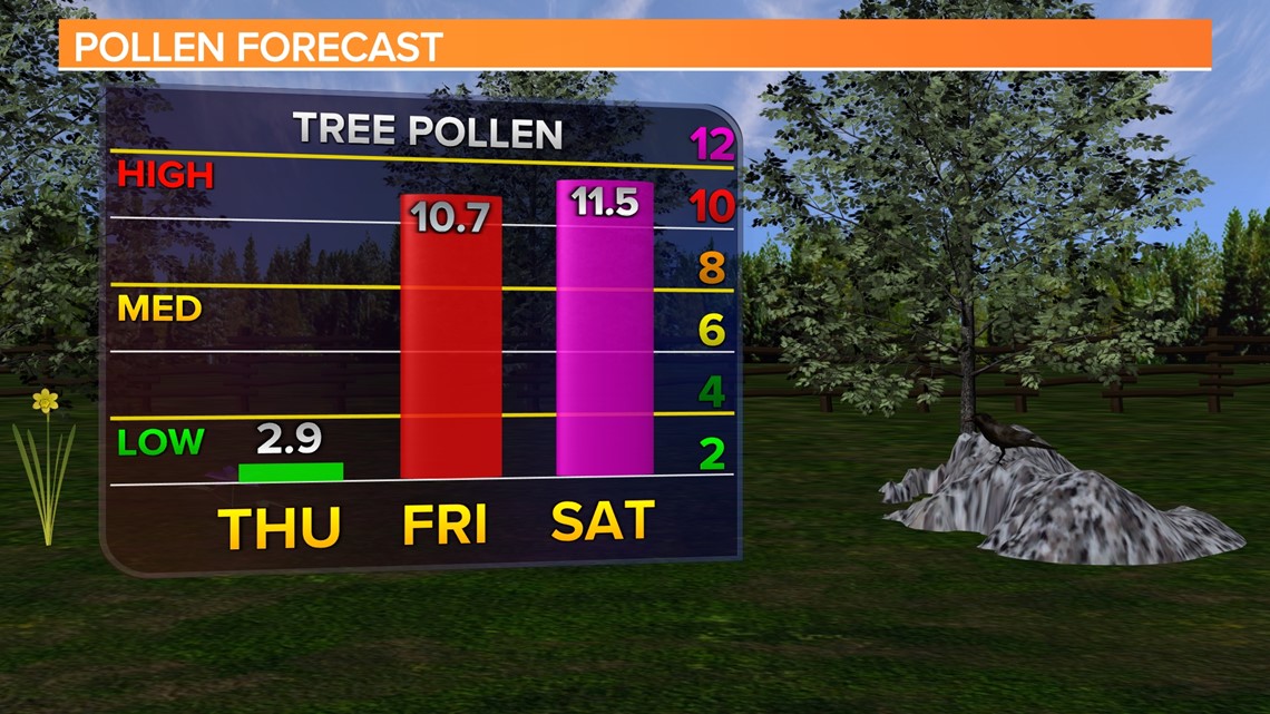
Pollen values will be low today, but as soon as the rain moves out, pollen counts will increase sharply.