COLUMBIA, S.C. — A cold front will continue to push towards the area. This will increase moisture, but most of the rain will be west of the Midlands today. Showers will be likely for most of the day Friday. Cooler conditions return to the Midlands over the weekend, but the chance for wintry weather has decreased.
A few showers fell across the Midlands this morning. Temperatures started off very mild. Lows only fell into the lower 50s for most of the area. Our average low temperature this time of the year is closer to the middle 30s. Our average high is the upper 50s.

This afternoon will be mostly cloudy and very warm. Highs will climb into the lower to middle 70s. The record high in Columbia for today is 84, this will be safe though.
A few isolated, light showers will be possible during the afternoon, but the chance for rain will increase during the overnight hours.
Here is the timeline of the rain late tonight through early Saturday morning.
12 AM Friday:

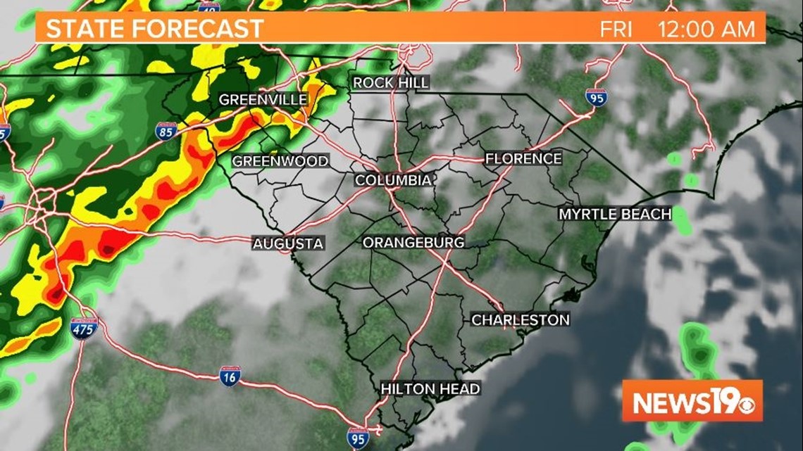
Rain begins to move into the state. Some showers are possible in the western half of the Midlands.
6 AM Friday:

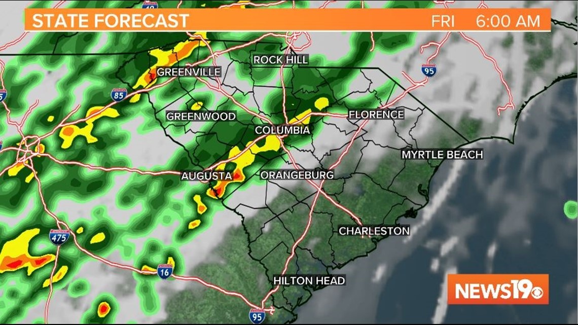
Widespread rain moves across the central Midlands through the Upstate. The rain continues to move towards the southern and eastern half of the area.
12 PM Friday:

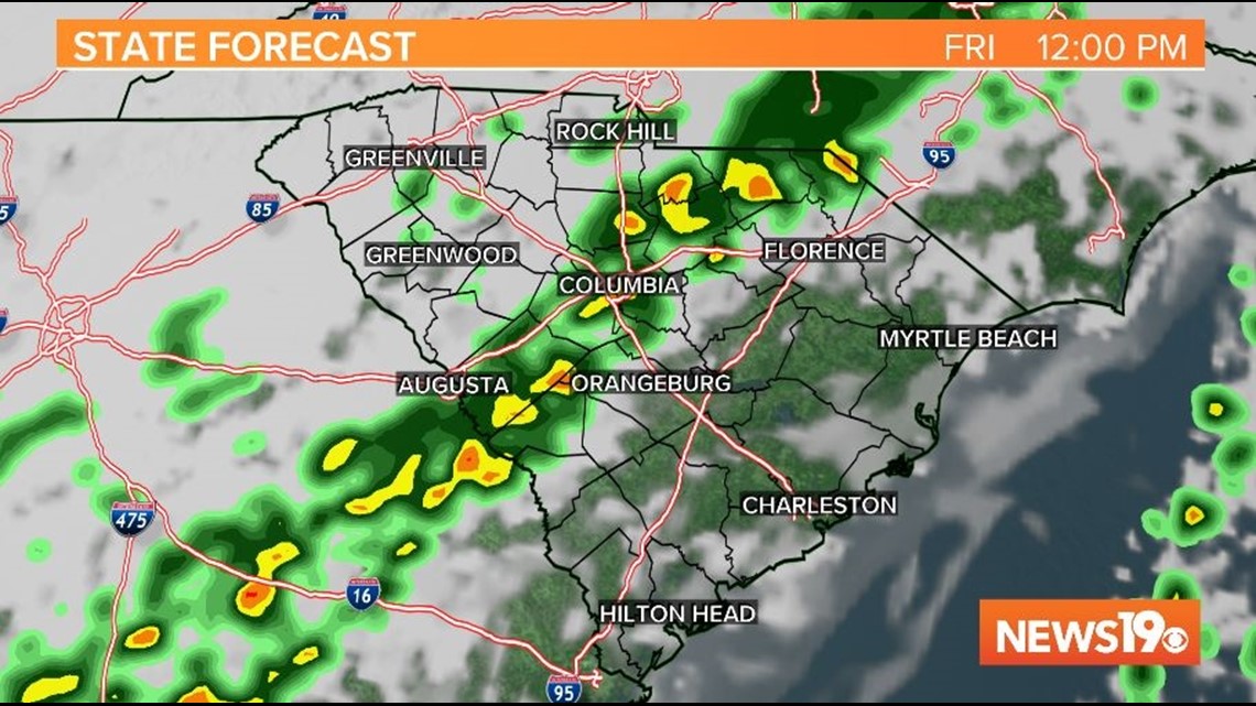
Rain will be likely for most of the area. The southern and eastern Midlands remain relatively dry at this point.
6 PM Friday:

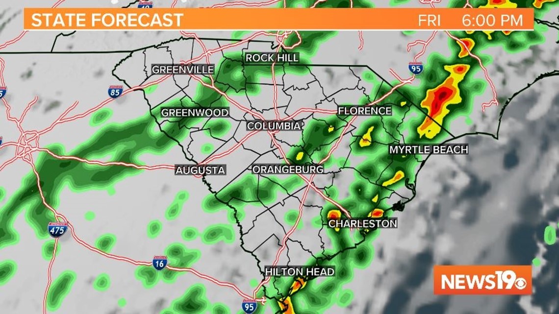
Showers continue to move across the area. Rain impacts most of the state, but showers begin to decrease in the Upstate.
12 AM Saturday:

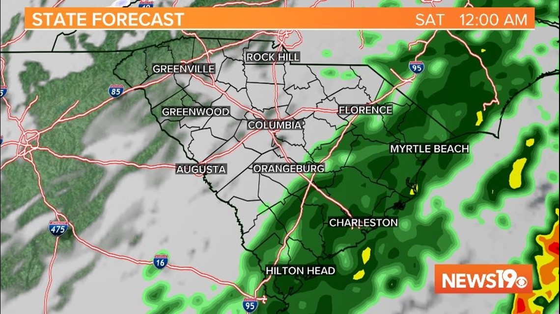
Rain decreases for most of the state. Showers will continue to impact areas along and east of I-95.
6 AM Saturday:


The rain is out of the area. The clouds will decrease through the morning hours.
The weekend is forecast to be cooler, but dry. Earlier this week, forecast models had hinted at the chance for wintry weather, but that has changed.
Saturday afternoon will be partly cloudy with highs in the lower to middle 50s. Sunday will be mostly sunny with highs in the upper 40s to lower 50s.
Rain will return to the Midlands Monday.