COLUMBIA, S.C. — Sunday morning started off foggy across much of the area. While the fog has lifted, the clouds will stick around for most of the day as we watch our next storm system move from the Gulf Coast into the Southeast.
Sunday will start dry for the first half of the day. In the afternoon and evening, a warm front will move north across South Carolina bringing scattered showers across the region. Showers will increase in coverage through dinnertime and overnight.
Temperatures will not move much through the afternoon and evening. With high temperatures only climbing into the low 60s and staying in the upper 50s through the overnight hours.


Winds will increase ahead of the cold front, which will move through the area early Monday morning. Expect wind gust speeds Monday morning between 35 and 45 mph. More showers and some thunderstorms are possible as the front moves through, with a small chance for a strong to severe storm east of Columbia.
The eastern Midlands are under a marginal risk for severe weather, with the coastline under a slight risk. The biggest concern with any storm that does form is damaging wind gusts and isolated heavy rainfall. There is also a small, isolated chance for a tornado.


Across the Midlands, between 0.5 and 1.5 inches of rain is likely, with isolated heavier amounts.
Winds will remain breezy through Monday afternoon with temperatures dropping throughout the day as cold air moves in from the northwest. By Tuesday morning, temperatures will drop into the low to mid 30s.
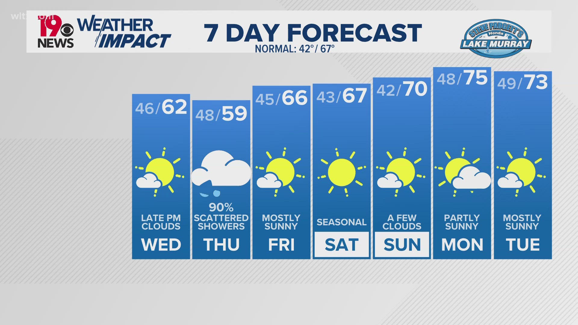
Temperatures will remain below average through the end of the week.
Another chance for rain returns by next weekend with another frontal system.