
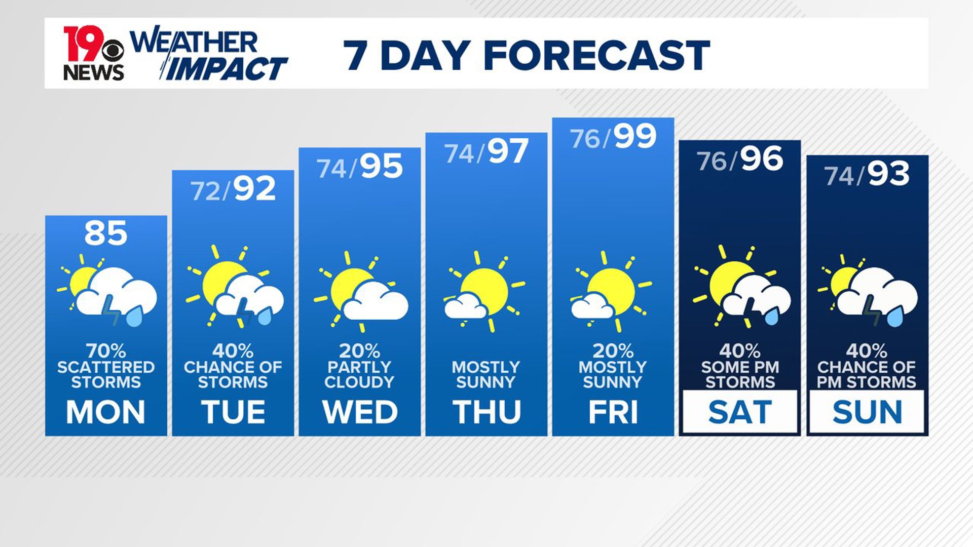
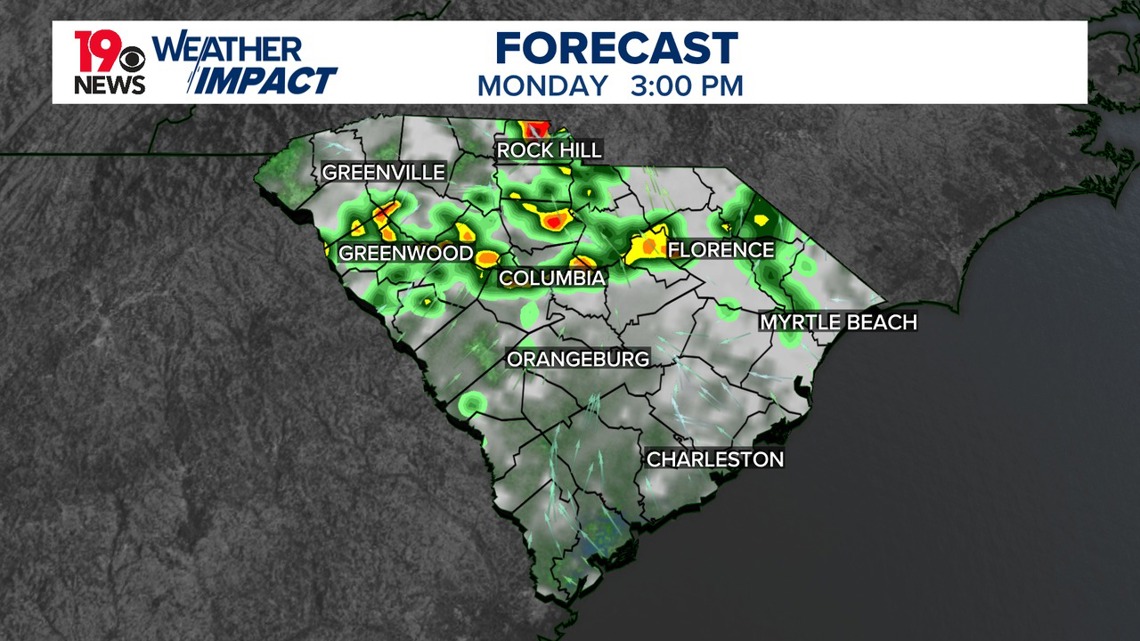
COLUMBIA, S.C. — Showers and storms are expected today. Some of the storms could be strong, producing heavy rain and the potential for damaging wind gusts.
After several days of heavy rain last week, the soil is already very wet. Combined with slow-moving storms and high moisture levels, there is an increased risk of flash floods. The Weather Prediction Center has placed the area at a marginal risk for excessive rainfall. There is also a small chance of isolated severe storms this afternoon and evening, with temperatures likely reaching the mid to upper 80s due to cloud cover.
High pressure this week, leading to rising temperatures. Southwest winds will bring plenty of moisture, resulting in high dew points and heat index values up to 105° on Tuesday and possibly higher on Wednesday. A heat advisory might be needed later this week.

Moisture levels will slightly decrease but still stay above 1.8 inches, reducing the flash flood risk. However, shortwaves in the northwest flow around the high-pressure system will drive showers and thunderstorms.
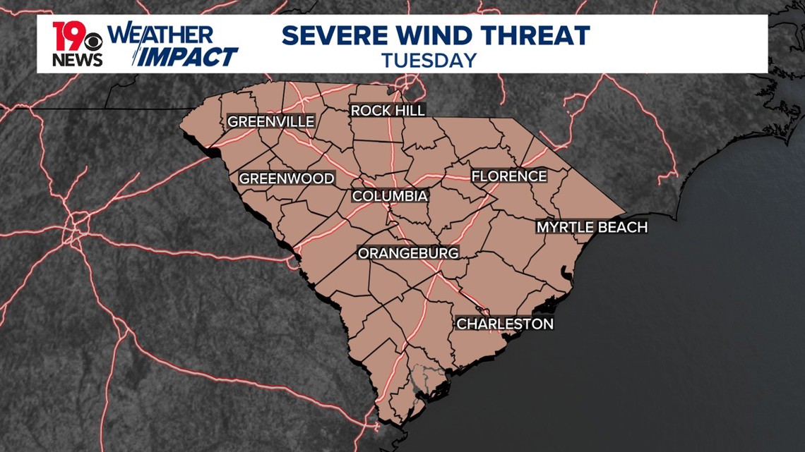
A mesoscale convective system is forecast to move into the area on Tuesday afternoon and evening. With high confidence in instability, these storms could bring severe wind gusts. Similar conditions are expected on Wednesday, with hot and humid weather leading to scattered storms, though stronger high pressure might keep the focus north of the area.

Dangerous heat is expected, with heat index values possibly reaching or exceeding 108 degrees. Isolated thunderstorms are possible each afternoon and evening, with higher chances over the weekend.
The high-pressure system will continue to strengthen over the lower Mississippi Valley towards the end of the week. This will push temperatures into the middle to upper 90s, with heat index values between 105 and 110. A heat advisory will likely be needed for parts of the area on Thursday and Friday.