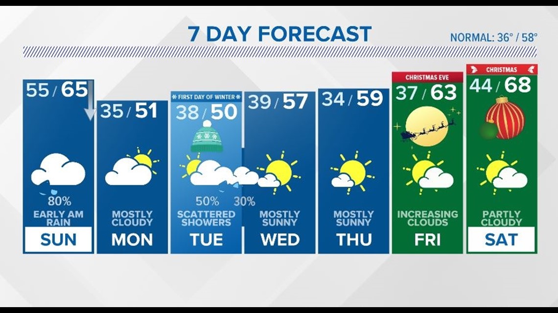
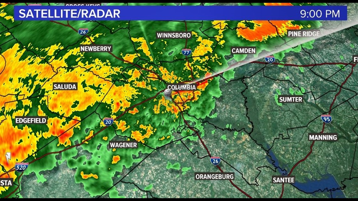
COLUMBIA, S.C. — As we go into Saturday night, look for wet weather to continue across the Midlands. A cold front is moving across the region and with southwest flow, there is plenty of moisture which is leading to some moderate to heavy downpours. All of this rain is very good news for us here across the Midlands with most of the state still under some sort of drought conditions. Going Sunday morning, we will see some isolated rain chances but overall, things should be winding down. By about 8-9 am in the morning we will be left with mostly cloudy conditions before the cold front itself moves in from the north and east.

Highs for Sunday will likely occur in the morning with afternoon temperatures falling steadily as we go into the night. This will setup for some pretty cold temperatures in the 30s to start off Monday morning.
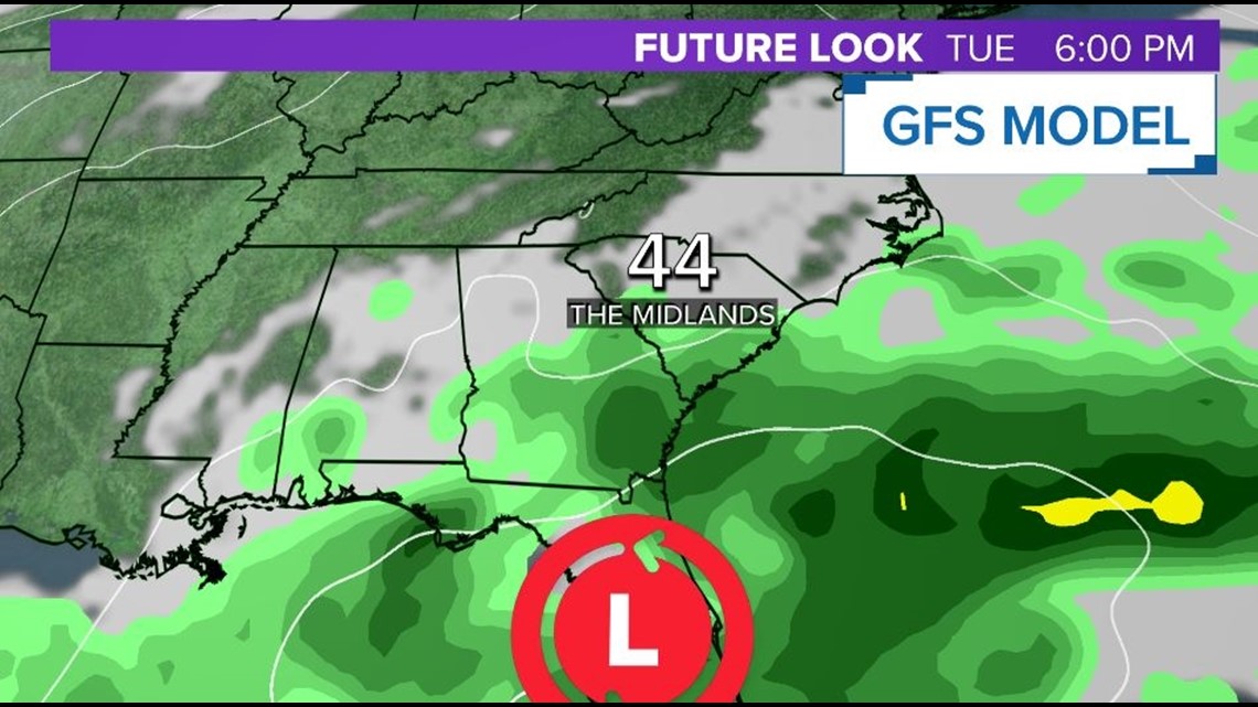
As we look towards next week, a low pressure system in the Gulf will be what we watch next. The low is expected to really ramp up as we go Tuesday and into Wednesday and then move northeast along the Atlantic coast. Depending on the track of the system we could see some decent rainfall mostly on Tuesday. Some models keep the low closer to the coast which would keep our rainfall totals much lower. We will likely have a much better understanding of how things setup with this system in the coming days.

As for the Christmas holiday, things are looking dry with plenty of sunshine and highs reaching the 60s once again.