COLUMBIA, S.C. — The Spring season is a period of transition so it never a surprise to see many different types of weather. With that being said, the month of April featured many impactful or notable weather events.
The month started off with the largest tornado outbreak we have seen in a long time in South Carolina.
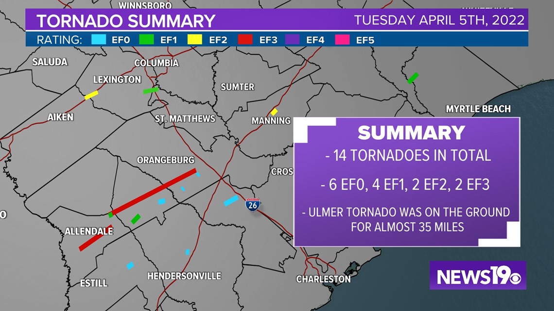
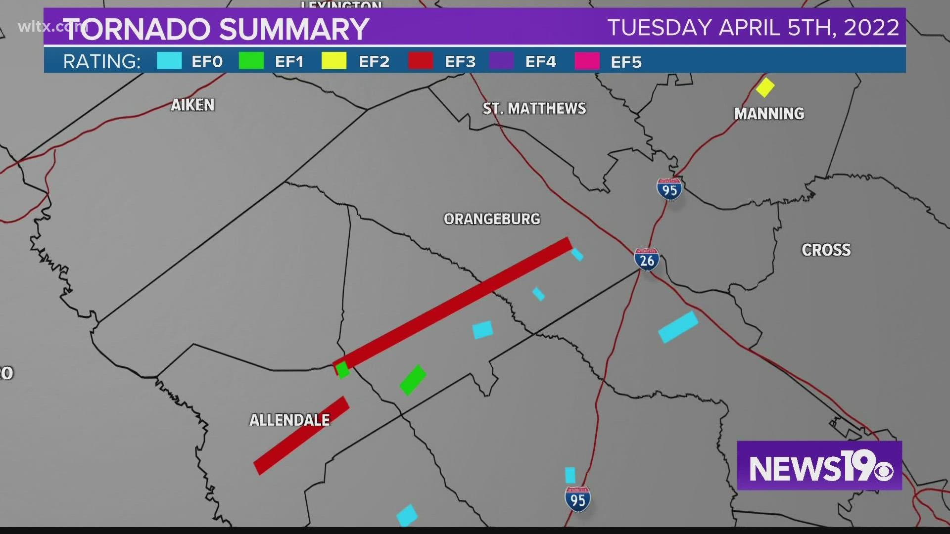
On Tuesday April 5th the state saw 14 tornadoes from the Midlands to the Lowcountry, two of them rated an EF3. Orangeburg county alone saw 5 tornadoes that day including the Ulmer tornado which was on the ground for almost 35 miles.


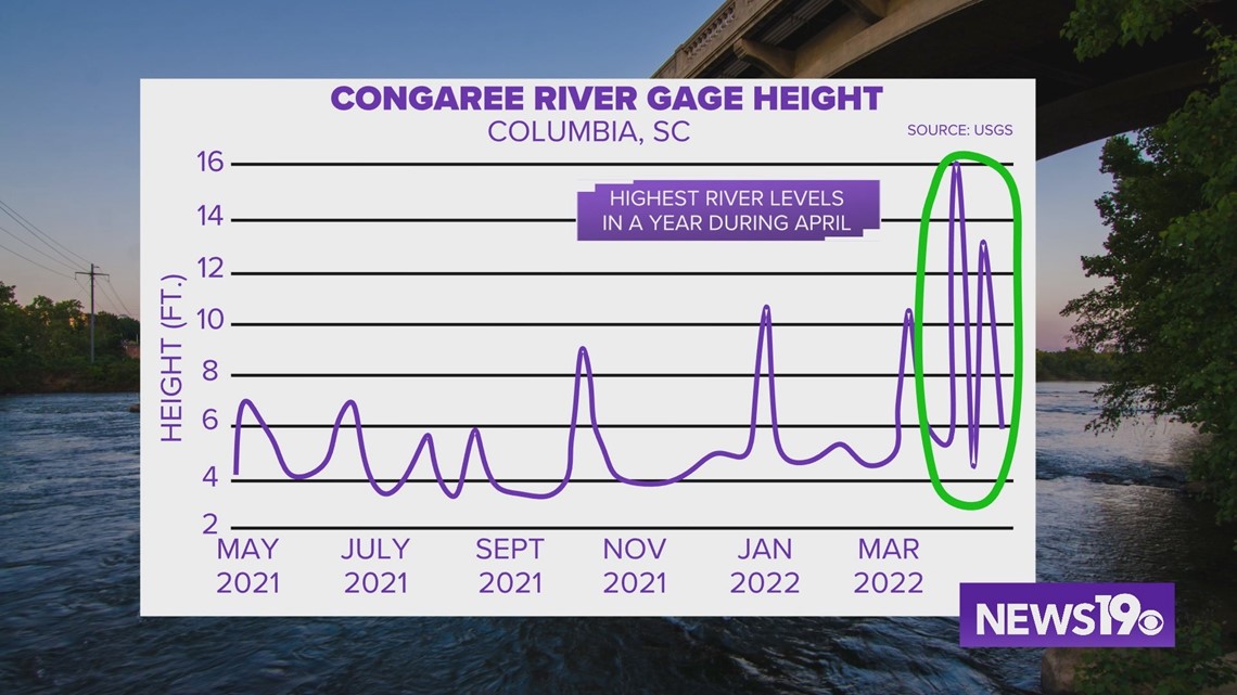
The April 5th event didn’t only bring severe weather to the Midlands, it also brought a pretty good amount of rainfall. In Columbia we picked up right around 4 inches of rain in 3 days. The Congaree River actually rose to its highest level in about a year. Those levels have since gone down to more typical levels.


Just a few days later on the 10th, the Midlands saw a late season freeze with many places briefly dipping below freezing in the morning hours.
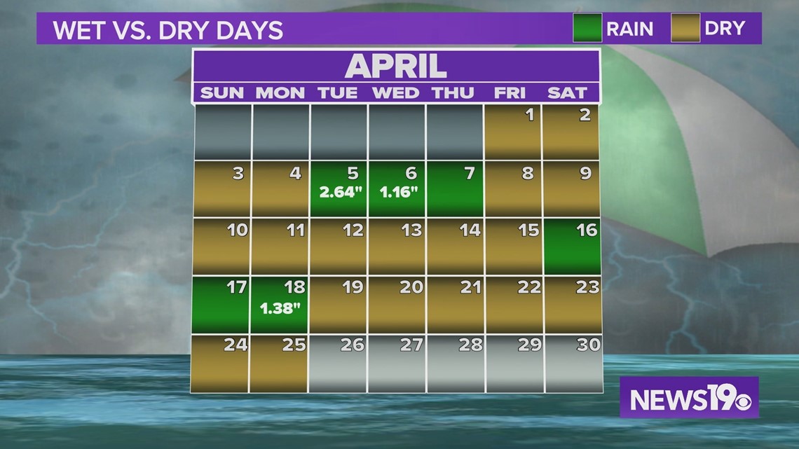
We are sitting several inches of rain above normal for the month of April, but this can be deceiving. We have only seen rain so far 6 days out of the entire month. In fact, the overall pattern has been very dry recently and has been paired with some warmer temperatures.


As for even warmer weather, our average first 90 degree day, that comes on April 28; this week. If we don’t hit this temperature this week, well, right now things are not looking terribly hot going forward so we will have to see when that 90 degree weather officially arrives.

