
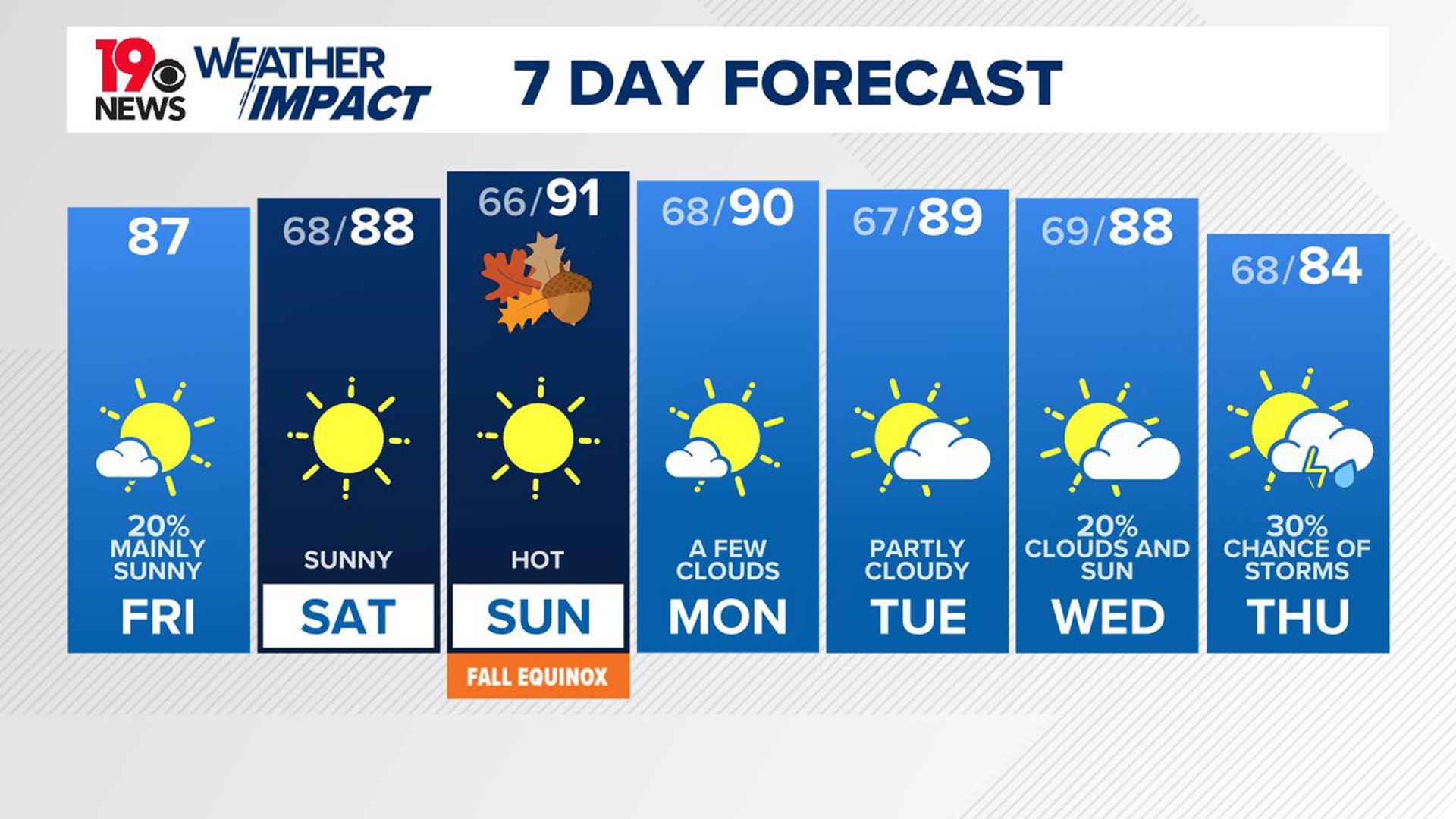
COLUMBIA, S.C. — Warmer weather is moving into the area today, with rain chances very isolated. The weather will remain dry and warm through Sunday, becoming more typical for this time of year as we head into the new week.
Yesterday, there were a few showers. It was a seasonably warm day with high temperatures in the lower and middle 80s. Our average high temperature for this time of the year is 85 degrees.
As the day progresses, high pressure will bring dry, warm conditions for most of the region. While there is a small chance of an isolated shower or thunderstorm across the Midlands this afternoon, it is likely to stay dry overall. Temperatures today will be slightly warmer than yesterday, with nighttime lows remaining similar.

As we move into the weekend, the warming trend will continue, with high pressure keeping conditions mostly dry. Isolated showers could develop in the northern areas on Saturday, but rain is unlikely due to the warm air and limited moisture. Temperatures on Saturday will be near normal, but by Sunday, many areas could see highs above 90 degrees.
Looking ahead to next week, the warm and mostly dry conditions will persist, with temperatures ranging from the mid-80s to low 90s. By midweek, there is a possibility of rain starting Wednesday, though confidence in this forecast remains low.
Some models suggest a potential tropical system could impact the Gulf of Mexico later in the week, which might bring more moisture and increase our chances of rain.
There are three areas in the tropics being monitored. The one that is near the Yucatan Peninsula has a moderate chance of further development.