

COLUMBIA, S.C. — The rest of the week will bring increasing moisture and isolated to widely scattered showers and thunderstorms, especially over the weekend. An area of high pressure building into the area late this week and into the weekend will bring in above-normal temperatures and heat index values nearing 110 degrees.
A ridge of high pressure over the Deep South will remain in place for the short term. By tonight, surface high pressure will shift off the East Coast, leading to increased moisture during your Independence Day holiday.
Today we will see dry conditions over most of the area. High temperatures this afternoon will be in the lower to middle 90s. The higher dew points and warmer temperatures on Thursday could push heat index values into the 100 to 105 range. Although reaching Heat Advisory criteria is unlikely, temperatures will rise with highs in the mid to upper 90s on Thursday.

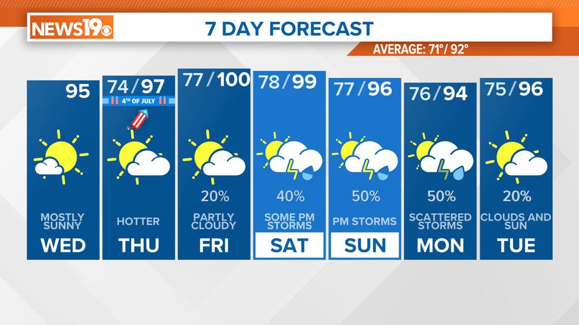
The upper ridge will continue to move east, which will increase the moisture. With the heat and humidity in place, heat index values could reach 110 on Friday afternoon. An isolated shower or storm is possible, but most of us will likely remain dry.
A weak front will approach the Southeast over the weekend but is expected to remain west of the area, keeping moisture in place. Scattered afternoon showers and thunderstorms are possible both Saturday and Sunday.
High temperatures will stay mainly in the middle to upper 90s, and heat index values could reach as high as 110. A heat advisory could be issued for Friday and possibly for the weekend.