
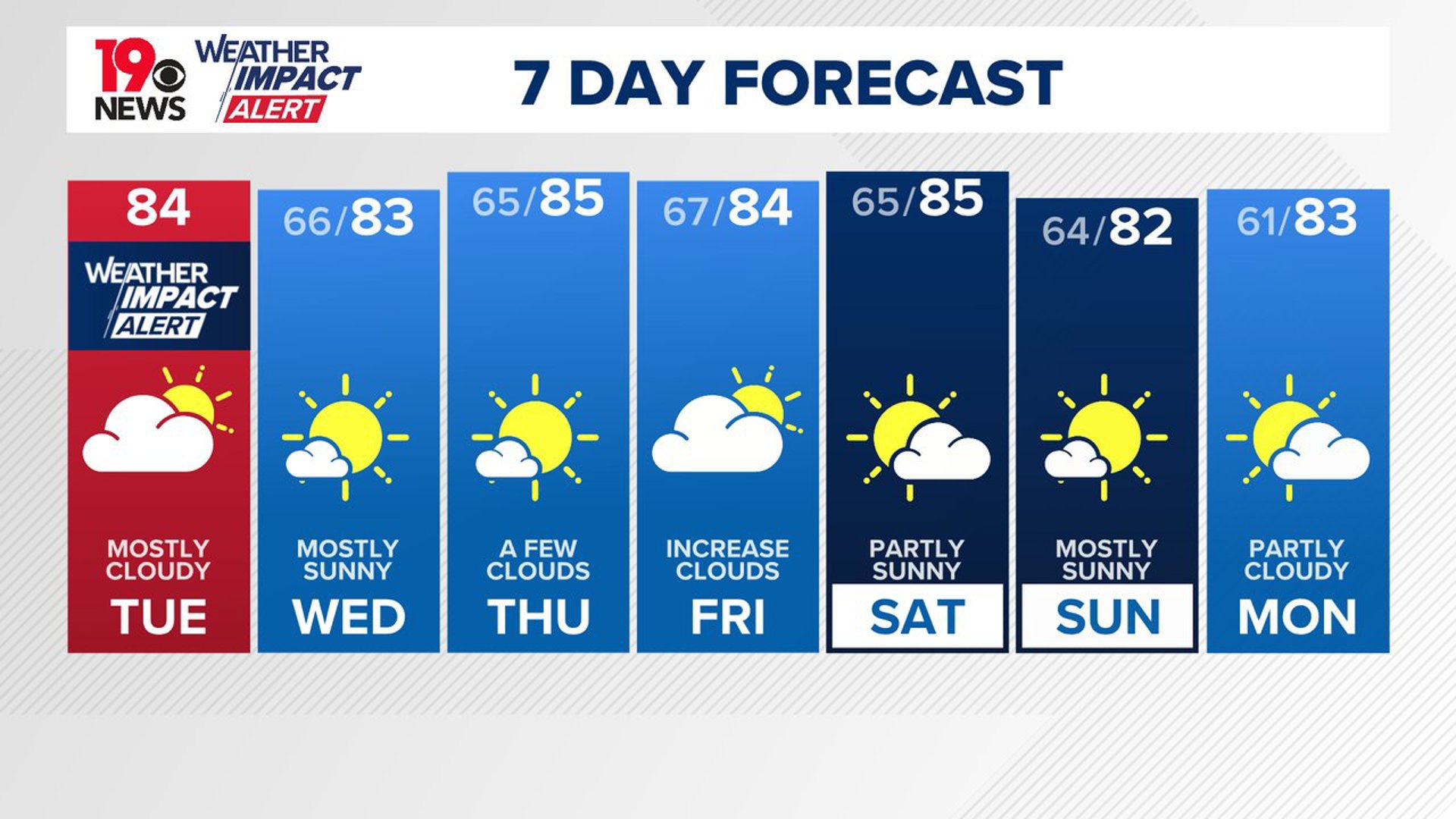
COLUMBIA, S.C. — An upper-level trough will remain north of the region today, bringing a slight chance of isolated showers to the northern part of South Carolina. As the trough moves out, high pressure will settle in behind a dry front midweek, leading to clear and dry conditions on Thursday and Friday. Temperatures are expected to stay at or slightly above normal levels as we head into the weekend.
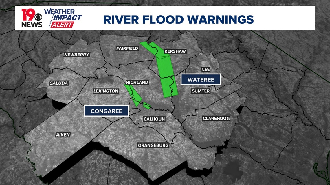
River flooding is ongoing but expected to gradually subside as water levels decrease. There is a low chance of isolated showers today, primarily in the Northern Midlands and Pee Dee regions.
The river flood warning for the Saluda River has been cancelled. The river flood warning for the Congaree and Wateree rivers continues. Both rivers have peaked and will continue to slowly drop in height.

Temperatures will continue to hover a few degrees above seasonal averages, although widespread cloud cover will contribute to slightly cooler conditions compared to the previous day. By evening, skies should clear as drier air moves in aloft. However, low-level moisture could lead to patchy fog, especially in northern areas.
As the upper trough moves out on Wednesday, an upper ridge will build back into the region from the west. Additionally, surface high pressure will move in from the north of the area through Thursday night. This combination of ridges will keep the weather dry during this period. Temperatures will continue to be slightly above normal, with daytime highs in the low to mid-80s and nighttime lows in the mid-60s.
The warm and dry weather is expected to last through much of the weekend. A weak cold front may pass through on Saturday, but with limited moisture, little to no rainfall is expected. Dry high pressure will likely persist through Sunday.
By Monday, moisture could start to return from the Atlantic, potentially bringing a few showers to the eastern Midlands and southern CSRA during the afternoon. Temperatures will remain warm, with daytime highs in the low to mid-80s and lows in the 60s.

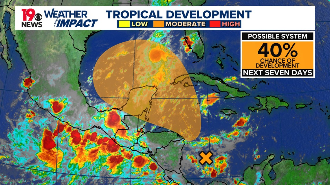
There is some uncertainty regarding potential tropical development in the Gulf of Mexico. The National Hurricane Center (NHC) has indicated a 40% chance of tropical development within the next seven days.
While long-range models suggest the possibility of development later in the forecast period, it is too early to predict any potential impacts. This system will need to be monitored closely in the coming days.