
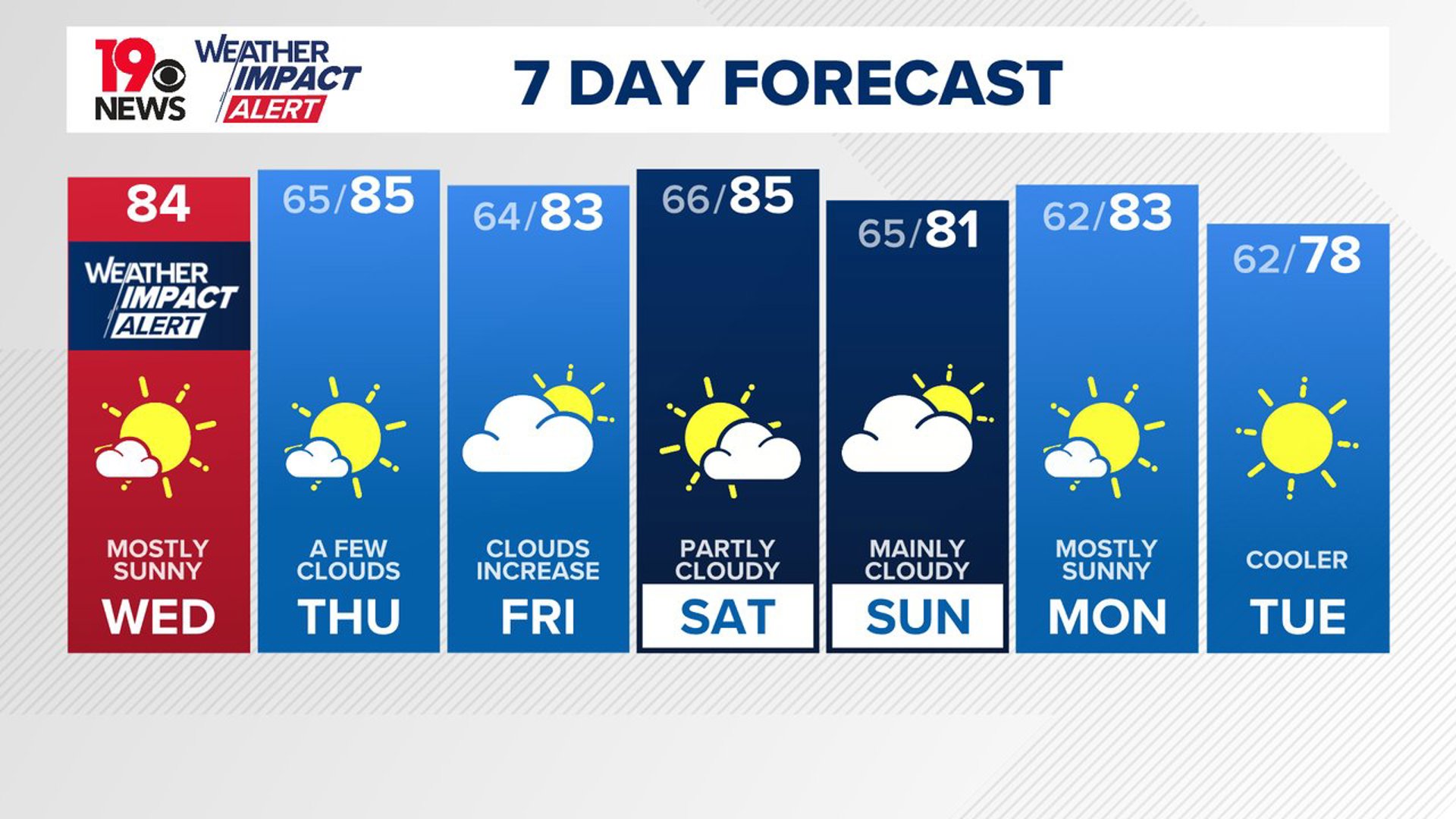
COLUMBIA, S.C. — An upper-level trough will remain north of the area, bringing the possibility of stray showers, but most of us will remain dry. As the week progresses, high pressure will build behind a dry front by midweek, ensuring mainly dry conditions through Thursday and Friday. Temperatures are expected to stay near or slightly above normal, extending into the weekend.
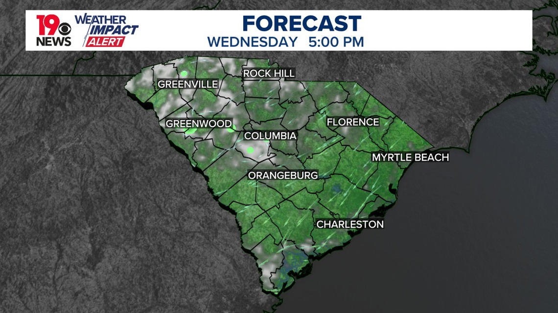
A stray shower will be possible today, but most of the area will stay dry. Highs will be in the lower to middle 80s. Temperatures will remain near average for this time of year, and a weak cold front will approach tonight, though it is likely to dissipate before reaching the area. Expect similar overnight temperatures to those of Tuesday night, with lows in the mid-60s.

As we move into Thursday and Friday, high pressure will dominate the weather pattern, with daytime temperatures slightly above normal. Surface high pressure will settle over New England, extending down the East Coast. While there is a slight chance for a shower on Friday due to a mid-level shortwave, confidence remains low, and cloud cover is more likely. This may cool temperatures by a degree or two, with overnight lows generally in the mid-60s.
Looking ahead to the weekend and early next week, temperatures could cool slightly. The upper ridge will weaken, allowing a few weak systems to move through the region. Although moisture levels will increase slightly on Saturday, this will be short-lived. Rain is not expected.

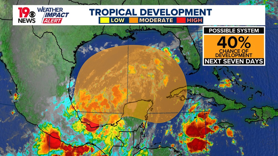
In the Gulf of Mexico, there is some uncertainty regarding potential development, with the National Hurricane Center giving the area a 40% chance of further development over the next seven days. While global models suggest a weak system moving across Florida, the upper trough is likely to keep it south of our region. It is too early to predict the exact impacts, but the situation will be monitored closely in the coming days.
Hydrologically, flood warnings remain in effect along the Congaree and Wateree Rivers, although river levels have crested and are slowly receding. The heavy rainfall from recent events has caused high flows and flooding in many streams and rivers across the Midlands.

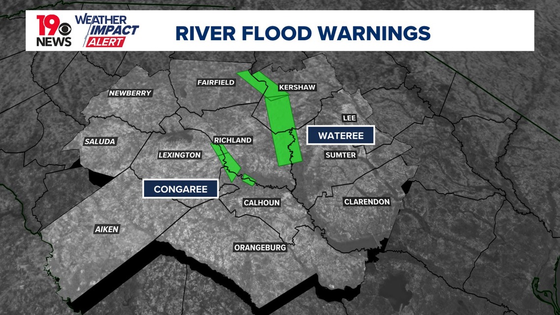
It may take several days for river levels to return to normal, so anyone working or recreating near these rivers and creeks should remain cautious, as underwater and unseen hazards are still present.